Caicó elevation
Caicó (Rio Grande do Norte), Brazil elevation is 161 meters and Caicó elevation in feet is 528 ft above sea level [src 1]. Caicó is a populated place (feature code) with elevation that is 221 meters (725 ft) smaller than average city elevation in Brazil.
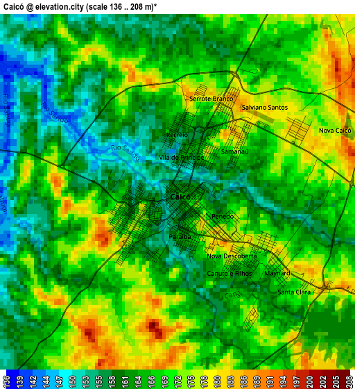
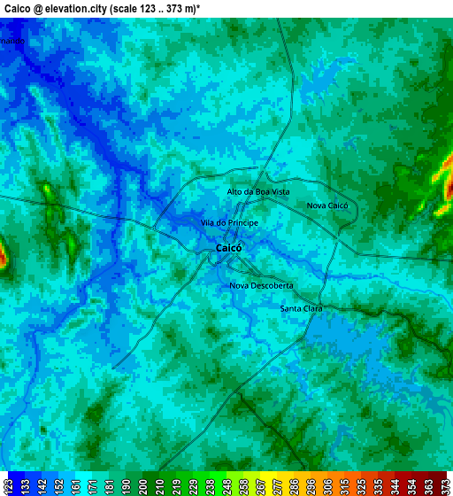
Below is the Elevation map of Caicó, which displays elevation range with different colors. Scale of the first map is from 136 to 208 m (446 to 682 ft) with average elevation of 166.5 meters (=546 ft) [note 1]
These maps also provides idea of topography and contour of this city, they are displayed at different zoom levels. More info about maps, scale and edge coordinates you can find below images.
| \ | Map #1 | Map #2 | Topo.Map |
| Scale [m] | 136..208 m | 123..373 m | × |
| Scale [ft] | 446..682 ft | 404..1224 ft | × |
| Average | 166.5 m = 546 ft | 174.2 m = 572 ft | × |
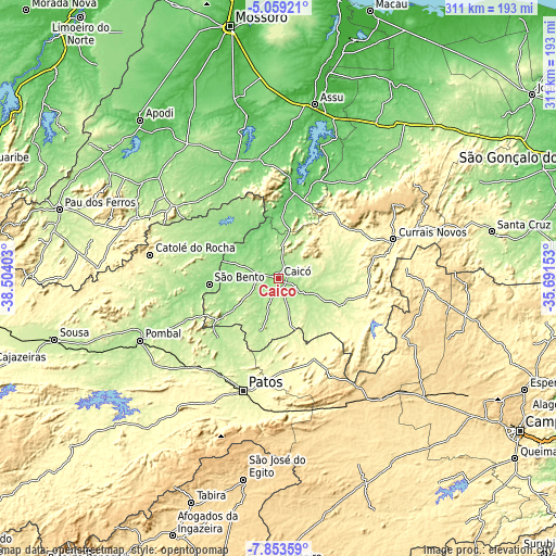
| Width | 9.71 km = 6 mi | 19.42 km = 12.1 mi | 310.7 km = 193.1 mi |
| Height | 9.71 km = 6 mi | 19.42 km = 12.1 mi | 310.7 km = 193.1 mi |
| ↑Max Latitude | -6.414662° | -6.37099° | -5.05921° |
| Latitude at center | -6.45833° | -6.45833° | -6.45833° |
| ↓Min Latitude | -6.501995° | -6.545655° | -7.85359° |
| ← Min Longitude | -37.141725° | -37.185671° | -38.50403° |
| Longitude center | -37.09778° | -37.09778° | -37.09778° |
| →Max Longitude | -37.053835° | -37.009889° | -35.69153° |
Nearby cities:
Cities around Caicó sort by population:
• Patos elevation 243 m
66.1 km,  197°
197°
• Currais Novos 361 m
67.8 km,  71°
71°
• Catolé do Rocha 303 m
72.8 km,  280°
280°
• Parelhas 274 m
54.9 km,  117°
117°
• Santa Luzia 304 m
50.1 km,  156°
156°
• Jucurutu 73 m
48 km,  10°
10°
• Jardim de Piranhas 143 m
29.4 km,  287°
287°
• Jardim do Seridó 223 m
38.4 km,  111°
111°
• Patu 253 m
71 km,  303°
303°
• Belém do Brejo do Cruz 184 m
56.9 km, 301°
• Santana do Matos 144 m
74.1 km,  41°
41°
• Paulista 165 m
60.1 km,  255°
255°
Multilingual:
 En español:
Caicó elevación 161 m.
 En France:
Caicó élévation 161 m.


Sources and notes:
- [note 1] Map square and city borders are not equal. Map elevation data is calculated only from area inside that square.
- [src 1] Elevation data from geonames database provided with same terms of usage.
- [src 2] The elevation map of Caicó is generated using elevation data from NASA's 3 arcsec (90m) resolution SRTM data.
- [src 3] Base (background) map © OpenStreetMap contributors tiles are generated by Geofabrik and OpenTopoMap.
Copyright & License:
This Caicó Elevation Map is licensed under CC BY-SA. You may reuse any part from this page, if you give a proper credit by linking to this URL:
 More info on terms of use page.