Desterro elevation
Desterro (Paraíba), Brazil elevation is 611 meters and Desterro elevation in feet is 2005 ft above sea level [src 1]. Desterro is a populated place (feature code) with elevation that is 229 meters (751 ft) bigger than average city elevation in Brazil.
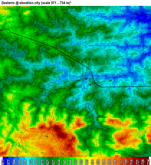
Below is the Elevation map of Desterro, which displays elevation range with different colors. Scale of the first map is from 571 to 734 m (1873 to 2408 ft) with average elevation of 629.9 meters (=2067 ft) [note 1]
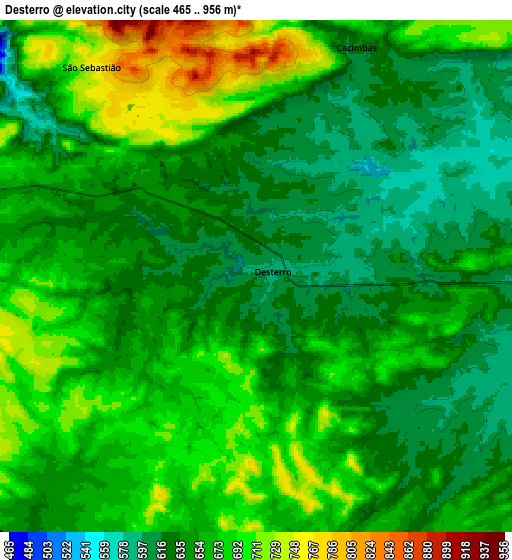
These maps also provides idea of topography and contour of this city, they are displayed at different zoom levels. More info about maps, scale and edge coordinates you can find below images.
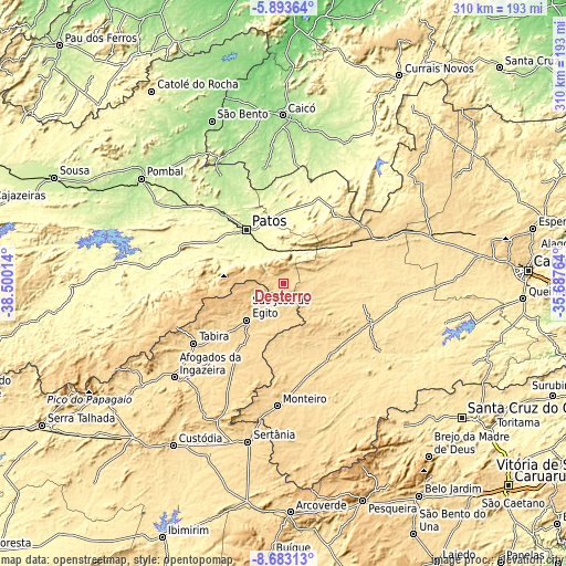
| \ | Map #1 | Map #2 | Topo.Map |
| Scale [m] | 571..734 m | 465..956 m | × |
| Scale [ft] | 1873..2408 ft | 1526..3136 ft | × |
| Average | 629.9 m = 2067 ft | 657 m = 2156 ft | × |
| Width | 9.69 km = 6 mi | 19.39 km = 12 mi | 310.2 km = 192.7 mi |
| Height | 9.69 km = 6 mi | 19.39 km = 12 mi | 310.2 km = 192.7 mi |
| ↑Max Latitude | -7.246968° | -7.203371° | -5.89364° |
| Latitude at center | -7.29056° | -7.29056° | -7.29056° |
| ↓Min Latitude | -7.334148° | -7.377732° | -8.68313° |
| ← Min Longitude | -37.137835° | -37.181781° | -38.50014° |
| Longitude center | -37.09389° | -37.09389° | -37.09389° |
| →Max Longitude | -37.049945° | -37.005999° | -35.68764° |
Nearby cities:
Cities around Desterro sort by population:
• Patos elevation 243 m
36 km,  325°
325°
• Afogados da Ingazeira 516 m
78.9 km,  229°
229°
• São José do Egito 594 m
28.9 km,  223°
223°
• Monteiro 600 m
66.7 km,  182°
182°
• Tabira 571 m
59.4 km,  235°
235°
• Parelhas 274 m
82.5 km,  35°
35°
• Santa Luzia 304 m
50.4 km,  22°
22°
• Sumé 518 m
48.5 km,  150°
150°
• Teixeira 780 m
19.2 km,  293°
293°
• Taperoá 533 m
30.9 km,  72°
72°
• Imaculada 763 m
47.1 km,  256°
256°
• Juru 588 m
84.5 km,  251°
251°
Multilingual:
 En español:
Desterro elevación 611 m.
 En France:
Desterro élévation 611 m.
 Auf Deutsch:
Desterro höhe über dem Meeresspiegel ist 611 m.

Sources and notes:
- [note 1] Map square and city borders are not equal. Map elevation data is calculated only from area inside that square.
- [src 1] Elevation data from geonames database provided with same terms of usage.
- [src 2] The elevation map of Desterro is generated using elevation data from NASA's 3 arcsec (90m) resolution SRTM data.
- [src 3] Base (background) map © OpenStreetMap contributors tiles are generated by Geofabrik and OpenTopoMap.
Copyright & License:
This Desterro Elevation Map is licensed under CC BY-SA. You may reuse any part from this page, if you give a proper credit by linking to this URL:
 More info on terms of use page.