Pilar elevation
Pilar (Paraíba), Brazil elevation is 38 meters and Pilar elevation in feet is 125 ft above sea level [src 1]. Pilar is a populated place (feature code) with elevation that is 344 meters (1129 ft) smaller than average city elevation in Brazil.
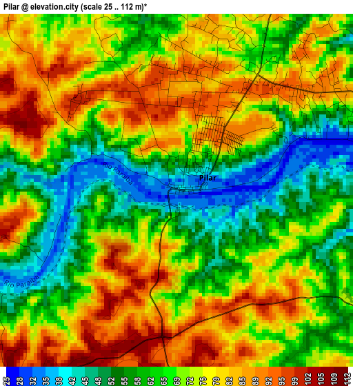
Below is the Elevation map of Pilar, which displays elevation range with different colors. Scale of the first map is from 25 to 112 m (82 to 367 ft) with average elevation of 70.3 meters (=231 ft) [note 1]
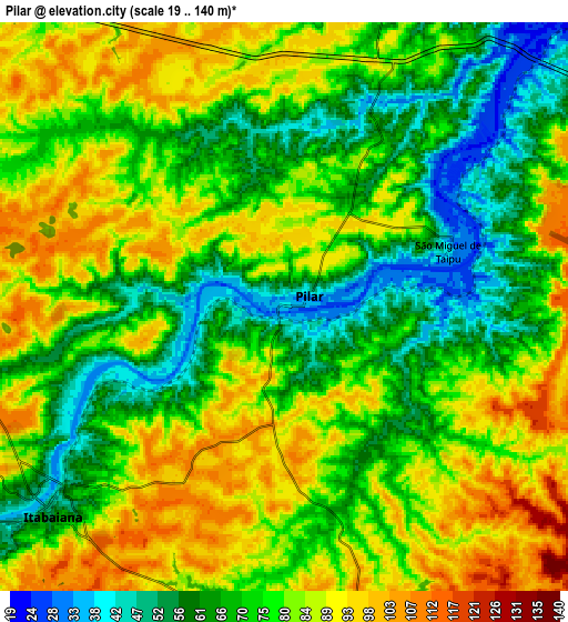
These maps also provides idea of topography and contour of this city, they are displayed at different zoom levels. More info about maps, scale and edge coordinates you can find below images.
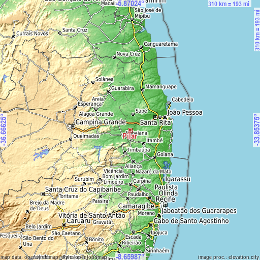
| \ | Map #1 | Map #2 | Topo.Map |
| Scale [m] | 25..112 m | 19..140 m | × |
| Scale [ft] | 82..367 ft | 62..459 ft | × |
| Average | 70.3 m = 231 ft | 76.8 m = 252 ft | × |
| Width | 9.69 km = 6 mi | 19.39 km = 12 mi | 310.2 km = 192.7 mi |
| Height | 9.69 km = 6 mi | 19.39 km = 12 mi | 310.2 km = 192.7 mi |
| ↑Max Latitude | -7.223626° | -7.180027° | -5.87024° |
| Latitude at center | -7.26722° | -7.26722° | -7.26722° |
| ↓Min Latitude | -7.31081° | -7.354396° | -8.65987° |
| ← Min Longitude | -35.303945° | -35.347891° | -36.66625° |
| Longitude center | -35.26° | -35.26° | -35.26° |
| →Max Longitude | -35.216055° | -35.172109° | -33.85375° |
Nearby cities:
Cities around Pilar sort by population:
• Santa Rita elevation 6 m
35.5 km,  61°
61°
• Timbaúba 136 m
27.2 km,  193°
193°
• Itabaiana 47 m
10.5 km,  229°
229°
• Mari 149 m
24 km,  344°
344°
• Pedras de Fogo 174 m
21.8 km,  133°
133°
• Ingá 155 m
38 km,  267°
267°
• Juripiranga 117 m
12 km,  168°
168°
• Cruz do Espírito Santo 19 m
23.8 km,  53°
53°
• Gurinhém 98 m
24.1 km,  311°
311°
• Mogeiro 119 m
24.5 km,  261°
261°
• Salgado de São Félix 64 m
22.3 km,  243°
243°
• Mulungu 89 m
35 km,  320°
320°
Multilingual:
 En español:
Pilar elevación 38 m.
 En France:
Pilar élévation 38 m.


Sources and notes:
- [note 1] Map square and city borders are not equal. Map elevation data is calculated only from area inside that square.
- [src 1] Elevation data from geonames database provided with same terms of usage.
- [src 2] The elevation map of Pilar is generated using elevation data from NASA's 3 arcsec (90m) resolution SRTM data.
- [src 3] Base (background) map © OpenStreetMap contributors tiles are generated by Geofabrik and OpenTopoMap.
Copyright & License:
This Pilar Elevation Map is licensed under CC BY-SA. You may reuse any part from this page, if you give a proper credit by linking to this URL:
 More info on terms of use page.