Tangará elevation
Tangará (Rio Grande do Norte), Brazil elevation is 188 meters and Tangará elevation in feet is 617 ft above sea level [src 1]. Tangará is a populated place (feature code) with elevation that is 194 meters (636 ft) smaller than average city elevation in Brazil.
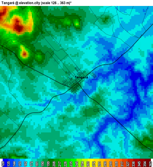
Below is the Elevation map of Tangará, which displays elevation range with different colors. Scale of the first map is from 126 to 363 m (413 to 1191 ft) with average elevation of 177.7 meters (=583 ft) [note 1]
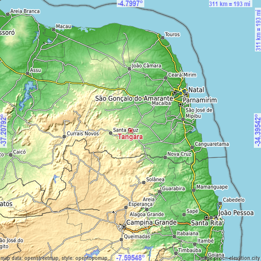
These maps also provides idea of topography and contour of this city, they are displayed at different zoom levels. More info about maps, scale and edge coordinates you can find below images.
| \ | Map #1 | Map #2 | Topo.Map |
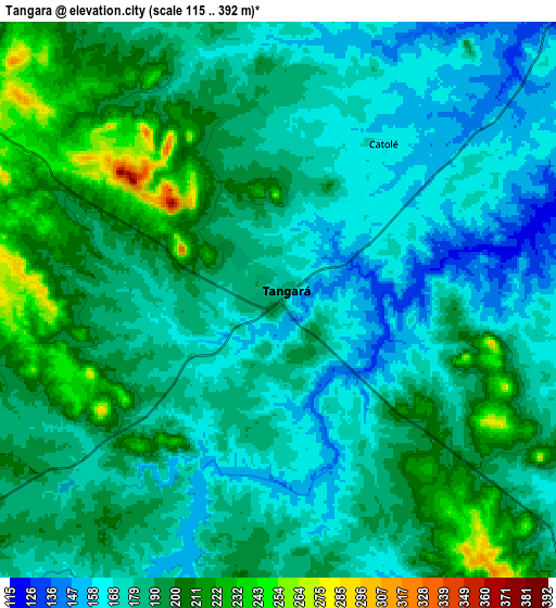
| Scale [m] | 126..363 m | 115..392 m | × |
| Scale [ft] | 413..1191 ft | 377..1286 ft | × |
| Average | 177.7 m = 583 ft | 185.8 m = 610 ft | × |
| Width | 9.72 km = 6 mi | 19.43 km = 12.1 mi | 310.9 km = 193.2 mi |
| Height | 9.72 km = 6 mi | 19.43 km = 12.1 mi | 310.9 km = 193.2 mi |
| ↑Max Latitude | -6.15575° | -6.112056° | -4.7997° |
| Latitude at center | -6.19944° | -6.19944° | -6.19944° |
| ↓Min Latitude | -6.243127° | -6.286809° | -7.59548° |
| ← Min Longitude | -35.845615° | -35.889561° | -37.20792° |
| Longitude center | -35.80167° | -35.80167° | -35.80167° |
| →Max Longitude | -35.757725° | -35.713779° | -34.39542° |
Nearby cities:
Cities around Tangará sort by population:
• Santa Cruz elevation 230 m
24.7 km,  262°
262°
• Nova Cruz 90 m
51.1 km,  127°
127°
• Santo Antônio 93 m
37.8 km,  109°
109°
• Cuité 670 m
50.1 km,  230°
230°
• São José do Campestre 153 m
16.2 km,  143°
143°
• São Paulo do Potengi 78 m
34.1 km,  7°
7°
• Nova Floresta 670 m
52.7 km,  237°
237°
• Araruna 496 m
40.5 km,  170°
170°
• Brejinho 151 m
49.2 km,  88°
88°
• Cacimba de Dentro 529 m
49.2 km,  178°
178°
• São Tomé 167 m
39.4 km,  309°
309°
• Dona Inês 462 m
49.9 km,  157°
157°
Multilingual:
 En español:
Tangará elevación 188 m.
 En France:
Tangará élévation 188 m.


Sources and notes:
- [note 1] Map square and city borders are not equal. Map elevation data is calculated only from area inside that square.
- [src 1] Elevation data from geonames database provided with same terms of usage.
- [src 2] The elevation map of Tangará is generated using elevation data from NASA's 3 arcsec (90m) resolution SRTM data.
- [src 3] Base (background) map © OpenStreetMap contributors tiles are generated by Geofabrik and OpenTopoMap.
Copyright & License:
This Tangará Elevation Map is licensed under CC BY-SA. You may reuse any part from this page, if you give a proper credit by linking to this URL:
 More info on terms of use page.