Upanema elevation
Upanema (Rio Grande do Norte), Brazil elevation is 46 meters and Upanema elevation in feet is 151 ft above sea level [src 1]. Upanema is a populated place (feature code) with elevation that is 336 meters (1102 ft) smaller than average city elevation in Brazil.
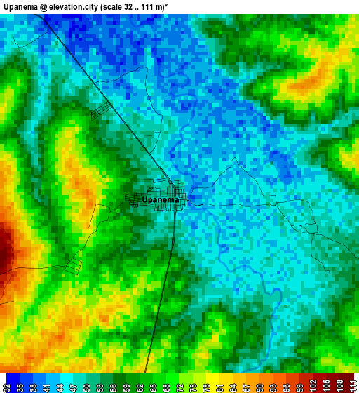
Below is the Elevation map of Upanema, which displays elevation range with different colors. Scale of the first map is from 32 to 111 m (105 to 364 ft) with average elevation of 58 meters (=190 ft) [note 1]
These maps also provides idea of topography and contour of this city, they are displayed at different zoom levels. More info about maps, scale and edge coordinates you can find below images.
| \ | Map #1 | Map #2 | Topo.Map |
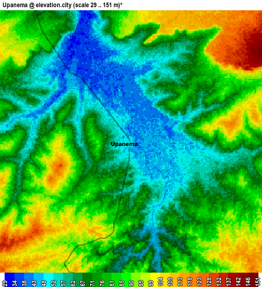
| Scale [m] | 32..111 m | 29..151 m | × |
| Scale [ft] | 105..364 ft | 95..495 ft | × |
| Average | 58 m = 190 ft | 75.5 m = 248 ft | × |
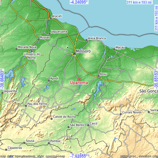
| Width | 9.73 km = 6 mi | 19.45 km = 12.1 mi | 311.2 km = 193.4 mi |
| Height | 9.73 km = 6 mi | 19.45 km = 12.1 mi | 311.2 km = 193.4 mi |
| ↑Max Latitude | -5.598206° | -5.554469° | -4.24095° |
| Latitude at center | -5.64194° | -5.64194° | -5.64194° |
| ↓Min Latitude | -5.685671° | -5.729398° | -7.03955° |
| ← Min Longitude | -37.301725° | -37.345671° | -38.66403° |
| Longitude center | -37.25778° | -37.25778° | -37.25778° |
| →Max Longitude | -37.213835° | -37.169889° | -35.85153° |
Nearby cities:
Cities around Upanema sort by population:
• Mossoró elevation 24 m
51.4 km,  349°
349°
• Açu 36 m
39.3 km,  79°
79°
• Apodi 73 m
59.9 km,  267°
267°
• Caraúbas 152 m
37.1 km,  243°
243°
• Jucurutu 73 m
50.9 km,  148°
148°
• Pendências 14 m
72.9 km,  54°
54°
• Patu 253 m
66.8 km,  218°
218°
• Umarizal 174 m
72.8 km, 237°
• Belém do Brejo do Cruz 184 m
68.1 km,  206°
206°
• Angicos 113 m
72.7 km,  92°
92°
• Governador Dix Sept Rosado 35 m
35.5 km,  304°
304°
• Ipanguaçu 20 m
47.3 km,  70°
70°
Multilingual:
 En español:
Upanema elevación 46 m.
 En France:
Upanema élévation 46 m.


Sources and notes:
- [note 1] Map square and city borders are not equal. Map elevation data is calculated only from area inside that square.
- [src 1] Elevation data from geonames database provided with same terms of usage.
- [src 2] The elevation map of Upanema is generated using elevation data from NASA's 3 arcsec (90m) resolution SRTM data.
- [src 3] Base (background) map © OpenStreetMap contributors tiles are generated by Geofabrik and OpenTopoMap.
Copyright & License:
This Upanema Elevation Map is licensed under CC BY-SA. You may reuse any part from this page, if you give a proper credit by linking to this URL:
 More info on terms of use page.