Santa Rosa elevation
Santa Rosa (El Beni), Bolivia elevation is 167 meters and Santa Rosa elevation in feet is 548 ft above sea level [src 1]. Santa Rosa is a populated place (feature code) with elevation that is 1709 meters (5607 ft) smaller than average city elevation in Bolivia.
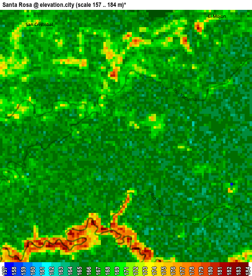
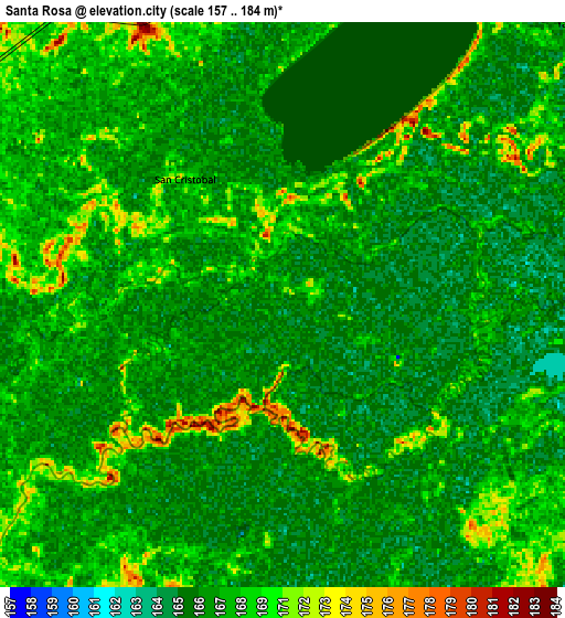
Below is the Elevation map of Santa Rosa, which displays elevation range with different colors. Scale of the first map is from 157 to 184 m (515 to 604 ft) with average elevation of 167.5 meters (=550 ft) [note 1]
These maps also provides idea of topography and contour of this city, they are displayed at different zoom levels. More info about maps, scale and edge coordinates you can find below images.
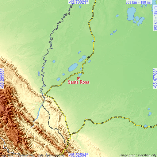
| \ | Map #1 | Map #2 | Topo.Map |
| Scale [m] | 157..184 m | 157..184 m | × |
| Scale [ft] | 515..604 ft | 515..604 ft | × |
| Average | 167.5 m = 550 ft | 167.5 m = 550 ft | × |
| Width | 9.48 km = 5.9 mi | 18.95 km = 11.8 mi | 303.2 km = 188.4 mi |
| Height | 9.48 km = 5.9 mi | 18.95 km = 11.8 mi | 303.2 km = 188.4 mi |
| ↑Max Latitude | -14.124057° | -14.081436° | -12.79921° |
| Latitude at center | -14.16667° | -14.16667° | -14.16667° |
| ↓Min Latitude | -14.209275° | -14.251872° | -15.52594° |
| ← Min Longitude | -66.927275° | -66.971221° | -68.28958° |
| Longitude center | -66.88333° | -66.88333° | -66.88333° |
| →Max Longitude | -66.839385° | -66.795439° | -65.47708° |
Nearby cities:
Cities around Santa Rosa sort by population:
• Trinidad elevation 159 m
226 km,  109°
109°
• San Borja 195 m
77.5 km,  169°
169°
• San Borja 191 m
72.4 km,  177°
177°
• Santa Ana de Yacuma 148 m
164 km,  73°
73°
• Rurrenabaque 210 m
75.9 km,  246°
246°
• Reyes 189 m
50.9 km, 253°
• San Ramón 136 m
253.8 km, 67°
• Mapiri 806 m
183.2 km,  228°
228°
• Coroico 1575 m
243 km,  201°
201°
• Amarete 3842 m
255.4 km,  242°
242°
• Coripata 1688 m
249.4 km, 197°
• Guanay 477 m
182.9 km,  215°
215°
Multilingual:
 En español:
Santa Rosa elevación 167 m.
 En France:
Santa Rosa élévation 167 m.
 Auf Deutsch:
Santa Rosa höhe über dem Meeresspiegel ist 167 m.

Sources and notes:
- [note 1] Map square and city borders are not equal. Map elevation data is calculated only from area inside that square.
- [src 1] Elevation data from geonames database provided with same terms of usage.
- [src 2] The elevation map of Santa Rosa is generated using elevation data from NASA's 3 arcsec (90m) resolution SRTM data.
- [src 3] Base (background) map © OpenStreetMap contributors tiles are generated by Geofabrik and OpenTopoMap.
Copyright & License:
This Santa Rosa Elevation Map is licensed under CC BY-SA. You may reuse any part from this page, if you give a proper credit by linking to this URL:
 More info on terms of use page.