San Matías elevation
San Matías (Santa Cruz, Provincia Ángel Sandoval), Bolivia elevation is 120 meters and San Matías elevation in feet is 394 ft above sea level [src 1]. San Matías is a populated place (feature code) with elevation that is 1756 meters (5761 ft) smaller than average city elevation in Bolivia.
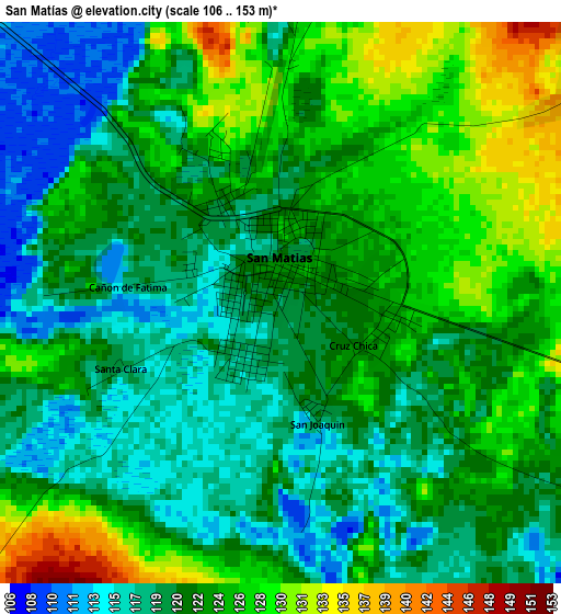
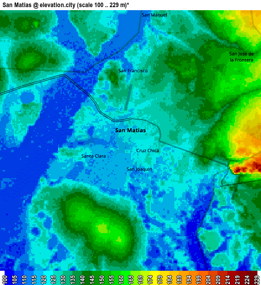
Below is the Elevation map of San Matías, which displays elevation range with different colors. Scale of the first map is from 106 to 153 m (348 to 502 ft) with average elevation of 122.3 meters (=401 ft) [note 1]
These maps also provides idea of topography and contour of this city, they are displayed at different zoom levels. More info about maps, scale and edge coordinates you can find below images.
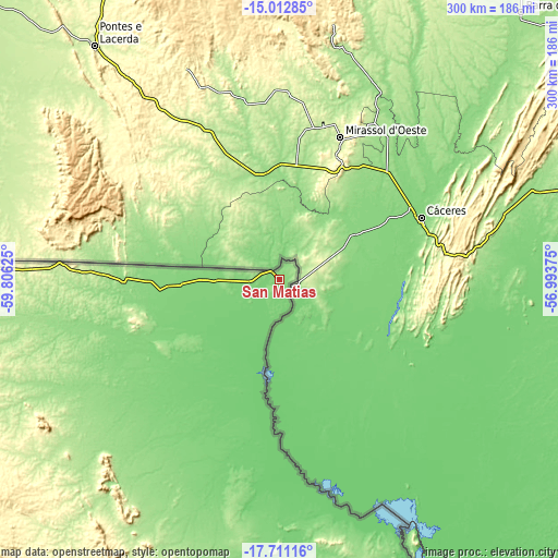
| \ | Map #1 | Map #2 | Topo.Map |
| Scale [m] | 106..153 m | 100..229 m | × |
| Scale [ft] | 348..502 ft | 328..751 ft | × |
| Average | 122.3 m = 401 ft | 128.5 m = 422 ft | × |
| Width | 9.38 km = 5.8 mi | 18.75 km = 11.7 mi | 300 km = 186.4 mi |
| Height | 9.38 km = 5.8 mi | 18.75 km = 11.7 mi | 300 km = 186.4 mi |
| ↑Max Latitude | -16.324501° | -16.282323° | -15.01285° |
| Latitude at center | -16.36667° | -16.36667° | -16.36667° |
| ↓Min Latitude | -16.40883° | -16.450981° | -17.71116° |
| ← Min Longitude | -58.443945° | -58.487891° | -59.80625° |
| Longitude center | -58.4° | -58.4° | -58.4° |
| →Max Longitude | -58.356055° | -58.312109° | -56.99375° |
Nearby cities:
Cities around San Matías sort by population:
• San Ignacio de Velasco elevation 385 m
272 km,  270°
270°
• Puerto Quijarro 92 m
171.3 km,  156°
156°
• Roboré 258 m
262.2 km,  213°
213°
• Concepción 478 m
266.8 km, 268°
• San Pedro 298 m
260.8 km,  215°
215°
Multilingual:
 En español:
San Matías elevación 120 m.
 En France:
San Matías élévation 120 m.
 Auf Deutsch:
San Matías höhe über dem Meeresspiegel ist 120 m.

Sources and notes:
- [note 1] Map square and city borders are not equal. Map elevation data is calculated only from area inside that square.
- [src 1] Elevation data from geonames database provided with same terms of usage.
- [src 2] The elevation map of San Matías is generated using elevation data from NASA's 3 arcsec (90m) resolution SRTM data.
- [src 3] Base (background) map © OpenStreetMap contributors tiles are generated by Geofabrik and OpenTopoMap.
Copyright & License:
This San Matías Elevation Map is licensed under CC BY-SA. You may reuse any part from this page, if you give a proper credit by linking to this URL:
 More info on terms of use page.