Gabrovo elevation
Gabrovo, Bulgaria elevation is 538 meters and Gabrovo elevation in feet is 1765 ft above sea level [src 1]. Gabrovo is a seat of a first-order administrative division (feature code) with elevation that is 219 meters (719 ft) bigger than average city elevation in Bulgaria.
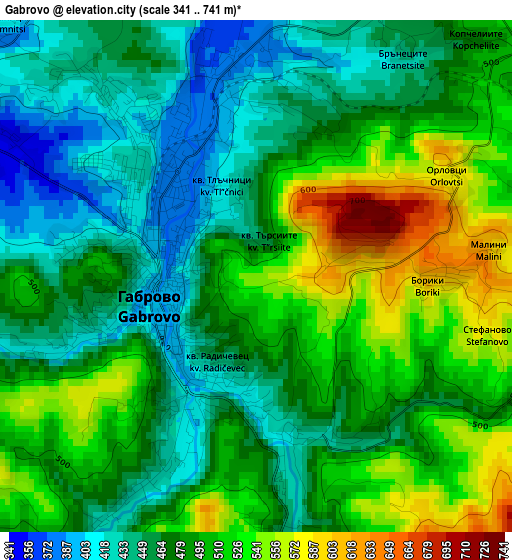
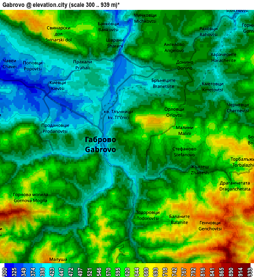
Below is the Elevation map of Gabrovo, which displays elevation range with different colors. Scale of the first map is from 341 to 741 m (1119 to 2431 ft) with average elevation of 484 meters (=1588 ft) [note 1]
These maps also provides idea of topography and contour of this city, they are displayed at different zoom levels. More info about maps, scale and edge coordinates you can find below images.
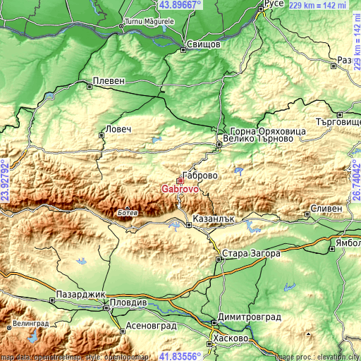
| \ | Map #1 | Map #2 | Topo.Map |
| Scale [m] | 341..741 m | 300..939 m | × |
| Scale [ft] | 1119..2431 ft | 984..3081 ft | × |
| Average | 484 m = 1588 ft | 536.5 m = 1760 ft | × |
| Width | 7.16 km = 4.4 mi | 14.32 km = 8.9 mi | 229.2 km = 142.4 mi |
| Height | 7.16 km = 4.4 mi | 14.32 km = 8.9 mi | 229.2 km = 142.4 mi |
| ↑Max Latitude | 42.906917° | 42.939096° | 43.89667° |
| Latitude at center | 42.87472° | 42.87472° | 42.87472° |
| ↓Min Latitude | 42.842507° | 42.810276° | 41.83556° |
| ← Min Longitude | 25.290225° | 25.246279° | 23.92792° |
| Longitude center | 25.33417° | 25.33417° | 25.33417° |
| →Max Longitude | 25.378115° | 25.422061° | 26.74042° |
Nearby cities:
Cities around Gabrovo sort by population:
• Veliko Tŭrnovo elevation 207 m
33.2 km,  46°
46°
• Kazanlak 366 m
29.2 km,  169°
169°
• Sevlievo 195 m
24.6 km,  313°
313°
• Tryavna 488 m
13.5 km,  93°
93°
• Dryanovo 256 m
16.5 km, 45°
• Debelets 158 m
29 km, 52°
• Apriltsi 511 m
34.2 km,  263°
263°
• Maglizh 353 m
35.3 km,  150°
150°
• Pavel Banya 411 m
32.5 km,  199°
199°
• Kilifarevo 268 m
27.2 km,  63°
63°
• Shipka 692 m
17.6 km,  180°
180°
• Asen 470 m
27.3 km, 203°
Multilingual:
 En español:
Gabrovo elevación 538 m.
 En France:
Gabrovo élévation 538 m.


Sources and notes:
- [note 1] Map square and city borders are not equal. Map elevation data is calculated only from area inside that square.
- [src 1] Elevation data from geonames database provided with same terms of usage.
- [src 2] The elevation map of Gabrovo is generated using elevation data from NASA's 3 arcsec (90m) resolution SRTM data.
- [src 3] Base (background) map © OpenStreetMap contributors tiles are generated by Geofabrik and OpenTopoMap.
Copyright & License:
This Gabrovo Elevation Map is licensed under CC BY-SA. You may reuse any part from this page, if you give a proper credit by linking to this URL:
 More info on terms of use page.