Chapelle-lez-Herlaimont elevation
Chapelle-lez-Herlaimont (Wallonia, Province du Hainaut), Belgium elevation is 165 meters and Chapelle-lez-Herlaimont elevation in feet is 541 ft above sea level [src 1]. Chapelle-lez-Herlaimont is a populated place (feature code) with elevation that is 66 meters (217 ft) bigger than average city elevation in Belgium.
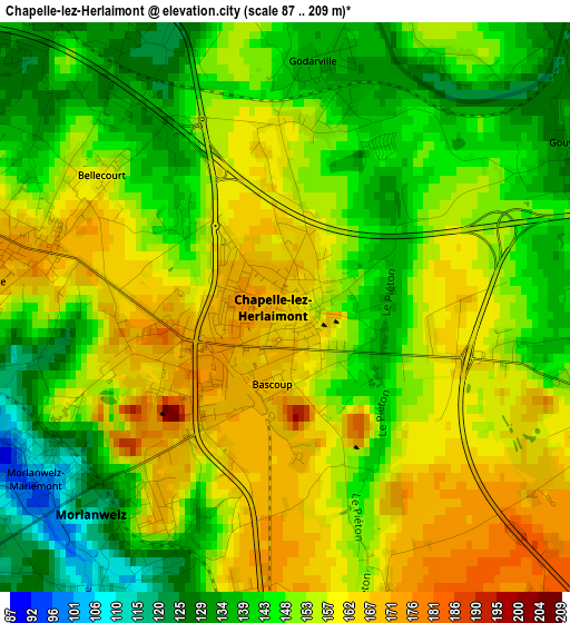
Below is the Elevation map of Chapelle-lez-Herlaimont, which displays elevation range with different colors. Scale of the first map is from 87 to 209 m (285 to 686 ft) with average elevation of 150.7 meters (=494 ft) [note 1]
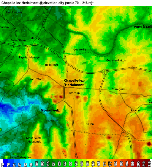
These maps also provides idea of topography and contour of this city, they are displayed at different zoom levels. More info about maps, scale and edge coordinates you can find below images.
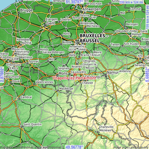
| \ | Map #1 | Map #2 | Topo.Map |
| Scale [m] | 87..209 m | 70..216 m | × |
| Scale [ft] | 285..686 ft | 230..709 ft | × |
| Average | 150.7 m = 494 ft | 144.6 m = 474 ft | × |
| Width | 6.22 km = 3.9 mi | 12.44 km = 7.7 mi | 199 km = 123.7 mi |
| Height | 6.22 km = 3.9 mi | 12.44 km = 7.7 mi | 199 km = 123.7 mi |
| ↑Max Latitude | 50.499261° | 50.527206° | 51.35787° |
| Latitude at center | 50.4713° | 50.4713° | 50.4713° |
| ↓Min Latitude | 50.443322° | 50.415328° | 49.56778° |
| ← Min Longitude | 4.238325° | 4.194379° | 2.87602° |
| Longitude center | 4.28227° | 4.28227° | 4.28227° |
| →Max Longitude | 4.326215° | 4.370161° | 5.68852° |
Nearby cities:
Cities around Chapelle-lez-Herlaimont sort by population:
• Charleroi elevation 136 m
13.3 km,  120°
120°
• La Louvière 133 m
6.9 km,  284°
284°
• Binche 92 m
10.7 km,  231°
231°
• Courcelles 160 m
6.6 km,  97°
97°
• Manage 134 m
4.8 km,  317°
317°
• Morlanwelz-Mariemont 106 m
3.2 km,  235°
235°
• Pont-à-Celles 137 m
7.2 km,  58°
58°
• Anderlues 181 m
7.2 km,  186°
186°
• Seneffe 112 m
6.8 km,  348°
348°
• Roeulx 132 m
12.6 km,  286°
286°
• Brunehault 147 m
11.3 km,  70°
70°
• Lobbes 170 m
13.2 km,  184°
184°
Multilingual:
 En español:
Chapelle-lez-Herlaimont elevación 165 m.
 En France:
Chapelle-lez-Herlaimont élévation 165 m.
 Auf Deutsch:
Chapelle-lez-Herlaimont höhe über dem Meeresspiegel ist 165 m.
 На русском:
Шапель-лез-Эрлемон высота над уровнем моря 165 м
Sources and notes:
- [note 1] Map square and city borders are not equal. Map elevation data is calculated only from area inside that square.
- [src 1] Elevation data from geonames database provided with same terms of usage.
- [src 2] The elevation map of Chapelle-lez-Herlaimont is generated using elevation data from NASA's 3 arcsec (90m) resolution SRTM data.
- [src 3] Base (background) map © OpenStreetMap contributors tiles are generated by Geofabrik and OpenTopoMap.
Copyright & License:
This Chapelle-lez-Herlaimont Elevation Map is licensed under CC BY-SA. You may reuse any part from this page, if you give a proper credit by linking to this URL:
 More info on terms of use page.