Lobbes elevation
Lobbes (Wallonia, Province du Hainaut), Belgium elevation is 170 meters and Lobbes elevation in feet is 558 ft above sea level [src 1]. Lobbes is a populated place (feature code) with elevation that is 71 meters (233 ft) bigger than average city elevation in Belgium.
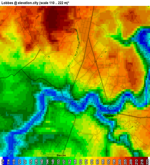
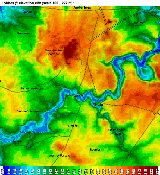
Below is the Elevation map of Lobbes, which displays elevation range with different colors. Scale of the first map is from 110 to 222 m (361 to 728 ft) with average elevation of 169.6 meters (=556 ft) [note 1]
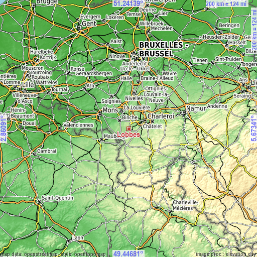
These maps also provides idea of topography and contour of this city, they are displayed at different zoom levels. More info about maps, scale and edge coordinates you can find below images.
| \ | Map #1 | Map #2 | Topo.Map |
| Scale [m] | 110..222 m | 105..227 m | × |
| Scale [ft] | 361..728 ft | 344..745 ft | × |
| Average | 169.6 m = 556 ft | 169.2 m = 555 ft | × |
| Width | 6.24 km = 3.9 mi | 12.47 km = 7.7 mi | 199.5 km = 124 mi |
| Height | 6.24 km = 3.9 mi | 12.47 km = 7.7 mi | 199.5 km = 124 mi |
| ↑Max Latitude | 50.380612° | 50.408627° | 51.24139° |
| Latitude at center | 50.35258° | 50.35258° | 50.35258° |
| ↓Min Latitude | 50.324532° | 50.296467° | 49.44681° |
| ← Min Longitude | 4.223215° | 4.179269° | 2.86091° |
| Longitude center | 4.26716° | 4.26716° | 4.26716° |
| →Max Longitude | 4.311105° | 4.355051° | 5.67341° |
Nearby cities:
Cities around Lobbes sort by population:
• Charleroi elevation 136 m
14.2 km,  62°
62°
• La Louvière 133 m
15.9 km,  339°
339°
• Binche 92 m
9.8 km,  312°
312°
• Courcelles 160 m
14.5 km,  31°
31°
• Morlanwelz-Mariemont 106 m
11.5 km,  352°
352°
• Thuin 156 m
2 km,  137°
137°
• Chapelle-lez-Herlaimont 165 m
13.2 km,  4°
4°
• Anderlues 181 m
6.1 km, 2°
• Erquelinnes 137 m
12.2 km,  245°
245°
• Estinnes-au-Val 60 m
13.2 km,  299°
299°
• Beaumont 222 m
13 km,  188°
188°
• Merbes-le-Château 131 m
7.9 km, 246°
Multilingual:
 En español:
Lobbes elevación 170 m.
 En France:
Lobbes élévation 170 m.


Sources and notes:
- [note 1] Map square and city borders are not equal. Map elevation data is calculated only from area inside that square.
- [src 1] Elevation data from geonames database provided with same terms of usage.
- [src 2] The elevation map of Lobbes is generated using elevation data from NASA's 3 arcsec (90m) resolution SRTM data.
- [src 3] Base (background) map © OpenStreetMap contributors tiles are generated by Geofabrik and OpenTopoMap.
Copyright & License:
This Lobbes Elevation Map is licensed under CC BY-SA. You may reuse any part from this page, if you give a proper credit by linking to this URL:
 More info on terms of use page.