Sprimont elevation
Sprimont (Wallonia, Province de Liège), Belgium elevation is 224 meters and Sprimont elevation in feet is 735 ft above sea level [src 1]. Sprimont is a populated place (feature code) with elevation that is 125 meters (410 ft) bigger than average city elevation in Belgium.
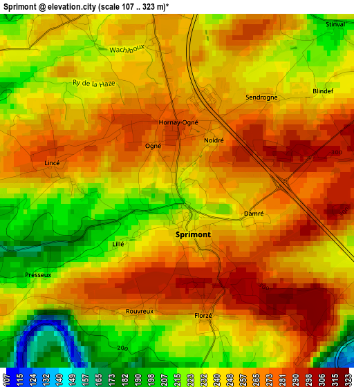
Below is the Elevation map of Sprimont, which displays elevation range with different colors. Scale of the first map is from 107 to 323 m (351 to 1060 ft) with average elevation of 247.9 meters (=813 ft) [note 1]
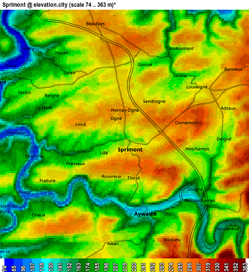
These maps also provides idea of topography and contour of this city, they are displayed at different zoom levels. More info about maps, scale and edge coordinates you can find below images.
| \ | Map #1 | Map #2 | Topo.Map |
| Scale [m] | 107..323 m | 74..363 m | × |
| Scale [ft] | 351..1060 ft | 243..1191 ft | × |
| Average | 247.9 m = 813 ft | 226.5 m = 743 ft | × |
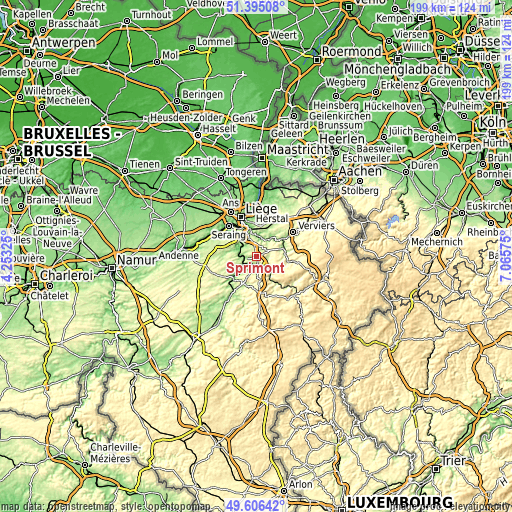
| Width | 6.21 km = 3.9 mi | 12.43 km = 7.7 mi | 198.9 km = 123.6 mi |
| Height | 6.21 km = 3.9 mi | 12.43 km = 7.7 mi | 198.9 km = 123.6 mi |
| ↑Max Latitude | 50.537159° | 50.565081° | 51.39508° |
| Latitude at center | 50.50922° | 50.50922° | 50.50922° |
| ↓Min Latitude | 50.481265° | 50.453293° | 49.60642° |
| ← Min Longitude | 5.615555° | 5.571609° | 4.25325° |
| Longitude center | 5.6595° | 5.6595° | 5.6595° |
| →Max Longitude | 5.703445° | 5.747391° | 7.06575° |
Nearby cities:
Cities around Sprimont sort by population:
• Chaudfontaine elevation 218 m
8.4 km,  347°
347°
• Fléron 258 m
11.9 km,  7°
7°
• Esneux 115 m
7.1 km,  294°
294°
• Beyne-Heusay 231 m
12.6 km,  1°
1°
• Theux 168 m
11.1 km,  76°
76°
• Aywaille 124 m
4.1 km,  162°
162°
• Pepinster 193 m
12.5 km,  55°
55°
• Trooz 98 m
7.2 km,  20°
20°
• Comblain-au-Pont 103 m
7 km,  236°
236°
• Ferrières 225 m
12.5 km,  196°
196°
• Anthisnes 275 m
10.3 km,  253°
253°
• Olne 226 m
10.9 km,  34°
34°
Multilingual:
 En español:
Sprimont elevación 224 m.
 En France:
Sprimont élévation 224 m.
 Auf Deutsch:
Sprimont höhe über dem Meeresspiegel ist 224 m.

Sources and notes:
- [note 1] Map square and city borders are not equal. Map elevation data is calculated only from area inside that square.
- [src 1] Elevation data from geonames database provided with same terms of usage.
- [src 2] The elevation map of Sprimont is generated using elevation data from NASA's 3 arcsec (90m) resolution SRTM data.
- [src 3] Base (background) map © OpenStreetMap contributors tiles are generated by Geofabrik and OpenTopoMap.
Copyright & License:
This Sprimont Elevation Map is licensed under CC BY-SA. You may reuse any part from this page, if you give a proper credit by linking to this URL:
 More info on terms of use page.