Theux elevation
Theux (Wallonia, Province de Liège), Belgium elevation is 168 meters and Theux elevation in feet is 551 ft above sea level [src 1]. Theux is a populated place (feature code) with elevation that is 69 meters (226 ft) bigger than average city elevation in Belgium.
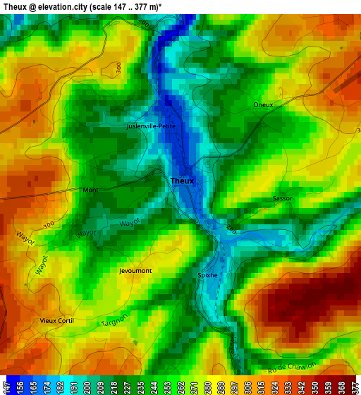
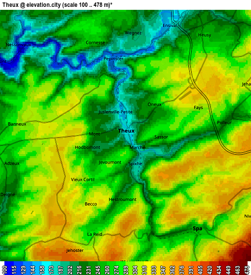
Below is the Elevation map of Theux, which displays elevation range with different colors. Scale of the first map is from 147 to 377 m (482 to 1237 ft) with average elevation of 262.4 meters (=861 ft) [note 1]
These maps also provides idea of topography and contour of this city, they are displayed at different zoom levels. More info about maps, scale and edge coordinates you can find below images.
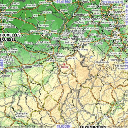
| \ | Map #1 | Map #2 | Topo.Map |
| Scale [m] | 147..377 m | 100..478 m | × |
| Scale [ft] | 482..1237 ft | 328..1568 ft | × |
| Average | 262.4 m = 861 ft | 275.4 m = 904 ft | × |
| Width | 6.21 km = 3.9 mi | 12.42 km = 7.7 mi | 198.8 km = 123.5 mi |
| Height | 6.21 km = 3.9 mi | 12.42 km = 7.7 mi | 198.8 km = 123.5 mi |
| ↑Max Latitude | 50.561155° | 50.589063° | 51.41864° |
| Latitude at center | 50.53323° | 50.53323° | 50.53323° |
| ↓Min Latitude | 50.505289° | 50.477331° | 49.63089° |
| ← Min Longitude | 5.768505° | 5.724559° | 4.4062° |
| Longitude center | 5.81245° | 5.81245° | 5.81245° |
| →Max Longitude | 5.856395° | 5.900341° | 7.2187° |
Nearby cities:
Cities around Theux sort by population:
• Verviers elevation 201 m
7.1 km,  29°
29°
• Herve 300 m
12 km,  353°
353°
• Soumagne 200 m
10.1 km,  332°
332°
• Dison 197 m
9 km,  18°
18°
• Sprimont 224 m
11.1 km,  256°
256°
• Spa 312 m
6.7 km,  145°
145°
• Aywaille 124 m
11.6 km,  235°
235°
• Pepinster 193 m
4.5 km, 353°
• Jalhay 386 m
11.3 km,  75°
75°
• Trooz 98 m
9.2 km,  296°
296°
• Limbourg 262 m
12.6 km,  45°
45°
• Olne 226 m
7.8 km,  323°
323°
Multilingual:
 En español:
Theux elevación 168 m.
 En France:
Theux élévation 168 m.


Sources and notes:
- [note 1] Map square and city borders are not equal. Map elevation data is calculated only from area inside that square.
- [src 1] Elevation data from geonames database provided with same terms of usage.
- [src 2] The elevation map of Theux is generated using elevation data from NASA's 3 arcsec (90m) resolution SRTM data.
- [src 3] Base (background) map © OpenStreetMap contributors tiles are generated by Geofabrik and OpenTopoMap.
Copyright & License:
This Theux Elevation Map is licensed under CC BY-SA. You may reuse any part from this page, if you give a proper credit by linking to this URL:
 More info on terms of use page.