Tournai elevation
Tournai (Wallonia, Province du Hainaut), Belgium elevation is 24 meters and Tournai elevation in feet is 79 ft above sea level [src 1]. Tournai is a seat of a third-order administrative division (feature code) with elevation that is 75 meters (246 ft) smaller than average city elevation in Belgium.
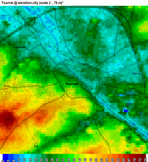
Below is the Elevation map of Tournai, which displays elevation range with different colors. Scale of the first map is from 2 to 76 m (7 to 249 ft) with average elevation of 30.7 meters (=101 ft) [note 1]
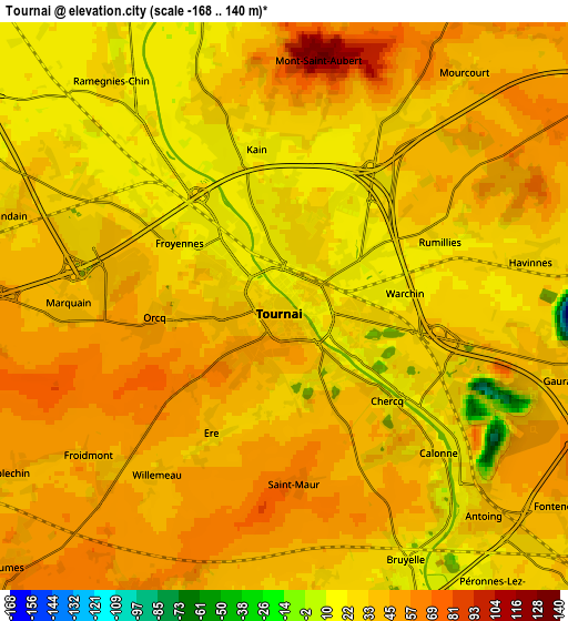
These maps also provides idea of topography and contour of this city, they are displayed at different zoom levels. More info about maps, scale and edge coordinates you can find below images.
| \ | Map #1 | Map #2 | Topo.Map |
| Scale [m] | 2..76 m | -168..140 m | × |
| Scale [ft] | 7..249 ft | -551..459 ft | × |
| Average | 30.7 m = 101 ft | 36.8 m = 121 ft | × |
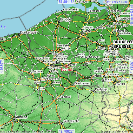
| Width | 6.2 km = 3.9 mi | 12.4 km = 7.7 mi | 198.5 km = 123.3 mi |
| Height | 6.2 km = 3.9 mi | 12.4 km = 7.7 mi | 198.5 km = 123.3 mi |
| ↑Max Latitude | 50.635031° | 50.662895° | 51.49116° |
| Latitude at center | 50.60715° | 50.60715° | 50.60715° |
| ↓Min Latitude | 50.579253° | 50.551339° | 49.70622° |
| ← Min Longitude | 3.345375° | 3.301429° | 1.98307° |
| Longitude center | 3.38932° | 3.38932° | 3.38932° |
| →Max Longitude | 3.433265° | 3.477211° | 4.79557° |
Nearby cities:
Cities around Tournai sort by population:
• Mouscron elevation 53 m
20 km,  319°
319°
• Ronse 42 m
21.4 km,  43°
43°
• Zwevegem 30 m
23.1 km,  351°
351°
• Péruwelz 34 m
18.2 km,  127°
127°
• Bernissart 20 m
23.6 km, 128°
• Frasnes-lez-Buissenal 38 m
17.6 km,  67°
67°
• Estaimpuis 27 m
13.8 km, 321°
• Avelgem 17 m
19.2 km,  11°
11°
• Antoing 31 m
6.1 km,  136°
136°
• Celles 19 m
12.6 km,  22°
22°
• Pecq 23 m
9.5 km,  337°
337°
• Rumes 58 m
8.3 km,  225°
225°
Multilingual:
 En español:
Tournai elevación 24 m.
 En France:
Tournai élévation 24 m.


Sources and notes:
- [note 1] Map square and city borders are not equal. Map elevation data is calculated only from area inside that square.
- [src 1] Elevation data from geonames database provided with same terms of usage.
- [src 2] The elevation map of Tournai is generated using elevation data from NASA's 3 arcsec (90m) resolution SRTM data.
- [src 3] Base (background) map © OpenStreetMap contributors tiles are generated by Geofabrik and OpenTopoMap.
Copyright & License:
This Tournai Elevation Map is licensed under CC BY-SA. You may reuse any part from this page, if you give a proper credit by linking to this URL:
 More info on terms of use page.