Ronse elevation
Ronse (Flanders, Provincie Oost-Vlaanderen), Belgium elevation is 42 meters and Ronse elevation in feet is 138 ft above sea level [src 1]. Ronse is a populated place (feature code) with elevation that is 57 meters (187 ft) smaller than average city elevation in Belgium.
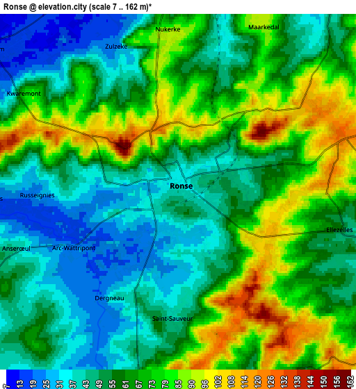
Below is the Elevation map of Ronse, which displays elevation range with different colors. Scale of the first map is from 16 to 162 m (52 to 531 ft) with average elevation of 56.3 meters (=185 ft) [note 1]
These maps also provides idea of topography and contour of this city, they are displayed at different zoom levels. More info about maps, scale and edge coordinates you can find below images.

| \ | Map #1 | Map #2 | Topo.Map |
| Scale [m] | 16..162 m | 7..162 m | × |
| Scale [ft] | 52..531 ft | 23..531 ft | × |
| Average | 56.3 m = 185 ft | 61.1 m = 200 ft | × |
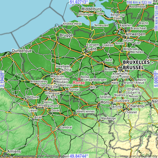
| Width | 6.18 km = 3.8 mi | 12.37 km = 7.7 mi | 197.9 km = 123 mi |
| Height | 6.18 km = 3.8 mi | 12.37 km = 7.7 mi | 197.9 km = 123 mi |
| ↑Max Latitude | 50.773539° | 50.801321° | 51.62713° |
| Latitude at center | 50.74574° | 50.74574° | 50.74574° |
| ↓Min Latitude | 50.717925° | 50.690093° | 49.84744° |
| ← Min Longitude | 3.556555° | 3.512609° | 2.19425° |
| Longitude center | 3.6005° | 3.6005° | 3.6005° |
| →Max Longitude | 3.644445° | 3.688391° | 5.00675° |
Nearby cities:
Cities around Ronse sort by population:
• Oudenaarde elevation 11 m
11.8 km,  2°
2°
• Ath 32 m
18 km,  135°
135°
• Lessines 23 m
17 km,  103°
103°
• Anzegem 51 m
13.3 km,  319°
319°
• Frasnes-lez-Buissenal 38 m
8.8 km,  170°
170°
• Avelgem 17 m
11.4 km,  287°
287°
• Kruishoutem 45 m
18.1 km,  343°
343°
• Zingem 16 m
18 km,  11°
11°
• Sint-Maria-Lierde 45 m
19 km,  64°
64°
• Ellezelles 56 m
5.7 km, 101°
• Celles 19 m
10.7 km,  249°
249°
• Flobecq 43 m
9.8 km, 95°
Multilingual:
 En español:
Ronse elevación 42 m.
 En France:
Ronse élévation 42 m.


Sources and notes:
- [note 1] Map square and city borders are not equal. Map elevation data is calculated only from area inside that square.
- [src 1] Elevation data from geonames database provided with same terms of usage.
- [src 2] The elevation map of Ronse is generated using elevation data from NASA's 3 arcsec (90m) resolution SRTM data.
- [src 3] Base (background) map © OpenStreetMap contributors tiles are generated by Geofabrik and OpenTopoMap.
Copyright & License:
This Ronse Elevation Map is licensed under CC BY-SA. You may reuse any part from this page, if you give a proper credit by linking to this URL:
 More info on terms of use page.