Estaimpuis elevation
Estaimpuis (Wallonia, Province du Hainaut), Belgium elevation is 27 meters and Estaimpuis elevation in feet is 89 ft above sea level [src 1]. Estaimpuis is a populated place (feature code) with elevation that is 72 meters (236 ft) smaller than average city elevation in Belgium.
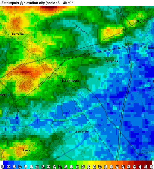
Below is the Elevation map of Estaimpuis, which displays elevation range with different colors. Scale of the first map is from 13 to 49 m (43 to 161 ft) with average elevation of 23.5 meters (=77 ft) [note 1]
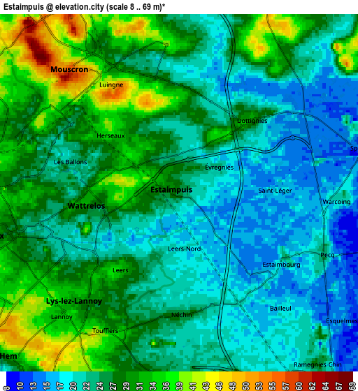
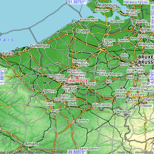
These maps also provides idea of topography and contour of this city, they are displayed at different zoom levels. More info about maps, scale and edge coordinates you can find below images.
| \ | Map #1 | Map #2 | Topo.Map |
| Scale [m] | 13..49 m | 8..69 m | × |
| Scale [ft] | 43..161 ft | 26..226 ft | × |
| Average | 23.5 m = 77 ft | 26 m = 85 ft | × |
| Width | 6.19 km = 3.8 mi | 12.38 km = 7.7 mi | 198.1 km = 123.1 mi |
| Height | 6.19 km = 3.8 mi | 12.38 km = 7.7 mi | 198 km = 123 mi |
| ↑Max Latitude | 50.732673° | 50.760479° | 51.58701° |
| Latitude at center | 50.70485° | 50.70485° | 50.70485° |
| ↓Min Latitude | 50.67701° | 50.649154° | 49.80578° |
| ← Min Longitude | 3.223905° | 3.179959° | 1.8616° |
| Longitude center | 3.26785° | 3.26785° | 3.26785° |
| →Max Longitude | 3.311795° | 3.355741° | 4.6741° |
Nearby cities:
Cities around Estaimpuis sort by population:
• Kortrijk elevation 22 m
13.7 km,  359°
359°
• Tournai 24 m
13.8 km,  141°
141°
• Mouscron 53 m
6.2 km,  315°
315°
• Menen 18 m
14.5 km, 315°
• Wevelgem 15 m
12.8 km,  326°
326°
• Harelbeke 16 m
16.8 km,  10°
10°
• Zwevegem 30 m
13 km,  22°
22°
• Kuurne 16 m
16.3 km,  3°
3°
• Avelgem 17 m
14.8 km,  57°
57°
• Celles 19 m
13.4 km,  86°
86°
• Pecq 23 m
5.4 km,  112°
112°
• Rumes 58 m
16.9 km,  171°
171°
Multilingual:
 En español:
Estaimpuis elevación 27 m.
 En France:
Estaimpuis élévation 27 m.
 Auf Deutsch:
Estaimpuis höhe über dem Meeresspiegel ist 27 m.

Sources and notes:
- [note 1] Map square and city borders are not equal. Map elevation data is calculated only from area inside that square.
- [src 1] Elevation data from geonames database provided with same terms of usage.
- [src 2] The elevation map of Estaimpuis is generated using elevation data from NASA's 3 arcsec (90m) resolution SRTM data.
- [src 3] Base (background) map © OpenStreetMap contributors tiles are generated by Geofabrik and OpenTopoMap.
Copyright & License:
This Estaimpuis Elevation Map is licensed under CC BY-SA. You may reuse any part from this page, if you give a proper credit by linking to this URL:
 More info on terms of use page.