Walcourt elevation
Walcourt (Wallonia, Province de Namur), Belgium elevation is 187 meters and Walcourt elevation in feet is 614 ft above sea level [src 1]. Walcourt is a populated place (feature code) with elevation that is 88 meters (289 ft) bigger than average city elevation in Belgium.
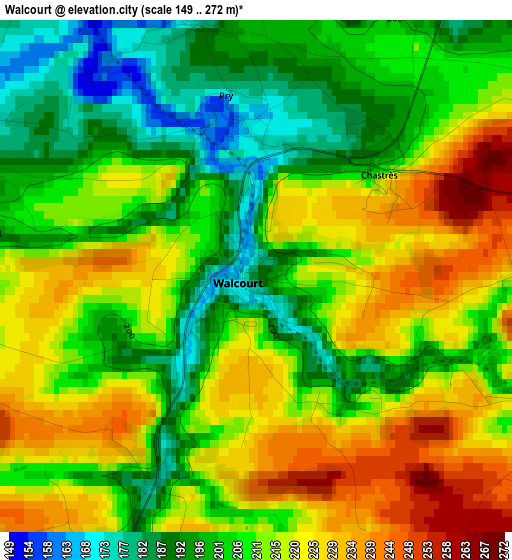
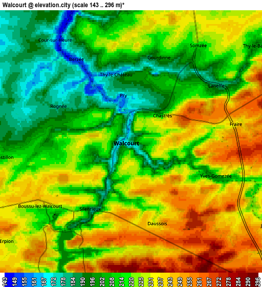
Below is the Elevation map of Walcourt, which displays elevation range with different colors. Scale of the first map is from 149 to 272 m (489 to 892 ft) with average elevation of 210.6 meters (=691 ft) [note 1]
These maps also provides idea of topography and contour of this city, they are displayed at different zoom levels. More info about maps, scale and edge coordinates you can find below images.
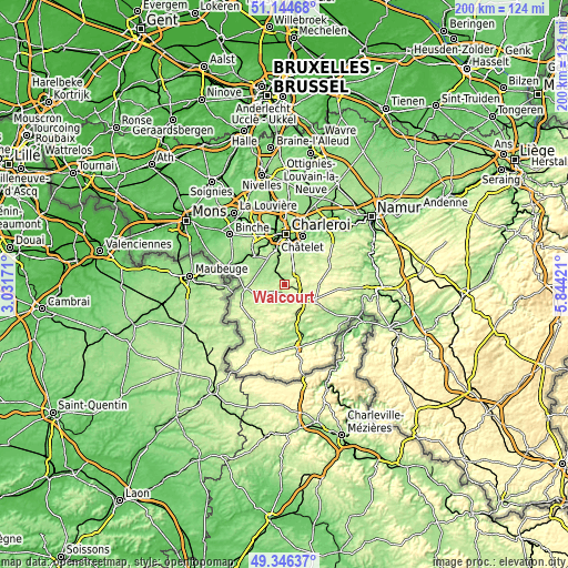
| \ | Map #1 | Map #2 | Topo.Map |
| Scale [m] | 149..272 m | 143..296 m | × |
| Scale [ft] | 489..892 ft | 469..971 ft | × |
| Average | 210.6 m = 691 ft | 220.7 m = 724 ft | × |
| Width | 6.25 km = 3.9 mi | 12.5 km = 7.8 mi | 200 km = 124.3 mi |
| Height | 6.25 km = 3.9 mi | 12.5 km = 7.8 mi | 199.9 km = 124.2 mi |
| ↑Max Latitude | 50.2821° | 50.310173° | 51.14468° |
| Latitude at center | 50.25401° | 50.25401° | 50.25401° |
| ↓Min Latitude | 50.225904° | 50.197781° | 49.34637° |
| ← Min Longitude | 4.394015° | 4.350069° | 3.03171° |
| Longitude center | 4.43796° | 4.43796° | 4.43796° |
| →Max Longitude | 4.481905° | 4.525851° | 5.84421° |
Nearby cities:
Cities around Walcourt sort by population:
• Charleroi elevation 136 m
17.5 km,  1°
1°
• Châtelet 118 m
17.8 km,  21°
21°
• Thuin 156 m
14.4 km,  311°
311°
• Mettet 241 m
17.6 km,  64°
64°
• Gerpinnes 185 m
11.3 km,  34°
34°
• Florennes 262 m
12 km,  91°
91°
• La Bruyère 194 m
20 km,  38°
38°
• Philippeville 290 m
9.9 km,  130°
130°
• Beaumont 222 m
14.3 km,  262°
262°
• Lobbes 170 m
16.3 km, 312°
• Cerfontaine 218 m
9.5 km,  191°
191°
• Froidchapelle 241 m
13.9 km,  214°
214°
Multilingual:
 En español:
Walcourt elevación 187 m.
 En France:
Walcourt élévation 187 m.
 Auf Deutsch:
Walcourt höhe über dem Meeresspiegel ist 187 m.

Sources and notes:
- [note 1] Map square and city borders are not equal. Map elevation data is calculated only from area inside that square.
- [src 1] Elevation data from geonames database provided with same terms of usage.
- [src 2] The elevation map of Walcourt is generated using elevation data from NASA's 3 arcsec (90m) resolution SRTM data.
- [src 3] Base (background) map © OpenStreetMap contributors tiles are generated by Geofabrik and OpenTopoMap.
Copyright & License:
This Walcourt Elevation Map is licensed under CC BY-SA. You may reuse any part from this page, if you give a proper credit by linking to this URL:
 More info on terms of use page.