Dubrave Gornje elevation
Dubrave Gornje (Federation of B&H), Bosnia and Herzegovina elevation is 287 meters and Dubrave Gornje elevation in feet is 942 ft above sea level [src 1]. Dubrave Gornje is a populated place (feature code) with elevation that is 76 meters (249 ft) smaller than average city elevation in Bosnia and Herzegovina.
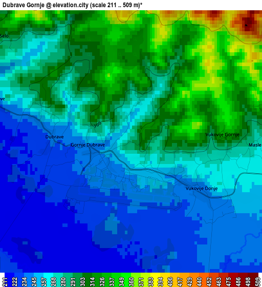
Below is the Elevation map of Dubrave Gornje, which displays elevation range with different colors. Scale of the first map is from 211 to 509 m (692 to 1670 ft) with average elevation of 276.2 meters (=906 ft) [note 1]
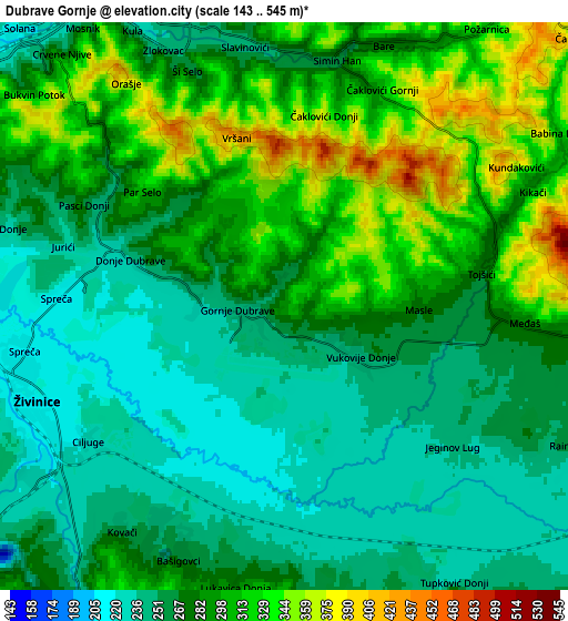
These maps also provides idea of topography and contour of this city, they are displayed at different zoom levels. More info about maps, scale and edge coordinates you can find below images.
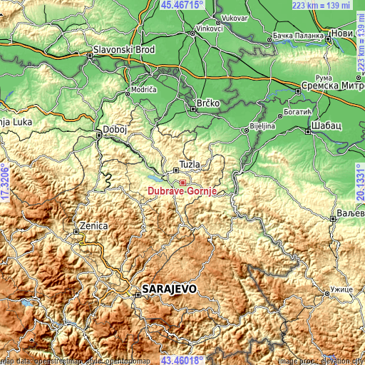
| \ | Map #1 | Map #2 | Topo.Map |
| Scale [m] | 211..509 m | 143..545 m | × |
| Scale [ft] | 692..1670 ft | 469..1788 ft | × |
| Average | 276.2 m = 906 ft | 280.4 m = 920 ft | × |
| Width | 6.97 km = 4.3 mi | 13.95 km = 8.7 mi | 223.2 km = 138.7 mi |
| Height | 6.97 km = 4.3 mi | 13.95 km = 8.7 mi | 223.1 km = 138.6 mi |
| ↑Max Latitude | 44.50364° | 44.534974° | 45.46715° |
| Latitude at center | 44.47229° | 44.47229° | 44.47229° |
| ↓Min Latitude | 44.440923° | 44.409538° | 43.46018° |
| ← Min Longitude | 18.682905° | 18.638959° | 17.3206° |
| Longitude center | 18.72685° | 18.72685° | 18.72685° |
| →Max Longitude | 18.770795° | 18.814741° | 20.1331° |
Nearby cities:
Cities around Dubrave Gornje sort by population:
• Tuzla elevation 225 m
8.7 km,  327°
327°
• Živinice 216 m
6.6 km,  247°
247°
• Tojšići 322 m
5.6 km,  55°
55°
• Gornja Tuzla 322 m
9.8 km,  16°
16°
• Solina 272 m
10.4 km,  345°
345°
• Gornje Živinice 285 m
10 km,  241°
241°
• Dubrave Donje 295 m
2.5 km,  291°
291°
• Šerići 221 m
13 km,  267°
267°
• Vukovije Donje 251 m
2.1 km,  122°
122°
• Svojat 307 m
8.6 km,  173°
173°
• Kiseljak 210 m
12.6 km,  278°
278°
• Kalesija 293 m
14.8 km,  105°
105°
Multilingual:
 En español:
Dubrave Gornje elevación 287 m.
 En France:
Dubrave Gornje élévation 287 m.
 Auf Deutsch:
Dubrave Gornje höhe über dem Meeresspiegel ist 287 m.

Sources and notes:
- [note 1] Map square and city borders are not equal. Map elevation data is calculated only from area inside that square.
- [src 1] Elevation data from geonames database provided with same terms of usage.
- [src 2] The elevation map of Dubrave Gornje is generated using elevation data from NASA's 3 arcsec (90m) resolution SRTM data.
- [src 3] Base (background) map © OpenStreetMap contributors tiles are generated by Geofabrik and OpenTopoMap.
Copyright & License:
This Dubrave Gornje Elevation Map is licensed under CC BY-SA. You may reuse any part from this page, if you give a proper credit by linking to this URL:
 More info on terms of use page.