Tojšići elevation
Tojšići (Federation of B&H), Bosnia and Herzegovina elevation is 322 meters and Tojšići elevation in feet is 1056 ft above sea level [src 1]. Tojšići is a populated place (feature code) with elevation that is 41 meters (135 ft) smaller than average city elevation in Bosnia and Herzegovina.
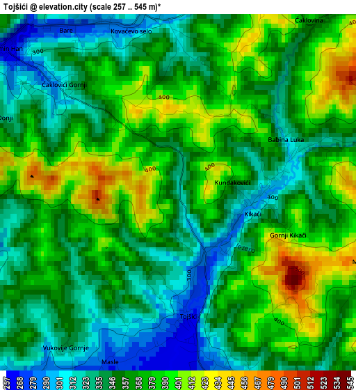
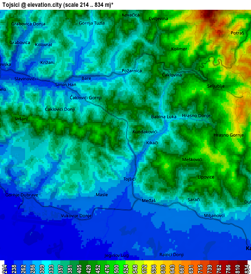
Below is the Elevation map of Tojšići, which displays elevation range with different colors. Scale of the first map is from 257 to 545 m (843 to 1788 ft) with average elevation of 360.1 meters (=1181 ft) [note 1]
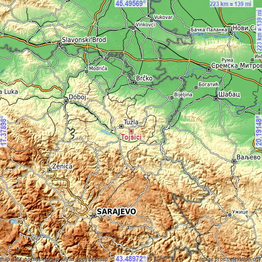
These maps also provides idea of topography and contour of this city, they are displayed at different zoom levels. More info about maps, scale and edge coordinates you can find below images.
| \ | Map #1 | Map #2 | Topo.Map |
| Scale [m] | 257..545 m | 214..834 m | × |
| Scale [ft] | 843..1788 ft | 702..2736 ft | × |
| Average | 360.1 m = 1181 ft | 359.9 m = 1181 ft | × |
| Width | 6.97 km = 4.3 mi | 13.94 km = 8.7 mi | 223 km = 138.6 mi |
| Height | 6.97 km = 4.3 mi | 13.94 km = 8.7 mi | 223 km = 138.6 mi |
| ↑Max Latitude | 44.532665° | 44.563983° | 45.49569° |
| Latitude at center | 44.50133° | 44.50133° | 44.50133° |
| ↓Min Latitude | 44.469978° | 44.43861° | 43.48972° |
| ← Min Longitude | 18.741285° | 18.697339° | 17.37898° |
| Longitude center | 18.78523° | 18.78523° | 18.78523° |
| →Max Longitude | 18.829175° | 18.873121° | 20.19148° |
Nearby cities:
Cities around Tojšići sort by population:
• Tuzla elevation 225 m
10.2 km,  293°
293°
• Živinice 216 m
12.2 km,  241°
241°
• Gornja Tuzla 322 m
6.4 km,  343°
343°
• Dubrave Gornje 287 m
5.6 km, 235°
• Solina 272 m
10 km,  312°
312°
• Gornje Živinice 285 m
15.6 km, 239°
• Dubrave Donje 295 m
7.4 km,  251°
251°
• Lopare 231 m
15.6 km,  17°
17°
• Vukovije Donje 251 m
5.2 km,  213°
213°
• Svojat 307 m
12.3 km,  197°
197°
• Osmaci 287 m
15.2 km,  136°
136°
• Kalesija 293 m
12 km,  126°
126°
Multilingual:
 En español:
Tojšići elevación 322 m.
 En France:
Tojšići élévation 322 m.


Sources and notes:
- [note 1] Map square and city borders are not equal. Map elevation data is calculated only from area inside that square.
- [src 1] Elevation data from geonames database provided with same terms of usage.
- [src 2] The elevation map of Tojšići is generated using elevation data from NASA's 3 arcsec (90m) resolution SRTM data.
- [src 3] Base (background) map © OpenStreetMap contributors tiles are generated by Geofabrik and OpenTopoMap.
Copyright & License:
This Tojšići Elevation Map is licensed under CC BY-SA. You may reuse any part from this page, if you give a proper credit by linking to this URL:
 More info on terms of use page.