Laktaši elevation
Laktaši (Srpska), Bosnia and Herzegovina elevation is 124 meters and Laktaši elevation in feet is 407 ft above sea level [src 1]. Laktaši is a seat of a second-order administrative division (feature code) with elevation that is 239 meters (784 ft) smaller than average city elevation in Bosnia and Herzegovina.
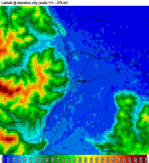
Below is the Elevation map of Laktaši, which displays elevation range with different colors. Scale of the first map is from 111 to 276 m (364 to 906 ft) with average elevation of 147.4 meters (=484 ft) [note 1]
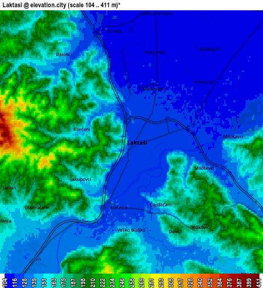
These maps also provides idea of topography and contour of this city, they are displayed at different zoom levels. More info about maps, scale and edge coordinates you can find below images.
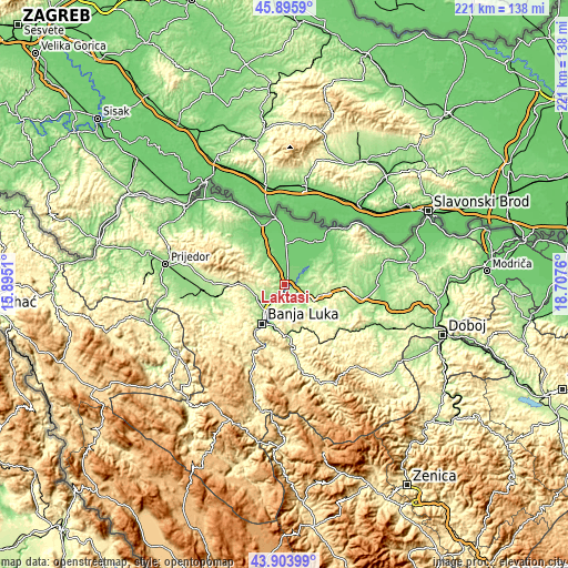
| \ | Map #1 | Map #2 | Topo.Map |
| Scale [m] | 111..276 m | 104..411 m | × |
| Scale [ft] | 364..906 ft | 341..1348 ft | × |
| Average | 147.4 m = 484 ft | 157.3 m = 516 ft | × |
| Width | 6.92 km = 4.3 mi | 13.84 km = 8.6 mi | 221.5 km = 137.6 mi |
| Height | 6.92 km = 4.3 mi | 13.84 km = 8.6 mi | 221.5 km = 137.6 mi |
| ↑Max Latitude | 44.939685° | 44.970783° | 45.8959° |
| Latitude at center | 44.90857° | 44.90857° | 44.90857° |
| ↓Min Latitude | 44.877438° | 44.846289° | 43.90399° |
| ← Min Longitude | 17.257405° | 17.213459° | 15.8951° |
| Longitude center | 17.30135° | 17.30135° | 17.30135° |
| →Max Longitude | 17.345295° | 17.389241° | 18.7076° |
Nearby cities:
Cities around Laktaši sort by population:
• Banja Luka elevation 164 m
16.8 km,  210°
210°
• Gradiška 91 m
26.5 km,  352°
352°
• Trn 135 m
7.6 km,  222°
222°
• Srbac 102 m
27.3 km,  39°
39°
• Prnjavor 173 m
28.8 km,  98°
98°
• Čelinac 194 m
20.5 km,  174°
174°
• Mejdan - Obilićevo 161 m
18.4 km, 208°
• Hiseti 172 m
19 km, 210°
• Maglajani 112 m
6 km, 39°
• Piskavica 175 m
26.1 km,  259°
259°
• Starcevica 206 m
18.3 km,  202°
202°
• Čelinac 201 m
18.8 km,  175°
175°
Multilingual:
 En español:
Laktaši elevación 124 m.
 En France:
Laktaši élévation 124 m.


Sources and notes:
- [note 1] Map square and city borders are not equal. Map elevation data is calculated only from area inside that square.
- [src 1] Elevation data from geonames database provided with same terms of usage.
- [src 2] The elevation map of Laktaši is generated using elevation data from NASA's 3 arcsec (90m) resolution SRTM data.
- [src 3] Base (background) map © OpenStreetMap contributors tiles are generated by Geofabrik and OpenTopoMap.
Copyright & License:
This Laktaši Elevation Map is licensed under CC BY-SA. You may reuse any part from this page, if you give a proper credit by linking to this URL:
 More info on terms of use page.