Mionica elevation
Mionica (Federation of B&H), Bosnia and Herzegovina elevation is 193 meters and Mionica elevation in feet is 633 ft above sea level [src 1]. Mionica is a populated locality (feature code) with elevation that is 170 meters (558 ft) smaller than average city elevation in Bosnia and Herzegovina.
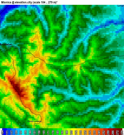
Below is the Elevation map of Mionica, which displays elevation range with different colors. Scale of the first map is from 104 to 279 m (341 to 915 ft) with average elevation of 169.4 meters (=556 ft) [note 1]
These maps also provides idea of topography and contour of this city, they are displayed at different zoom levels. More info about maps, scale and edge coordinates you can find below images.
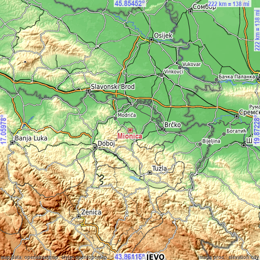
| \ | Map #1 | Map #2 | Topo.Map |
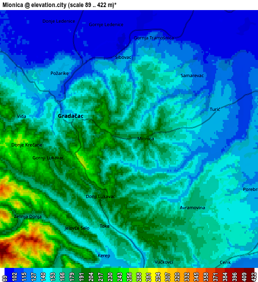
| Scale [m] | 104..279 m | 89..422 m | × |
| Scale [ft] | 341..915 ft | 292..1385 ft | × |
| Average | 169.4 m = 556 ft | 156.5 m = 513 ft | × |
| Width | 6.93 km = 4.3 mi | 13.85 km = 8.6 mi | 221.6 km = 137.7 mi |
| Height | 6.93 km = 4.3 mi | 13.85 km = 8.6 mi | 221.6 km = 137.7 mi |
| ↑Max Latitude | 44.897598° | 44.928719° | 45.85452° |
| Latitude at center | 44.86646° | 44.86646° | 44.86646° |
| ↓Min Latitude | 44.835305° | 44.804134° | 43.86115° |
| ← Min Longitude | 18.422085° | 18.378139° | 17.05978° |
| Longitude center | 18.46603° | 18.46603° | 18.46603° |
| →Max Longitude | 18.509975° | 18.553921° | 19.87228° |
Nearby cities:
Cities around Mionica sort by population:
• Gradačac elevation 139 m
3.3 km,  293°
293°
• Odžak 98 m
21 km,  327°
327°
• Srebrenik 181 m
17.7 km,  174°
174°
• Sladna 336 m
15.6 km,  191°
191°
• Oštra Luka 85 m
17.3 km,  32°
32°
• Donja Međiđa 208 m
8.6 km,  214°
214°
• Malešići 382 m
20.8 km,  226°
226°
• Šamac 86 m
21.5 km,  0°
0°
• Brka 105 m
20.8 km,  101°
101°
• Obudovac 88 m
14.1 km,  47°
47°
• Pelagićevo 101 m
10.6 km,  68°
68°
• Donji Žabar 87 m
16.6 km,  59°
59°
Multilingual:
 En español:
Mionica elevación 193 m.
 En France:
Mionica élévation 193 m.


Sources and notes:
- [note 1] Map square and city borders are not equal. Map elevation data is calculated only from area inside that square.
- [src 1] Elevation data from geonames database provided with same terms of usage.
- [src 2] The elevation map of Mionica is generated using elevation data from NASA's 3 arcsec (90m) resolution SRTM data.
- [src 3] Base (background) map © OpenStreetMap contributors tiles are generated by Geofabrik and OpenTopoMap.
Copyright & License:
This Mionica Elevation Map is licensed under CC BY-SA. You may reuse any part from this page, if you give a proper credit by linking to this URL:
 More info on terms of use page.