Srebrenik elevation
Srebrenik (Federation of B&H), Bosnia and Herzegovina elevation is 181 meters and Srebrenik elevation in feet is 594 ft above sea level [src 1]. Srebrenik is a seat of a third-order administrative division (feature code) with elevation that is 182 meters (597 ft) smaller than average city elevation in Bosnia and Herzegovina.
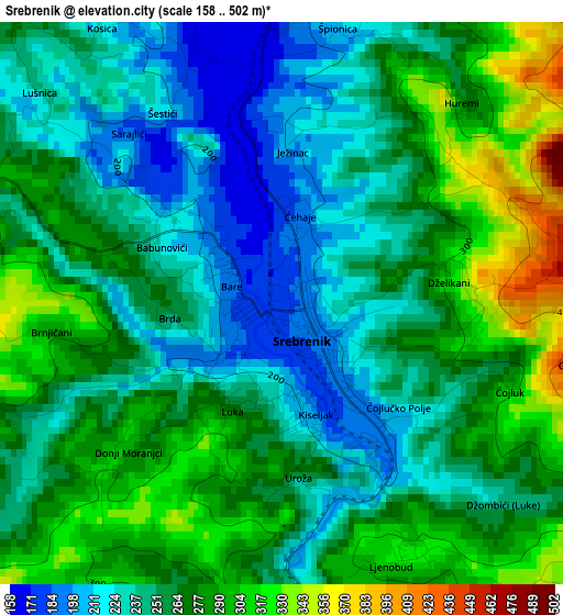
Below is the Elevation map of Srebrenik, which displays elevation range with different colors. Scale of the first map is from 158 to 502 m (518 to 1647 ft) with average elevation of 260.6 meters (=855 ft) [note 1]
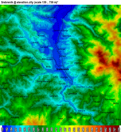
These maps also provides idea of topography and contour of this city, they are displayed at different zoom levels. More info about maps, scale and edge coordinates you can find below images.
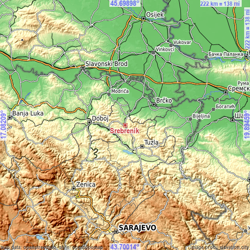
| \ | Map #1 | Map #2 | Topo.Map |
| Scale [m] | 158..502 m | 139..730 m | × |
| Scale [ft] | 518..1647 ft | 456..2395 ft | × |
| Average | 260.6 m = 855 ft | 328.1 m = 1076 ft | × |
| Width | 6.95 km = 4.3 mi | 13.89 km = 8.6 mi | 222.3 km = 138.1 mi |
| Height | 6.95 km = 4.3 mi | 13.89 km = 8.6 mi | 222.2 km = 138.1 mi |
| ↑Max Latitude | 44.739413° | 44.77062° | 45.69898° |
| Latitude at center | 44.70819° | 44.70819° | 44.70819° |
| ↓Min Latitude | 44.67695° | 44.645693° | 43.70014° |
| ← Min Longitude | 18.444395° | 18.400449° | 17.08209° |
| Longitude center | 18.48834° | 18.48834° | 18.48834° |
| →Max Longitude | 18.532285° | 18.576231° | 19.89459° |
Nearby cities:
Cities around Srebrenik sort by population:
• Gračanica elevation 188 m
14.1 km,  267°
267°
• Mionica 193 m
17.7 km,  354°
354°
• Orahovica Donja 195 m
11.2 km,  237°
237°
• Stjepan-Polje 239 m
18.2 km, 272°
• Sladna 336 m
5.5 km,  295°
295°
• Gnojnica 238 m
10.3 km,  198°
198°
• Mramor 250 m
14.2 km,  154°
154°
• Donja Međiđa 208 m
12.4 km,  327°
327°
• Malešići 382 m
17.3 km,  281°
281°
• Barice 221 m
18.6 km,  181°
181°
• Puračić 188 m
18.1 km, 182°
• Petrovo 210 m
13.9 km,  230°
230°
Multilingual:
 En español:
Srebrenik elevación 181 m.
 En France:
Srebrenik élévation 181 m.
 Auf Deutsch:
Srebrenik höhe über dem Meeresspiegel ist 181 m.

Sources and notes:
- [note 1] Map square and city borders are not equal. Map elevation data is calculated only from area inside that square.
- [src 1] Elevation data from geonames database provided with same terms of usage.
- [src 2] The elevation map of Srebrenik is generated using elevation data from NASA's 3 arcsec (90m) resolution SRTM data.
- [src 3] Base (background) map © OpenStreetMap contributors tiles are generated by Geofabrik and OpenTopoMap.
Copyright & License:
This Srebrenik Elevation Map is licensed under CC BY-SA. You may reuse any part from this page, if you give a proper credit by linking to this URL:
 More info on terms of use page.