Rogatica elevation
Rogatica (Srpska), Bosnia and Herzegovina elevation is 528 meters and Rogatica elevation in feet is 1732 ft above sea level [src 1]. Rogatica is a seat of a second-order administrative division (feature code) with elevation that is 165 meters (541 ft) bigger than average city elevation in Bosnia and Herzegovina.
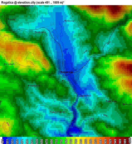
Below is the Elevation map of Rogatica, which displays elevation range with different colors. Scale of the first map is from 491 to 1009 m (1611 to 3310 ft) with average elevation of 662.9 meters (=2175 ft) [note 1]
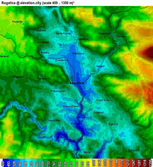
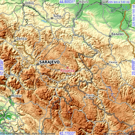
These maps also provides idea of topography and contour of this city, they are displayed at different zoom levels. More info about maps, scale and edge coordinates you can find below images.
| \ | Map #1 | Map #2 | Topo.Map |
| Scale [m] | 491..1009 m | 459..1350 m | × |
| Scale [ft] | 1611..3310 ft | 1506..4429 ft | × |
| Average | 662.9 m = 2175 ft | 773.9 m = 2539 ft | × |
| Width | 7.05 km = 4.4 mi | 14.11 km = 8.8 mi | 225.7 km = 140.2 mi |
| Height | 7.05 km = 4.4 mi | 14.11 km = 8.8 mi | 225.7 km = 140.2 mi |
| ↑Max Latitude | 43.83065° | 43.862343° | 44.80531° |
| Latitude at center | 43.79894° | 43.79894° | 43.79894° |
| ↓Min Latitude | 43.767213° | 43.735469° | 42.77533° |
| ← Min Longitude | 18.959685° | 18.915739° | 17.59738° |
| Longitude center | 19.00363° | 19.00363° | 19.00363° |
| →Max Longitude | 19.047575° | 19.091521° | 20.40988° |
Nearby cities:
Cities around Rogatica sort by population:
• Goražde elevation 348 m
14.7 km,  188°
188°
• Foča 393 m
37.2 km,  209°
209°
• Sokolac 876 m
22.5 km,  313°
313°
• Pale 834 m
34.9 km,  273°
273°
• Višegrad 311 m
23.3 km,  94°
94°
• Ustikolina 392 m
29.4 km,  215°
215°
• Han Pijesak 1086 m
31.7 km,  352°
352°
• Čajniče 827 m
27.4 km,  168°
168°
• Koran 853 m
34.8 km, 272°
• Rudo 407 m
35.5 km,  124°
124°
• Prača 695 m
19.5 km,  258°
258°
• Kopači 353 m
13.6 km, 171°
Multilingual:
 En español:
Rogatica elevación 528 m.
 En France:
Rogatica élévation 528 m.
 Auf Deutsch:
Rogatica höhe über dem Meeresspiegel ist 528 m.

Sources and notes:
- [note 1] Map square and city borders are not equal. Map elevation data is calculated only from area inside that square.
- [src 1] Elevation data from geonames database provided with same terms of usage.
- [src 2] The elevation map of Rogatica is generated using elevation data from NASA's 3 arcsec (90m) resolution SRTM data.
- [src 3] Base (background) map © OpenStreetMap contributors tiles are generated by Geofabrik and OpenTopoMap.
Copyright & License:
This Rogatica Elevation Map is licensed under CC BY-SA. You may reuse any part from this page, if you give a proper credit by linking to this URL:
 More info on terms of use page.