Ustikolina elevation
Ustikolina (Federation of B&H, Bosansko-Podrinjski Kanton Goražde), Bosnia and Herzegovina elevation is 392 meters and Ustikolina elevation in feet is 1286 ft above sea level [src 1]. Ustikolina is a populated place (feature code) with elevation that is 29 meters (95 ft) bigger than average city elevation in Bosnia and Herzegovina.
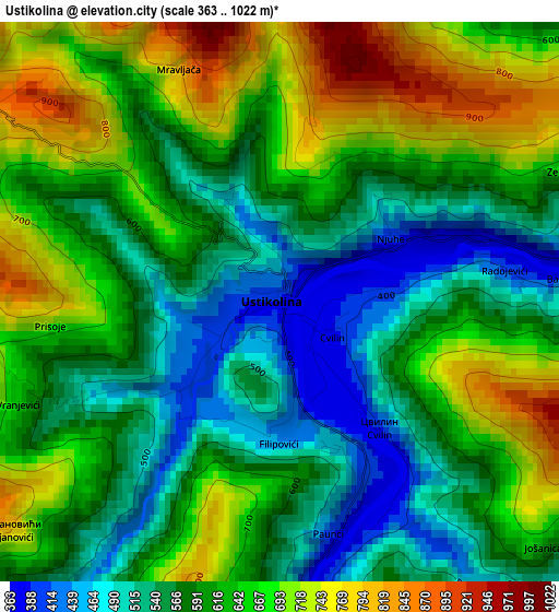
Below is the Elevation map of Ustikolina, which displays elevation range with different colors. Scale of the first map is from 363 to 1022 m (1191 to 3353 ft) with average elevation of 613.8 meters (=2014 ft) [note 1]
These maps also provides idea of topography and contour of this city, they are displayed at different zoom levels. More info about maps, scale and edge coordinates you can find below images.

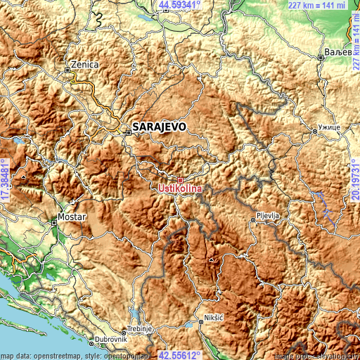
| \ | Map #1 | Map #2 | Topo.Map |
| Scale [m] | 363..1022 m | 357..1487 m | × |
| Scale [ft] | 1191..3353 ft | 1171..4879 ft | × |
| Average | 613.8 m = 2014 ft | 754.3 m = 2475 ft | × |
| Width | 7.08 km = 4.4 mi | 14.16 km = 8.8 mi | 226.5 km = 140.7 mi |
| Height | 7.08 km = 4.4 mi | 14.16 km = 8.8 mi | 226.5 km = 140.7 mi |
| ↑Max Latitude | 43.615204° | 43.647012° | 44.59341° |
| Latitude at center | 43.58338° | 43.58338° | 43.58338° |
| ↓Min Latitude | 43.551539° | 43.519681° | 42.55612° |
| ← Min Longitude | 18.747115° | 18.703169° | 17.38481° |
| Longitude center | 18.79106° | 18.79106° | 18.79106° |
| →Max Longitude | 18.835005° | 18.878951° | 20.19731° |
Nearby cities:
Cities around Ustikolina sort by population:
• Goražde elevation 348 m
17.6 km,  57°
57°
• Foča 393 m
8.6 km,  186°
186°
• Sokolac 876 m
39.5 km,  1°
1°
• Pale 834 m
31.5 km,  325°
325°
• Rogatica 528 m
29.4 km,  35°
35°
• Čajniče 827 m
22.8 km,  97°
97°
• Koran 853 m
30.9 km,  324°
324°
• Hreša 1063 m
40.4 km, 324°
• Trnovo 817 m
29.3 km,  288°
288°
• Kalinovik 1078 m
29.1 km,  252°
252°
• Kopači 353 m
21.8 km, 61°
• Prača 695 m
20.2 km,  354°
354°
Multilingual:
 En español:
Ustikolina elevación 392 m.
 En France:
Ustikolina élévation 392 m.
 Auf Deutsch:
Ustikolina höhe über dem Meeresspiegel ist 392 m.

Sources and notes:
- [note 1] Map square and city borders are not equal. Map elevation data is calculated only from area inside that square.
- [src 1] Elevation data from geonames database provided with same terms of usage.
- [src 2] The elevation map of Ustikolina is generated using elevation data from NASA's 3 arcsec (90m) resolution SRTM data.
- [src 3] Base (background) map © OpenStreetMap contributors tiles are generated by Geofabrik and OpenTopoMap.
Copyright & License:
This Ustikolina Elevation Map is licensed under CC BY-SA. You may reuse any part from this page, if you give a proper credit by linking to this URL:
 More info on terms of use page.