Velagići elevation
Velagići (Federation of B&H), Bosnia and Herzegovina elevation is 350 meters and Velagići elevation in feet is 1148 ft above sea level [src 1]. Velagići is a populated locality (feature code) with elevation that is 13 meters (43 ft) smaller than average city elevation in Bosnia and Herzegovina.
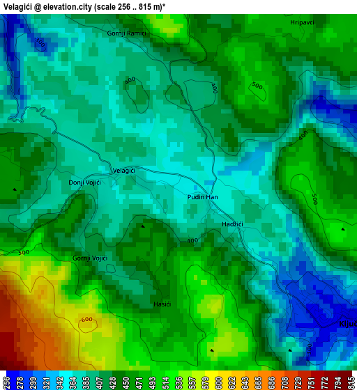
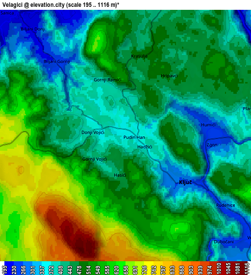
Below is the Elevation map of Velagići, which displays elevation range with different colors. Scale of the first map is from 256 to 815 m (840 to 2674 ft) with average elevation of 430.7 meters (=1413 ft) [note 1]
These maps also provides idea of topography and contour of this city, they are displayed at different zoom levels. More info about maps, scale and edge coordinates you can find below images.
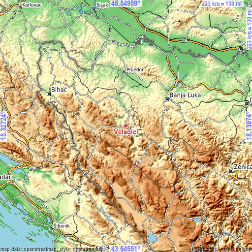
| \ | Map #1 | Map #2 | Topo.Map |
| Scale [m] | 256..815 m | 195..1116 m | × |
| Scale [ft] | 840..2674 ft | 640..3661 ft | × |
| Average | 430.7 m = 1413 ft | 495.5 m = 1626 ft | × |
| Width | 6.96 km = 4.3 mi | 13.93 km = 8.7 mi | 222.8 km = 138.4 mi |
| Height | 6.96 km = 4.3 mi | 13.93 km = 8.7 mi | 222.8 km = 138.4 mi |
| ↑Max Latitude | 44.587485° | 44.618774° | 45.54959° |
| Latitude at center | 44.55618° | 44.55618° | 44.55618° |
| ↓Min Latitude | 44.524858° | 44.493519° | 43.54551° |
| ← Min Longitude | 16.689545° | 16.645599° | 15.32724° |
| Longitude center | 16.73349° | 16.73349° | 16.73349° |
| →Max Longitude | 16.777435° | 16.821381° | 18.13974° |
Nearby cities:
Cities around Velagići sort by population:
• Mrkonjić Grad elevation 575 m
31.7 km,  119°
119°
• Sanski Most 158 m
24 km,  347°
347°
• Ključ 258 m
4.3 km,  127°
127°
• Sanica 204 m
9.7 km,  310°
310°
• Podbrdo 780 m
25.7 km, 119°
• Bronzani Majdan 275 m
30.9 km,  31°
31°
• Peći 365 m
9.2 km,  24°
24°
• Krupa na Vrbasu 221 m
33.2 km,  77°
77°
• Bosanski Petrovac 673 m
28.9 km,  269°
269°
• Drinić 723 m
21.8 km,  255°
255°
• Potoci 1041 m
20.3 km,  206°
206°
• Gornji Ribnik 311 m
16.8 km,  156°
156°
Multilingual:
 En español:
Velagići elevación 350 m.
 En France:
Velagići élévation 350 m.
 Auf Deutsch:
Velagići höhe über dem Meeresspiegel ist 350 m.

Sources and notes:
- [note 1] Map square and city borders are not equal. Map elevation data is calculated only from area inside that square.
- [src 1] Elevation data from geonames database provided with same terms of usage.
- [src 2] The elevation map of Velagići is generated using elevation data from NASA's 3 arcsec (90m) resolution SRTM data.
- [src 3] Base (background) map © OpenStreetMap contributors tiles are generated by Geofabrik and OpenTopoMap.
Copyright & License:
This Velagići Elevation Map is licensed under CC BY-SA. You may reuse any part from this page, if you give a proper credit by linking to this URL:
 More info on terms of use page.