Oğuz elevation
Oğuz, Azerbaijan elevation is 652 meters and Oğuz elevation in feet is 2139 ft above sea level [src 1]. Oğuz is a seat of a first-order administrative division (feature code) with elevation that is 292 meters (958 ft) bigger than average city elevation in Azerbaijan.
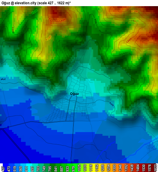
Below is the Elevation map of Oğuz, which displays elevation range with different colors. Scale of the first map is from 427 to 1622 m (1401 to 5322 ft) with average elevation of 766.2 meters (=2514 ft) [note 1]
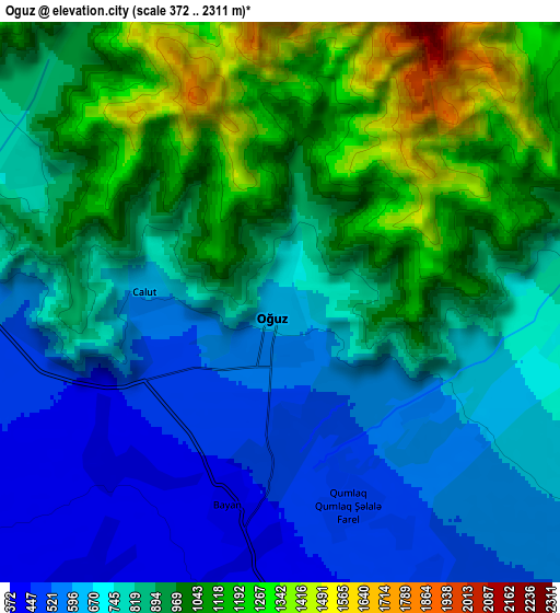
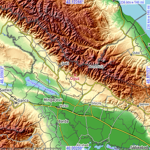
These maps also provides idea of topography and contour of this city, they are displayed at different zoom levels. More info about maps, scale and edge coordinates you can find below images.
| \ | Map #1 | Map #2 | Topo.Map |
| Scale [m] | 427..1622 m | 372..2311 m | × |
| Scale [ft] | 1401..5322 ft | 1220..7582 ft | × |
| Average | 766.2 m = 2514 ft | 845.8 m = 2775 ft | × |
| Width | 7.37 km = 4.6 mi | 14.73 km = 9.2 mi | 235.8 km = 146.5 mi |
| Height | 7.37 km = 4.6 mi | 14.73 km = 9.2 mi | 235.7 km = 146.5 mi |
| ↑Max Latitude | 41.104402° | 41.137507° | 42.12288° |
| Latitude at center | 41.07128° | 41.07128° | 41.07128° |
| ↓Min Latitude | 41.038142° | 41.004987° | 40.00259° |
| ← Min Longitude | 47.421335° | 47.377389° | 46.05903° |
| Longitude center | 47.46528° | 47.46528° | 47.46528° |
| →Max Longitude | 47.509225° | 47.553171° | 48.87153° |
Nearby cities:
Cities around Oğuz sort by population:
• Yevlakh elevation 17 m
56.9 km,  207°
207°
• Mingelchaur 26 m
48.3 km,  224°
224°
• Sheki 549 m
28.1 km,  298°
298°
• Geoktschai 122 m
52.3 km,  153°
153°
• Ağdaş 50 m
47.2 km,  179°
179°
• Ujar 18 m
63.4 km,  165°
165°
• Qax 590 m
59.7 km,  310°
310°
• Qutqashen 795 m
33.7 km,  107°
107°
• Çinarlı 795 m
63.8 km, 313°
• Qaxbaş 758 m
58 km, 313°
• Qax İngiloy 656 m
59 km, 311°
• Baş Göynük 858 m
40.8 km, 313°
Multilingual:
 En español:
Oğuz elevación 652 m.
 En France:
Oğuz élévation 652 m.


Sources and notes:
- [note 1] Map square and city borders are not equal. Map elevation data is calculated only from area inside that square.
- [src 1] Elevation data from geonames database provided with same terms of usage.
- [src 2] The elevation map of Oğuz is generated using elevation data from NASA's 3 arcsec (90m) resolution SRTM data.
- [src 3] Base (background) map © OpenStreetMap contributors tiles are generated by Geofabrik and OpenTopoMap.
Copyright & License:
This Oğuz Elevation Map is licensed under CC BY-SA. You may reuse any part from this page, if you give a proper credit by linking to this URL:
 More info on terms of use page.