Geoktschai elevation
Geoktschai (Göyçay), Azerbaijan elevation is 122 meters and Geoktschai elevation in feet is 400 ft above sea level [src 1]. Geoktschai is a seat of a first-order administrative division (feature code) with elevation that is 238 meters (781 ft) smaller than average city elevation in Azerbaijan.
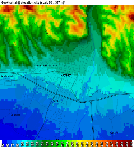
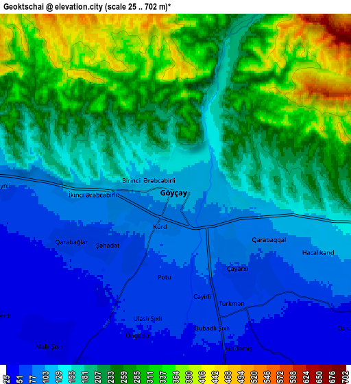
Below is the Elevation map of Geoktschai, which displays elevation range with different colors. Scale of the first map is from 50 to 377 m (164 to 1237 ft) with average elevation of 135.9 meters (=446 ft) [note 1]
These maps also provides idea of topography and contour of this city, they are displayed at different zoom levels. More info about maps, scale and edge coordinates you can find below images.
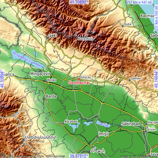
| \ | Map #1 | Map #2 | Topo.Map |
| Scale [m] | 50..377 m | 25..702 m | × |
| Scale [ft] | 164..1237 ft | 82..2303 ft | × |
| Average | 135.9 m = 446 ft | 179.2 m = 588 ft | × |
| Width | 7.41 km = 4.6 mi | 14.83 km = 9.2 mi | 237.3 km = 147.5 mi |
| Height | 7.41 km = 4.6 mi | 14.83 km = 9.2 mi | 237.3 km = 147.5 mi |
| ↑Max Latitude | 40.683883° | 40.717199° | 41.70892° |
| Latitude at center | 40.65055° | 40.65055° | 40.65055° |
| ↓Min Latitude | 40.617201° | 40.583834° | 39.57512° |
| ← Min Longitude | 47.698245° | 47.654299° | 46.33594° |
| Longitude center | 47.74219° | 47.74219° | 47.74219° |
| →Max Longitude | 47.786135° | 47.830081° | 49.14844° |
Nearby cities:
Cities around Geoktschai sort by population:
• Yevlakh elevation 17 m
50.1 km,  265°
265°
• Mingelchaur 26 m
58.9 km,  282°
282°
• Ağdaş 50 m
22.6 km, 268°
• Kyurdarmir 11 m
49 km,  134°
134°
• Aghsu 179 m
56.3 km,  99°
99°
• Ujar 18 m
16.4 km,  206°
206°
• İsmayıllı 579 m
37.6 km,  66°
66°
• Qutqashen 795 m
38 km,  13°
13°
• Zardob 2 m
48.1 km,  183°
183°
• Oğuz 652 m
52.3 km,  333°
333°
• Samuxlu 34 m
50.9 km,  251°
251°
• Basqal 1081 m
55.9 km,  77°
77°
Multilingual:
 En español:
Geoktschai elevación 122 m.
 En France:
Geoktschai élévation 122 m.
 Auf Deutsch:
Geoktschai höhe über dem Meeresspiegel ist 122 m.

Sources and notes:
- [note 1] Map square and city borders are not equal. Map elevation data is calculated only from area inside that square.
- [src 1] Elevation data from geonames database provided with same terms of usage.
- [src 2] The elevation map of Geoktschai is generated using elevation data from NASA's 3 arcsec (90m) resolution SRTM data.
- [src 3] Base (background) map © OpenStreetMap contributors tiles are generated by Geofabrik and OpenTopoMap.
Copyright & License:
This Geoktschai Elevation Map is licensed under CC BY-SA. You may reuse any part from this page, if you give a proper credit by linking to this URL:
 More info on terms of use page.