Marayong elevation
Marayong (New South Wales, Blacktown), Australia elevation is 35 meters and Marayong elevation in feet is 115 ft above sea level [src 1]. Marayong is a section of populated place (feature code) with elevation that is 78 meters (256 ft) smaller than average city elevation in Australia.
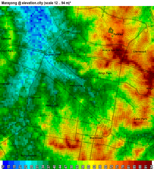
Below is the Elevation map of Marayong, which displays elevation range with different colors. Scale of the first map is from 12 to 94 m (39 to 308 ft) with average elevation of 50.3 meters (=165 ft) [note 1]
These maps also provides idea of topography and contour of this city, they are displayed at different zoom levels. More info about maps, scale and edge coordinates you can find below images.
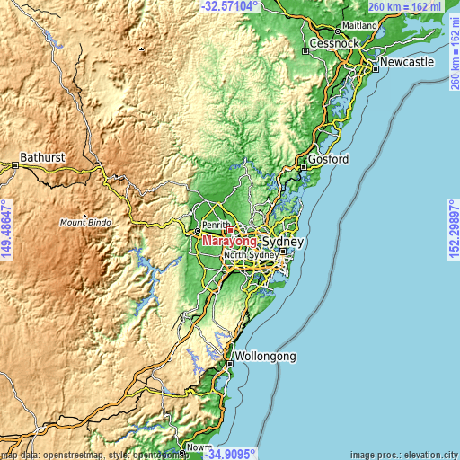
| \ | Map #1 | Map #2 | Topo.Map |
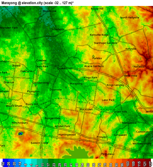
| Scale [m] | 12..94 m | -32..127 m | × |
| Scale [ft] | 39..308 ft | -105..417 ft | × |
| Average | 50.3 m = 165 ft | 54.2 m = 178 ft | × |
| Width | 8.13 km = 5.1 mi | 16.25 km = 10.1 mi | 260 km = 161.6 mi |
| Height | 8.13 km = 5.1 mi | 16.25 km = 10.1 mi | 260 km = 161.6 mi |
| ↑Max Latitude | -33.711692° | -33.675129° | -32.57104° |
| Latitude at center | -33.74824° | -33.74824° | -33.74824° |
| ↓Min Latitude | -33.784772° | -33.821289° | -34.9095° |
| ← Min Longitude | 150.848775° | 150.804829° | 149.48647° |
| Longitude center | 150.89272° | 150.89272° | 150.89272° |
| →Max Longitude | 150.936665° | 150.980611° | 152.29897° |
Nearby cities:
Cities around Marayong sort by population:
• Blacktown elevation 67 m
3 km,  132°
132°
• Quakers Hill 39 m
1.9 km,  332°
332°
• Doonside 46 m
3.2 km,  229°
229°
• Kings Langley 82 m
4 km,  92°
92°
• Lalor Park 79 m
3.8 km,  111°
111°
• Woodcroft 40 m
1.4 km, 230°
• Glendenning 36 m
3.6 km,  269°
269°
• Acacia Gardens 87 m
2.9 km,  49°
49°
• Parklea 80 m
3.5 km,  41°
41°
• Kings Park 62 m
1.5 km,  67°
67°
• Dean Park 40 m
3.4 km,  294°
294°
• Bungarribee 40 m
3.9 km,  215°
215°
Multilingual:
 En español:
Marayong elevación 35 m.
 En France:
Marayong élévation 35 m.


Sources and notes:
- [note 1] Map square and city borders are not equal. Map elevation data is calculated only from area inside that square.
- [src 1] Elevation data from geonames database provided with same terms of usage.
- [src 2] The elevation map of Marayong is generated using elevation data from NASA's 3 arcsec (90m) resolution SRTM data.
- [src 3] Base (background) map © OpenStreetMap contributors tiles are generated by Geofabrik and OpenTopoMap.
Copyright & License:
This Marayong Elevation Map is licensed under CC BY-SA. You may reuse any part from this page, if you give a proper credit by linking to this URL:
 More info on terms of use page.