Underwood elevation
Underwood (Queensland, Logan), Australia elevation is 32 meters and Underwood elevation in feet is 105 ft above sea level [src 1]. Underwood is a section of populated place (feature code) with elevation that is 81 meters (266 ft) smaller than average city elevation in Australia.
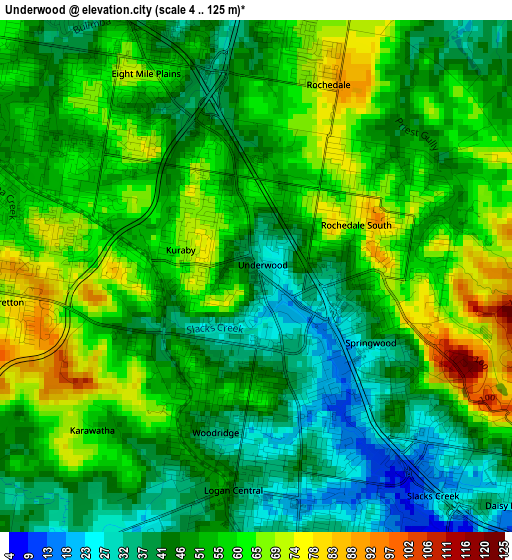
Below is the Elevation map of Underwood, which displays elevation range with different colors. Scale of the first map is from 4 to 125 m (13 to 410 ft) with average elevation of 51.9 meters (=170 ft) [note 1]
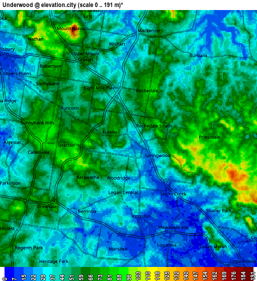
These maps also provides idea of topography and contour of this city, they are displayed at different zoom levels. More info about maps, scale and edge coordinates you can find below images.
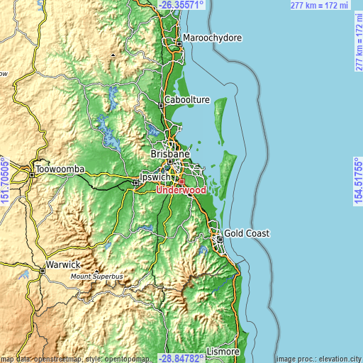
| \ | Map #1 | Map #2 | Topo.Map |
| Scale [m] | 4..125 m | 0..191 m | × |
| Scale [ft] | 13..410 ft | 0..627 ft | × |
| Average | 51.9 m = 170 ft | 47.9 m = 157 ft | × |
| Width | 8.66 km = 5.4 mi | 17.32 km = 10.8 mi | 277.1 km = 172.2 mi |
| Height | 8.66 km = 5.4 mi | 17.32 km = 10.8 mi | 277.1 km = 172.2 mi |
| ↑Max Latitude | -27.569902° | -27.53094° | -26.35571° |
| Latitude at center | -27.60885° | -27.60885° | -27.60885° |
| ↓Min Latitude | -27.647784° | -27.686705° | -28.84782° |
| ← Min Longitude | 153.067355° | 153.023409° | 151.70505° |
| Longitude center | 153.1113° | 153.1113° | 153.1113° |
| →Max Longitude | 153.155245° | 153.199191° | 154.51755° |
Nearby cities:
Cities around Underwood sort by population:
• Logan City elevation 39 m
3.4 km,  183°
183°
• Sunnybank Hills 85 m
5.7 km,  268°
268°
• Eight Mile Plains 35 m
3 km,  338°
338°
• Rochedale South 59 m
1.9 km,  37°
37°
• Runcorn 59 m
3.6 km,  290°
290°
• Woodridge 40 m
2.9 km,  202°
202°
• Springwood 46 m
1.8 km,  100°
100°
• Kuraby 52 m
1.8 km,  277°
277°
• Daisy Hill 71 m
5.2 km,  117°
117°
• Logan Central 37 m
3.9 km,  185°
185°
• Stretton 98 m
4.7 km,  251°
251°
• Rochedale 56 m
5.2 km,  24°
24°
Multilingual:
 En español:
Underwood elevación 32 m.
 En France:
Underwood élévation 32 m.
 Auf Deutsch:
Underwood höhe über dem Meeresspiegel ist 32 m.

Sources and notes:
- [note 1] Map square and city borders are not equal. Map elevation data is calculated only from area inside that square.
- [src 1] Elevation data from geonames database provided with same terms of usage.
- [src 2] The elevation map of Underwood is generated using elevation data from NASA's 3 arcsec (90m) resolution SRTM data.
- [src 3] Base (background) map © OpenStreetMap contributors tiles are generated by Geofabrik and OpenTopoMap.
Copyright & License:
This Underwood Elevation Map is licensed under CC BY-SA. You may reuse any part from this page, if you give a proper credit by linking to this URL:
 More info on terms of use page.