Yamanto elevation
Yamanto (Queensland, Ipswich), Australia elevation is 51 meters and Yamanto elevation in feet is 167 ft above sea level [src 1]. Yamanto is a section of populated place (feature code) with elevation that is 62 meters (203 ft) smaller than average city elevation in Australia.
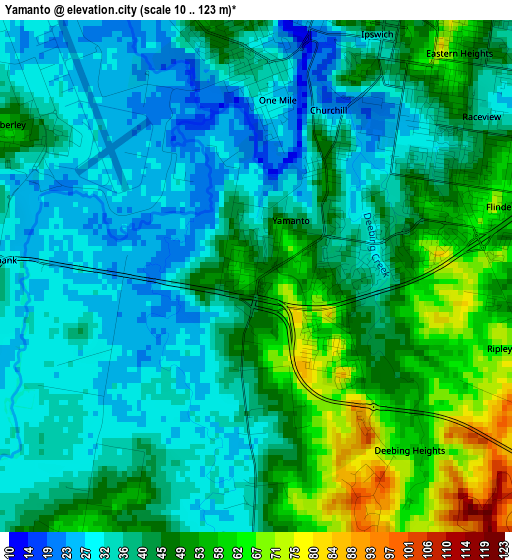
Below is the Elevation map of Yamanto, which displays elevation range with different colors. Scale of the first map is from 10 to 123 m (33 to 404 ft) with average elevation of 42.1 meters (=138 ft) [note 1]
These maps also provides idea of topography and contour of this city, they are displayed at different zoom levels. More info about maps, scale and edge coordinates you can find below images.
| \ | Map #1 | Map #2 | Topo.Map |
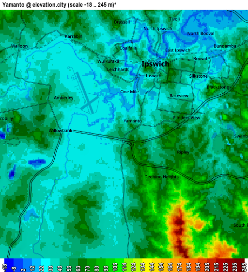
| Scale [m] | 10..123 m | -18..245 m | × |
| Scale [ft] | 33..404 ft | -59..804 ft | × |
| Average | 42.1 m = 138 ft | 49.9 m = 164 ft | × |
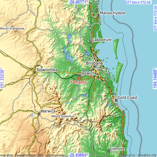
| Width | 8.66 km = 5.4 mi | 17.31 km = 10.8 mi | 277 km = 172.1 mi |
| Height | 8.66 km = 5.4 mi | 17.31 km = 10.8 mi | 277 km = 172.1 mi |
| ↑Max Latitude | -27.62134° | -27.582396° | -26.40771° |
| Latitude at center | -27.66027° | -27.66027° | -27.66027° |
| ↓Min Latitude | -27.699186° | -27.738088° | -28.89864° |
| ← Min Longitude | 152.694685° | 152.650739° | 151.33238° |
| Longitude center | 152.73863° | 152.73863° | 152.73863° |
| →Max Longitude | 152.782575° | 152.826521° | 154.14488° |
Nearby cities:
Cities around Yamanto sort by population:
• Raceview elevation 44 m
4.6 km,  51°
51°
• Flinders View 56 m
3.7 km,  72°
72°
• Leichhardt 44 m
4.2 km,  353°
353°
• Eastern Heights 43 m
5.3 km, 47°
• Ipswich 14 m
4.6 km,  27°
27°
• One Mile 39 m
3.5 km,  358°
358°
• Deebing Heights 66 m
1.3 km,  127°
127°
• Churchill 46 m
2.3 km, 29°
• Newtown 41 m
6.2 km,  37°
37°
• Sadliers Crossing 47 m
5.4 km,  7°
7°
• Woodend 36 m
6.2 km, 13°
• Wulkuraka 24 m
5.4 km,  342°
342°
Multilingual:
 En español:
Yamanto elevación 51 m.
 En France:
Yamanto élévation 51 m.


Sources and notes:
- [note 1] Map square and city borders are not equal. Map elevation data is calculated only from area inside that square.
- [src 1] Elevation data from geonames database provided with same terms of usage.
- [src 2] The elevation map of Yamanto is generated using elevation data from NASA's 3 arcsec (90m) resolution SRTM data.
- [src 3] Base (background) map © OpenStreetMap contributors tiles are generated by Geofabrik and OpenTopoMap.
Copyright & License:
This Yamanto Elevation Map is licensed under CC BY-SA. You may reuse any part from this page, if you give a proper credit by linking to this URL:
 More info on terms of use page.