Kurunjang elevation
Kurunjang (Victoria, Melton), Australia elevation is 142 meters and Kurunjang elevation in feet is 466 ft above sea level [src 1]. Kurunjang is a section of populated place (feature code) with elevation that is 29 meters (95 ft) bigger than average city elevation in Australia.
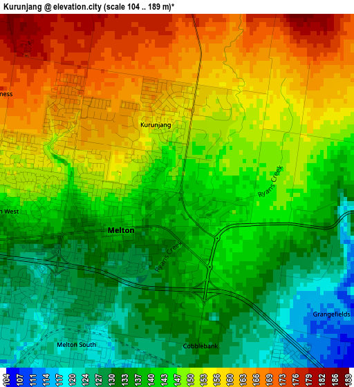
Below is the Elevation map of Kurunjang, which displays elevation range with different colors. Scale of the first map is from 104 to 189 m (341 to 620 ft) with average elevation of 145.6 meters (=478 ft) [note 1]
These maps also provides idea of topography and contour of this city, they are displayed at different zoom levels. More info about maps, scale and edge coordinates you can find below images.
| \ | Map #1 | Map #2 | Topo.Map |
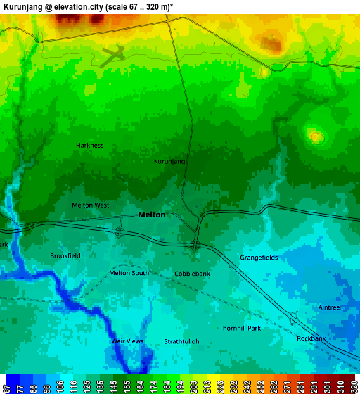
| Scale [m] | 104..189 m | 67..320 m | × |
| Scale [ft] | 341..620 ft | 220..1050 ft | × |
| Average | 145.6 m = 478 ft | 150.7 m = 494 ft | × |
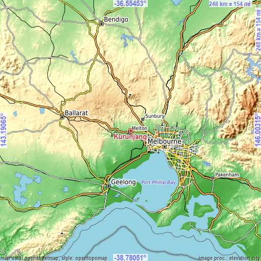
| Width | 7.73 km = 4.8 mi | 15.47 km = 9.6 mi | 247.5 km = 153.8 mi |
| Height | 7.73 km = 4.8 mi | 15.47 km = 9.6 mi | 247.5 km = 153.8 mi |
| ↑Max Latitude | -37.64108° | -37.606274° | -36.55453° |
| Latitude at center | -37.67587° | -37.67587° | -37.67587° |
| ↓Min Latitude | -37.710644° | -37.745401° | -38.78051° |
| ← Min Longitude | 144.552955° | 144.509009° | 143.19065° |
| Longitude center | 144.5969° | 144.5969° | 144.5969° |
| →Max Longitude | 144.640845° | 144.684791° | 146.00315° |
Nearby cities:
Cities around Kurunjang sort by population:
• Caroline Springs elevation 82 m
14.3 km,  120°
120°
• Melton West 140 m
2.5 km,  263°
263°
• Hillside 136 m
12.8 km,  97°
97°
• Melton South 119 m
4 km,  208°
208°
• Brookfield 121 m
4.3 km,  229°
229°
• Darley 118 m
13.7 km,  278°
278°
• Melton 138 m
1.3 km, 230°
• Bacchus Marsh 111 m
14 km,  271°
271°
• Plumpton 139 m
8.4 km, 98°
• Diggers Rest 201 m
12.1 km,  62°
62°
• Eynesbury 79 m
14 km,  188°
188°
• Rockbank 98 m
9.1 km,  134°
134°
Multilingual:
 En español:
Kurunjang elevación 142 m.
 En France:
Kurunjang élévation 142 m.
 Auf Deutsch:
Kurunjang höhe über dem Meeresspiegel ist 142 m.

Sources and notes:
- [note 1] Map square and city borders are not equal. Map elevation data is calculated only from area inside that square.
- [src 1] Elevation data from geonames database provided with same terms of usage.
- [src 2] The elevation map of Kurunjang is generated using elevation data from NASA's 3 arcsec (90m) resolution SRTM data.
- [src 3] Base (background) map © OpenStreetMap contributors tiles are generated by Geofabrik and OpenTopoMap.
Copyright & License:
This Kurunjang Elevation Map is licensed under CC BY-SA. You may reuse any part from this page, if you give a proper credit by linking to this URL:
 More info on terms of use page.