Caroline Springs elevation
Caroline Springs (Victoria, Melton), Australia elevation is 82 meters and Caroline Springs elevation in feet is 269 ft above sea level [src 1]. Caroline Springs is a section of populated place (feature code) with elevation that is 31 meters (102 ft) smaller than average city elevation in Australia.
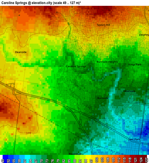
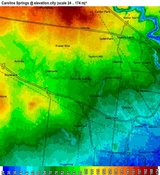
Below is the Elevation map of Caroline Springs, which displays elevation range with different colors. Scale of the first map is from 49 to 127 m (161 to 417 ft) with average elevation of 87.7 meters (=288 ft) [note 1]
These maps also provides idea of topography and contour of this city, they are displayed at different zoom levels. More info about maps, scale and edge coordinates you can find below images.
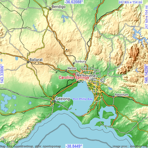
| \ | Map #1 | Map #2 | Topo.Map |
| Scale [m] | 49..127 m | 24..174 m | × |
| Scale [ft] | 161..417 ft | 79..571 ft | × |
| Average | 87.7 m = 288 ft | 87.7 m = 288 ft | × |
| Width | 7.73 km = 4.8 mi | 15.46 km = 9.6 mi | 247.3 km = 153.7 mi |
| Height | 7.73 km = 4.8 mi | 15.46 km = 9.6 mi | 247.3 km = 153.7 mi |
| ↑Max Latitude | -37.706481° | -37.671705° | -36.62088° |
| Latitude at center | -37.74124° | -37.74124° | -37.74124° |
| ↓Min Latitude | -37.775983° | -37.81071° | -38.8449° |
| ← Min Longitude | 144.692365° | 144.648419° | 143.33006° |
| Longitude center | 144.73631° | 144.73631° | 144.73631° |
| →Max Longitude | 144.780255° | 144.824201° | 146.14256° |
Nearby cities:
Cities around Caroline Springs sort by population:
• Saint Albans elevation 81 m
5.7 km,  81°
81°
• Deer Park 52 m
3.9 km,  137°
137°
• Hillside 136 m
5.7 km,  4°
4°
• Taylors Hill 117 m
3.8 km,  25°
25°
• Sydenham 115 m
5.3 km, 30°
• Cairnlea 59 m
5 km,  113°
113°
• Delahey 95 m
4.3 km,  56°
56°
• Kings Park 80 m
3.7 km, 77°
• Burnside Heights 94 m
2.1 km,  41°
41°
• Albanvale 73 m
2.9 km,  100°
100°
• Burnside 75 m
1.7 km,  121°
121°
• Ravenhall 69 m
3 km,  154°
154°
Multilingual:
 En español:
Caroline Springs elevación 82 m.
 En France:
Caroline Springs élévation 82 m.
 Auf Deutsch:
Caroline Springs höhe über dem Meeresspiegel ist 82 m.

Sources and notes:
- [note 1] Map square and city borders are not equal. Map elevation data is calculated only from area inside that square.
- [src 1] Elevation data from geonames database provided with same terms of usage.
- [src 2] The elevation map of Caroline Springs is generated using elevation data from NASA's 3 arcsec (90m) resolution SRTM data.
- [src 3] Base (background) map © OpenStreetMap contributors tiles are generated by Geofabrik and OpenTopoMap.
Copyright & License:
This Caroline Springs Elevation Map is licensed under CC BY-SA. You may reuse any part from this page, if you give a proper credit by linking to this URL:
 More info on terms of use page.