Bywong elevation
Bywong (New South Wales, Queanbeyan-Palerang Regional), Australia elevation is 753 meters and Bywong elevation in feet is 2470 ft above sea level [src 1]. Bywong is a populated place (feature code) with elevation that is 640 meters (2100 ft) bigger than average city elevation in Australia.
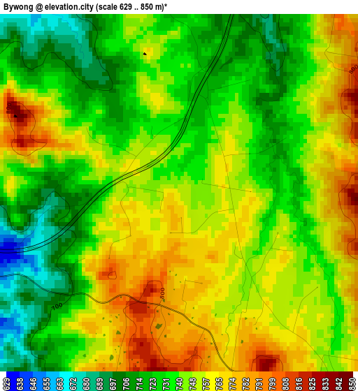
Below is the Elevation map of Bywong, which displays elevation range with different colors. Scale of the first map is from 629 to 850 m (2064 to 2789 ft) with average elevation of 743.3 meters (=2439 ft) [note 1]
These maps also provides idea of topography and contour of this city, they are displayed at different zoom levels. More info about maps, scale and edge coordinates you can find below images.
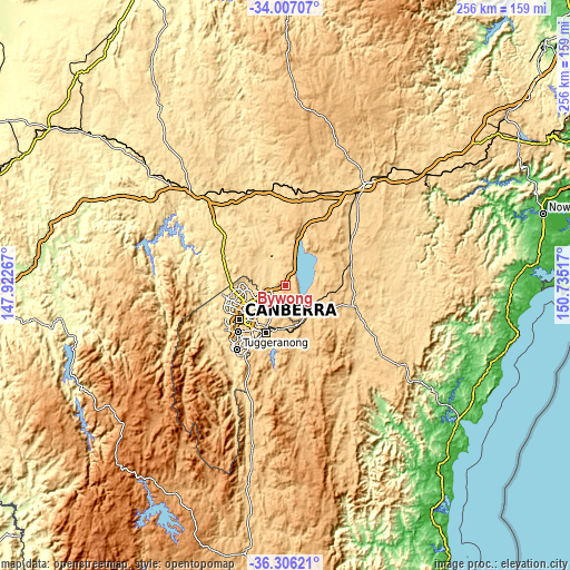
| \ | Map #1 | Topo.Map |
| Scale [m] | 629..850 m | × |
| Scale [ft] | 2064..2789 ft | × |
| Average | 743.3 m = 2439 ft | × |
| Width | 7.99 km = 5 mi | 255.6 km = 158.8 mi |
| Height | 7.99 km = 5 mi | 255.6 km = 158.8 mi |
| ↑Max Latitude | -35.128827° | -34.00707° |
| Latitude at center | -35.16476° | -35.16476° |
| ↓Min Latitude | -35.200677° | -36.30621° |
| ← Min Longitude | 149.284975° | 147.92267° |
| Longitude center | 149.32892° | 149.32892° |
| →Max Longitude | 149.372865° | 150.73517° |
Nearby cities:
Cities around Bywong sort by population:
• Harrison elevation 619 m
16.1 km,  256°
256°
• Bonner 630 m
17.3 km,  270°
270°
• Franklin 611 m
17.3 km, 257°
• Gungahlin 627 m
17.7 km, 262°
• Watson 592 m
18 km,  242°
242°
• Amaroo 625 m
18.3 km, 268°
• Forde 644 m
16.6 km, 268°
• Bungendore 694 m
14.1 km,  134°
134°
• Hackett 611 m
17.7 km, 237°
• Sutton 614 m
7.2 km, 268°
• Wamboin 796 m
9.6 km,  177°
177°
• Gundaroo 578 m
16.3 km,  333°
333°
Multilingual:
 En español:
Bywong elevación 753 m.
 En France:
Bywong élévation 753 m.


Sources and notes:
- [note 1] Map square and city borders are not equal. Map elevation data is calculated only from area inside that square.
- [src 1] Elevation data from geonames database provided with same terms of usage.
- [src 2] The elevation map of Bywong is generated using elevation data from NASA's 3 arcsec (90m) resolution SRTM data.
- [src 3] Base (background) map © OpenStreetMap contributors tiles are generated by Geofabrik and OpenTopoMap.
Copyright & License:
This Bywong Elevation Map is licensed under CC BY-SA. You may reuse any part from this page, if you give a proper credit by linking to this URL:
 More info on terms of use page.