Kerang elevation
Kerang (Victoria, Gannawarra), Australia elevation is 86 meters and Kerang elevation in feet is 282 ft above sea level [src 1]. Kerang is a populated place (feature code) with elevation that is 27 meters (89 ft) smaller than average city elevation in Australia.
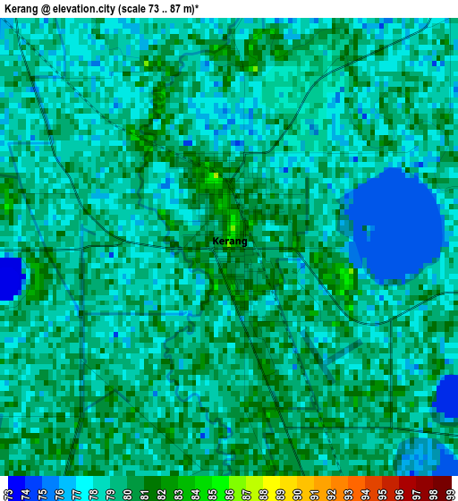
Below is the Elevation map of Kerang, which displays elevation range with different colors. Scale of the first map is from 73 to 87 m (240 to 285 ft) with average elevation of 78.6 meters (=258 ft) [note 1]
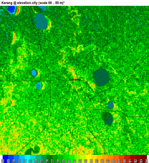
These maps also provides idea of topography and contour of this city, they are displayed at different zoom levels. More info about maps, scale and edge coordinates you can find below images.
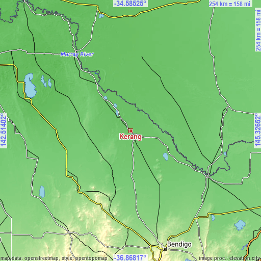
| \ | Map #1 | Map #2 | Topo.Map |
| Scale [m] | 73..87 m | 68..89 m | × |
| Scale [ft] | 240..285 ft | 223..292 ft | × |
| Average | 78.6 m = 258 ft | 78.7 m = 258 ft | × |
| Width | 7.93 km = 4.9 mi | 15.87 km = 9.9 mi | 253.8 km = 157.7 mi |
| Height | 7.93 km = 4.9 mi | 15.87 km = 9.9 mi | 253.8 km = 157.7 mi |
| ↑Max Latitude | -35.69921° | -35.663515° | -34.58525° |
| Latitude at center | -35.73489° | -35.73489° | -35.73489° |
| ↓Min Latitude | -35.770554° | -35.806201° | -36.86817° |
| ← Min Longitude | 143.876325° | 143.832379° | 142.51402° |
| Longitude center | 143.92027° | 143.92027° | 143.92027° |
| →Max Longitude | 143.964215° | 144.008161° | 145.32652° |
Nearby cities:
Cities around Kerang sort by population:
• Echuca elevation 100 m
87.4 km,  121°
121°
• Swan Hill 75 m
55.2 km,  323°
323°
• Deniliquin 93 m
96.1 km,  76°
76°
• Moama 98 m
86.1 km, 118°
• Rochester 118 m
99 km,  134°
134°
• Cohuna 86 m
28.1 km,  106°
106°
• Huntly 179 m
109.8 km,  160°
160°
• Tongala 103 m
109.7 km, 121°
• Barham 80 m
22.4 km,  57°
57°
• Donald 114 m
110 km,  230°
230°
• Marong 193 m
112.6 km,  170°
170°
• Charlton 135 m
78.1 km,  221°
221°
Multilingual:
 En español:
Kerang elevación 86 m.
 En France:
Kerang élévation 86 m.


Sources and notes:
- [note 1] Map square and city borders are not equal. Map elevation data is calculated only from area inside that square.
- [src 1] Elevation data from geonames database provided with same terms of usage.
- [src 2] The elevation map of Kerang is generated using elevation data from NASA's 3 arcsec (90m) resolution SRTM data.
- [src 3] Base (background) map © OpenStreetMap contributors tiles are generated by Geofabrik and OpenTopoMap.
Copyright & License:
This Kerang Elevation Map is licensed under CC BY-SA. You may reuse any part from this page, if you give a proper credit by linking to this URL:
 More info on terms of use page.