Swan Hill elevation
Swan Hill (Victoria), Australia elevation is 75 meters and Swan Hill elevation in feet is 246 ft above sea level [src 1]. Swan Hill is a populated place (feature code) with elevation that is 38 meters (125 ft) smaller than average city elevation in Australia.
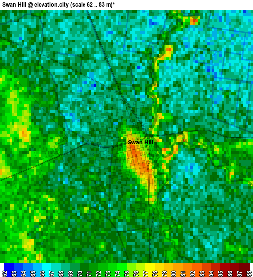
Below is the Elevation map of Swan Hill, which displays elevation range with different colors. Scale of the first map is from 62 to 83 m (203 to 272 ft) with average elevation of 69.8 meters (=229 ft) [note 1]
These maps also provides idea of topography and contour of this city, they are displayed at different zoom levels. More info about maps, scale and edge coordinates you can find below images.
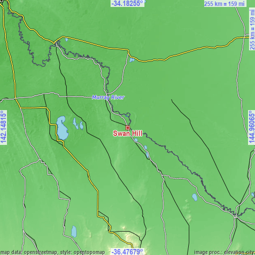
| \ | Map #1 | Map #2 | Topo.Map |
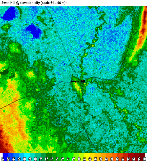
| Scale [m] | 62..83 m | 61..96 m | × |
| Scale [ft] | 203..272 ft | 200..315 ft | × |
| Average | 69.8 m = 229 ft | 71.6 m = 235 ft | × |
| Width | 7.97 km = 5 mi | 15.94 km = 9.9 mi | 255.1 km = 158.5 mi |
| Height | 7.97 km = 5 mi | 15.94 km = 9.9 mi | 255.1 km = 158.5 mi |
| ↑Max Latitude | -35.301953° | -35.266081° | -34.18255° |
| Latitude at center | -35.33781° | -35.33781° | -35.33781° |
| ↓Min Latitude | -35.373651° | -35.409475° | -36.47679° |
| ← Min Longitude | 143.510455° | 143.466509° | 142.14815° |
| Longitude center | 143.5544° | 143.5544° | 143.5544° |
| →Max Longitude | 143.598345° | 143.642291° | 144.96065° |
Nearby cities:
Cities around Swan Hill sort by population:
• Echuca elevation 100 m
140.2 km,  129°
129°
• Deniliquin 93 m
128.6 km,  99°
99°
• Moama 98 m
138.3 km, 128°
• Kerang 86 m
55.2 km,  143°
143°
• Robinvale 57 m
110.1 km,  319°
319°
• Warracknabeal 109 m
146.1 km,  225°
225°
• Cohuna 86 m
79.6 km, 130°
• Barham 80 m
61.1 km,  121°
121°
• Donald 114 m
125.7 km,  204°
204°
• Balranald 65 m
78 km,  0°
0°
• Ouyen 56 m
116 km,  284°
284°
• Charlton 135 m
104.7 km,  190°
190°
Multilingual:
 En español:
Swan Hill elevación 75 m.
 En France:
Swan Hill élévation 75 m.
 Auf Deutsch:
Swan Hill höhe über dem Meeresspiegel ist 75 m.

Sources and notes:
- [note 1] Map square and city borders are not equal. Map elevation data is calculated only from area inside that square.
- [src 1] Elevation data from geonames database provided with same terms of usage.
- [src 2] The elevation map of Swan Hill is generated using elevation data from NASA's 3 arcsec (90m) resolution SRTM data.
- [src 3] Base (background) map © OpenStreetMap contributors tiles are generated by Geofabrik and OpenTopoMap.
Copyright & License:
This Swan Hill Elevation Map is licensed under CC BY-SA. You may reuse any part from this page, if you give a proper credit by linking to this URL:
 More info on terms of use page.