Lalor elevation
Lalor (Victoria, Whittlesea), Australia elevation is 123 meters and Lalor elevation in feet is 404 ft above sea level [src 1]. Lalor is a section of populated place (feature code) with elevation that is 10 meters (33 ft) bigger than average city elevation in Australia.
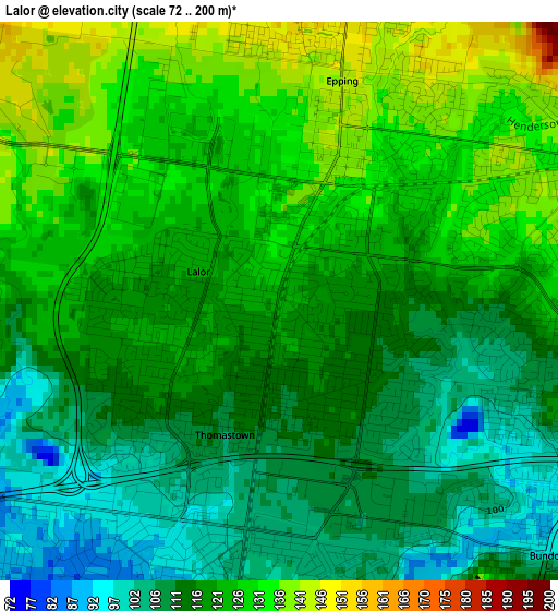
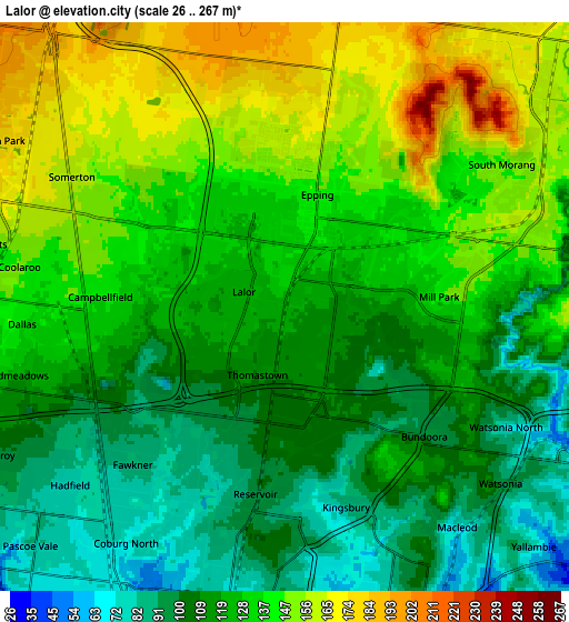
Below is the Elevation map of Lalor, which displays elevation range with different colors. Scale of the first map is from 72 to 200 m (236 to 656 ft) with average elevation of 119.9 meters (=393 ft) [note 1]
These maps also provides idea of topography and contour of this city, they are displayed at different zoom levels. More info about maps, scale and edge coordinates you can find below images.
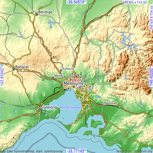
| \ | Map #1 | Map #2 | Topo.Map |
| Scale [m] | 72..200 m | 26..267 m | × |
| Scale [ft] | 236..656 ft | 85..876 ft | × |
| Average | 119.9 m = 393 ft | 126.4 m = 415 ft | × |
| Width | 7.74 km = 4.8 mi | 15.47 km = 9.6 mi | 247.5 km = 153.8 mi |
| Height | 7.74 km = 4.8 mi | 15.47 km = 9.6 mi | 247.5 km = 153.8 mi |
| ↑Max Latitude | -37.631876° | -37.597065° | -36.54519° |
| Latitude at center | -37.66667° | -37.66667° | -37.66667° |
| ↓Min Latitude | -37.701448° | -37.73621° | -38.77145° |
| ← Min Longitude | 144.972725° | 144.928779° | 143.61042° |
| Longitude center | 145.01667° | 145.01667° | 145.01667° |
| →Max Longitude | 145.060615° | 145.104561° | 146.42292° |
Nearby cities:
Cities around Lalor sort by population:
• Reservoir elevation 89 m
5.7 km,  194°
194°
• Epping 131 m
2.4 km,  38°
38°
• Mill Park 133 m
4.4 km,  90°
90°
• Bundoora 101 m
5.2 km,  132°
132°
• South Morang 145 m
7.6 km,  75°
75°
• Thomastown 113 m
1.9 km,  180°
180°
• Fawkner 77 m
7.1 km,  218°
218°
• Dallas 137 m
7.2 km,  266°
266°
• Campbellfield 117 m
5 km, 273°
• Kingsbury 85 m
5.5 km,  162°
162°
• Watsonia North 88 m
7 km,  121°
121°
• Coolaroo 148 m
7.3 km,  278°
278°
Multilingual:
 En español:
Lalor elevación 123 m.
 En France:
Lalor élévation 123 m.


Sources and notes:
- [note 1] Map square and city borders are not equal. Map elevation data is calculated only from area inside that square.
- [src 1] Elevation data from geonames database provided with same terms of usage.
- [src 2] The elevation map of Lalor is generated using elevation data from NASA's 3 arcsec (90m) resolution SRTM data.
- [src 3] Base (background) map © OpenStreetMap contributors tiles are generated by Geofabrik and OpenTopoMap.
Copyright & License:
This Lalor Elevation Map is licensed under CC BY-SA. You may reuse any part from this page, if you give a proper credit by linking to this URL:
 More info on terms of use page.