Mortdale elevation
Mortdale (New South Wales, Georges River), Australia elevation is 63 meters and Mortdale elevation in feet is 207 ft above sea level [src 1]. Mortdale is a section of populated place (feature code) with elevation that is 50 meters (164 ft) smaller than average city elevation in Australia.
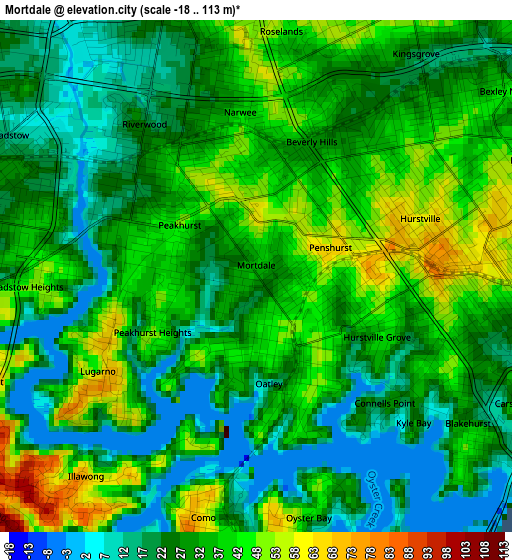
Below is the Elevation map of Mortdale, which displays elevation range with different colors. Scale of the first map is from -18 to 113 m (-59 to 371 ft) with average elevation of 32 meters (=105 ft) [note 1]
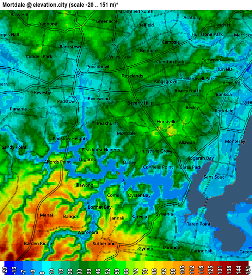
These maps also provides idea of topography and contour of this city, they are displayed at different zoom levels. More info about maps, scale and edge coordinates you can find below images.
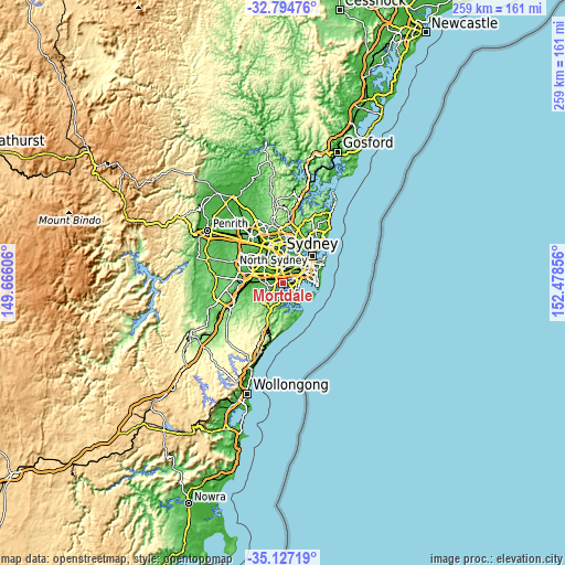
| \ | Map #1 | Map #2 | Topo.Map |
| Scale [m] | -18..113 m | -20..151 m | × |
| Scale [ft] | -59..371 ft | -66..495 ft | × |
| Average | 32 m = 105 ft | 36.7 m = 120 ft | × |
| Width | 8.1 km = 5 mi | 16.21 km = 10.1 mi | 259.3 km = 161.1 mi |
| Height | 8.1 km = 5 mi | 16.21 km = 10.1 mi | 259.3 km = 161.1 mi |
| ↑Max Latitude | -33.932517° | -33.896048° | -32.79476° |
| Latitude at center | -33.96897° | -33.96897° | -33.96897° |
| ↓Min Latitude | -34.005408° | -34.04183° | -35.12719° |
| ← Min Longitude | 151.028365° | 150.984419° | 149.66606° |
| Longitude center | 151.07231° | 151.07231° | 151.07231° |
| →Max Longitude | 151.116255° | 151.160201° | 152.47856° |
Nearby cities:
Cities around Mortdale sort by population:
• Hurstville elevation 80 m
2.7 km,  86°
86°
• Penshurst 63 m
1 km,  75°
75°
• Peakhurst 36 m
2 km,  289°
289°
• Oatley 42 m
1.2 km,  181°
181°
• Beverly Hills 42 m
2.4 km,  16°
16°
• Narwee 43 m
2.5 km,  353°
353°
• Lugarno 55 m
3.2 km,  241°
241°
• South Hurstville 38 m
3.2 km,  107°
107°
• Padstow Heights 38 m
3 km,  273°
273°
• Connells Point 18 m
2.7 km,  141°
141°
• Hurstville Grove 32 m
2.1 km,  126°
126°
• Peakhurst Heights 45 m
1.8 km, 238°
Multilingual:
 En español:
Mortdale elevación 63 m.
 En France:
Mortdale élévation 63 m.


Sources and notes:
- [note 1] Map square and city borders are not equal. Map elevation data is calculated only from area inside that square.
- [src 1] Elevation data from geonames database provided with same terms of usage.
- [src 2] The elevation map of Mortdale is generated using elevation data from NASA's 3 arcsec (90m) resolution SRTM data.
- [src 3] Base (background) map © OpenStreetMap contributors tiles are generated by Geofabrik and OpenTopoMap.
Copyright & License:
This Mortdale Elevation Map is licensed under CC BY-SA. You may reuse any part from this page, if you give a proper credit by linking to this URL:
 More info on terms of use page.