Waitara elevation
Waitara (New South Wales, City of Sydney), Australia elevation is 192 meters and Waitara elevation in feet is 630 ft above sea level [src 1]. Waitara is a section of populated place (feature code) with elevation that is 79 meters (259 ft) bigger than average city elevation in Australia.
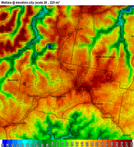
Below is the Elevation map of Waitara, which displays elevation range with different colors. Scale of the first map is from 28 to 225 m (92 to 738 ft) with average elevation of 158.4 meters (=520 ft) [note 1]
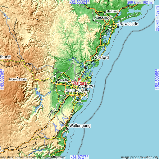
These maps also provides idea of topography and contour of this city, they are displayed at different zoom levels. More info about maps, scale and edge coordinates you can find below images.
| \ | Map #1 | Map #2 | Topo.Map |
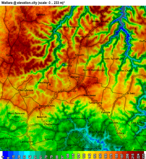
| Scale [m] | 28..225 m | -3..233 m | × |
| Scale [ft] | 92..738 ft | -10..764 ft | × |
| Average | 158.4 m = 520 ft | 140.9 m = 462 ft | × |
| Width | 8.13 km = 5.1 mi | 16.26 km = 10.1 mi | 260.1 km = 161.6 mi |
| Height | 8.13 km = 5.1 mi | 16.26 km = 10.1 mi | 260.1 km = 161.6 mi |
| ↑Max Latitude | -33.674356° | -33.637777° | -32.53321° |
| Latitude at center | -33.71092° | -33.71092° | -33.71092° |
| ↓Min Latitude | -33.747468° | -33.784001° | -34.8727° |
| ← Min Longitude | 151.059355° | 151.015409° | 149.69705° |
| Longitude center | 151.1033° | 151.1033° | 151.1033° |
| →Max Longitude | 151.147245° | 151.191191° | 152.50955° |
Nearby cities:
Cities around Waitara sort by population:
• Hornsby elevation 186 m
1 km,  338°
338°
• Wahroonga 206 m
1.4 km,  125°
125°
• Turramurra 183 m
3.4 km,  137°
137°
• Thornleigh 171 m
3.3 km,  223°
223°
• Pennant Hills 172 m
4.2 km, 223°
• Mount Colah 164 m
3.3 km,  21°
21°
• Normanhurst 178 m
1.6 km,  206°
206°
• Westleigh 156 m
3 km,  268°
268°
• North Turramurra 165 m
4 km,  93°
93°
• Asquith 167 m
2.9 km, 24°
• Warrawee 184 m
2.6 km, 141°
• North Wahroonga 202 m
1.9 km,  70°
70°
Multilingual:
 En español:
Waitara elevación 192 m.
 En France:
Waitara élévation 192 m.


Sources and notes:
- [note 1] Map square and city borders are not equal. Map elevation data is calculated only from area inside that square.
- [src 1] Elevation data from geonames database provided with same terms of usage.
- [src 2] The elevation map of Waitara is generated using elevation data from NASA's 3 arcsec (90m) resolution SRTM data.
- [src 3] Base (background) map © OpenStreetMap contributors tiles are generated by Geofabrik and OpenTopoMap.
Copyright & License:
This Waitara Elevation Map is licensed under CC BY-SA. You may reuse any part from this page, if you give a proper credit by linking to this URL:
 More info on terms of use page.