Yarragon elevation
Yarragon (Victoria, Baw Baw), Australia elevation is 86 meters and Yarragon elevation in feet is 282 ft above sea level [src 1]. Yarragon is a populated place (feature code) with elevation that is 27 meters (89 ft) smaller than average city elevation in Australia.
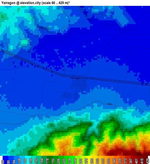
Below is the Elevation map of Yarragon, which displays elevation range with different colors. Scale of the first map is from 66 to 429 m (217 to 1407 ft) with average elevation of 120.2 meters (=394 ft) [note 1]
These maps also provides idea of topography and contour of this city, they are displayed at different zoom levels. More info about maps, scale and edge coordinates you can find below images.
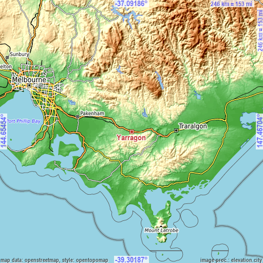
| \ | Map #1 | Topo.Map |
| Scale [m] | 66..429 m | × |
| Scale [ft] | 217..1407 ft | × |
| Average | 120.2 m = 394 ft | × |
| Width | 7.68 km = 4.8 mi | 245.7 km = 152.7 mi |
| Height | 7.68 km = 4.8 mi | 245.7 km = 152.7 mi |
| ↑Max Latitude | -38.17071° | -37.09186° |
| Latitude at center | -38.20525° | -38.20525° |
| ↓Min Latitude | -38.239774° | -39.30187° |
| ← Min Longitude | 146.016845° | 144.65454° |
| Longitude center | 146.06079° | 146.06079° |
| →Max Longitude | 146.104735° | 147.46704° |
Nearby cities:
Cities around Yarragon sort by population:
• Warragul elevation 135 m
12.4 km,  294°
294°
• Morwell 85 m
29.4 km,  96°
96°
• Drouin 143 m
19.3 km, 293°
• Moe 76 m
17.8 km,  80°
80°
• Newborough 76 m
20.6 km, 79°
• Leongatha 92 m
31.7 km,  198°
198°
• Trafalgar 72 m
8.1 km,  92°
92°
• Bunyip 47 m
32.4 km, 291°
• Mirboo North 245 m
23.5 km,  158°
158°
• Longwarry 45 m
27.5 km, 291°
• Yallourn North 101 m
27 km, 79°
• Neerim South 258 m
22.9 km,  336°
336°
Multilingual:
 En español:
Yarragon elevación 86 m.
 En France:
Yarragon élévation 86 m.


Sources and notes:
- [note 1] Map square and city borders are not equal. Map elevation data is calculated only from area inside that square.
- [src 1] Elevation data from geonames database provided with same terms of usage.
- [src 2] The elevation map of Yarragon is generated using elevation data from NASA's 3 arcsec (90m) resolution SRTM data.
- [src 3] Base (background) map © OpenStreetMap contributors tiles are generated by Geofabrik and OpenTopoMap.
Copyright & License:
This Yarragon Elevation Map is licensed under CC BY-SA. You may reuse any part from this page, if you give a proper credit by linking to this URL:
 More info on terms of use page.