Burgfried elevation
Burgfried (Salzburg, Politischer Bezirk Hallein), Austria elevation is 448 meters and Burgfried elevation in feet is 1470 ft above sea level [src 1]. Burgfried is a populated place (feature code) with elevation that is 61 meters (200 ft) smaller than average city elevation in Austria.
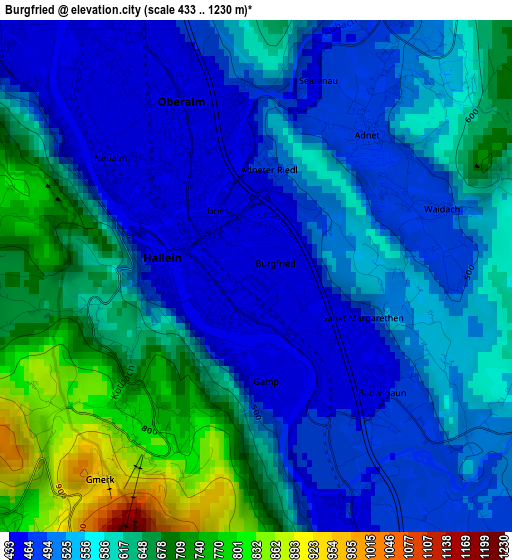
Below is the Elevation map of Burgfried, which displays elevation range with different colors. Scale of the first map is from 433 to 1230 m (1421 to 4035 ft) with average elevation of 570.8 meters (=1873 ft) [note 1]
These maps also provides idea of topography and contour of this city, they are displayed at different zoom levels. More info about maps, scale and edge coordinates you can find below images.
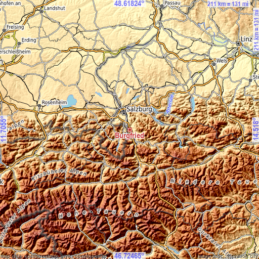
| \ | Map #1 | Topo.Map |
| Scale [m] | 433..1230 m | × |
| Scale [ft] | 1421..4035 ft | × |
| Average | 570.8 m = 1873 ft | × |
| Width | 6.58 km = 4.1 mi | 210.5 km = 130.8 mi |
| Height | 6.58 km = 4.1 mi | 210.5 km = 130.8 mi |
| ↑Max Latitude | 47.709619° | 48.61824° |
| Latitude at center | 47.68004° | 47.68004° |
| ↓Min Latitude | 47.650445° | 46.72465° |
| ← Min Longitude | 13.067805° | 11.7055° |
| Longitude center | 13.11175° | 13.11175° |
| →Max Longitude | 13.155695° | 14.518° |
Nearby cities:
Cities around Burgfried sort by population:
• Hallein elevation 447 m
1 km,  292°
292°
• Oberalm 450 m
2.4 km,  338°
338°
• Puch bei Hallein 465 m
4.2 km, 340°
• Taxach 426 m
5.9 km,  329°
329°
• Neualm 444 m
2.3 km,  309°
309°
• Kuchl 466 m
6.5 km,  157°
157°
• Georgenberg 466 m
5.9 km,  151°
151°
• Niederalm 431 m
6.6 km, 325°
• Adnet 487 m
2.4 km,  36°
36°
• Vigaun 458 m
2.2 km,  132°
132°
• Au 608 m
4 km,  303°
303°
• Krispl 838 m
6.7 km,  52°
52°
Multilingual:
 En español:
Burgfried elevación 448 m.
 En France:
Burgfried élévation 448 m.
 Auf Deutsch:
Burgfried höhe über dem Meeresspiegel ist 448 m.

Sources and notes:
- [note 1] Map square and city borders are not equal. Map elevation data is calculated only from area inside that square.
- [src 1] Elevation data from geonames database provided with same terms of usage.
- [src 2] The elevation map of Burgfried is generated using elevation data from NASA's 3 arcsec (90m) resolution SRTM data.
- [src 3] Base (background) map © OpenStreetMap contributors tiles are generated by Geofabrik and OpenTopoMap.
Copyright & License:
This Burgfried Elevation Map is licensed under CC BY-SA. You may reuse any part from this page, if you give a proper credit by linking to this URL:
 More info on terms of use page.