Taxach elevation
Taxach (Salzburg, Politischer Bezirk Hallein), Austria elevation is 426 meters and Taxach elevation in feet is 1398 ft above sea level [src 1]. Taxach is a populated place (feature code) with elevation that is 83 meters (272 ft) smaller than average city elevation in Austria.
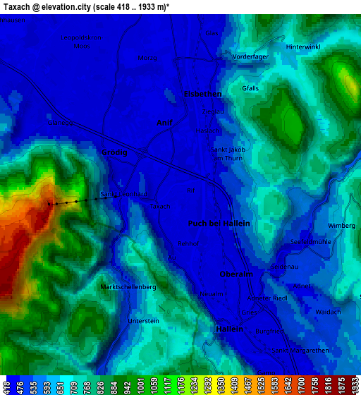
Below is the Elevation map of Taxach, which displays elevation range with different colors. Scale of the first map is from 422 to 975 m (1385 to 3199 ft) with average elevation of 513.9 meters (=1686 ft) [note 1]
These maps also provides idea of topography and contour of this city, they are displayed at different zoom levels. More info about maps, scale and edge coordinates you can find below images.

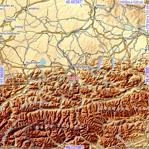
| \ | Map #1 | Map #2 | Topo.Map |
| Scale [m] | 422..975 m | 418..1933 m | × |
| Scale [ft] | 1385..3199 ft | 1371..6342 ft | × |
| Average | 513.9 m = 1686 ft | 650.8 m = 2135 ft | × |
| Width | 6.57 km = 4.1 mi | 13.15 km = 8.2 mi | 210.4 km = 130.7 mi |
| Height | 6.57 km = 4.1 mi | 13.15 km = 8.2 mi | 210.3 km = 130.7 mi |
| ↑Max Latitude | 47.755653° | 47.785188° | 48.66347° |
| Latitude at center | 47.7261° | 47.7261° | 47.7261° |
| ↓Min Latitude | 47.696531° | 47.666945° | 46.77155° |
| ← Min Longitude | 13.027895° | 12.983949° | 11.66559° |
| Longitude center | 13.07184° | 13.07184° | 13.07184° |
| →Max Longitude | 13.115785° | 13.159731° | 14.47809° |
Nearby cities:
Cities around Taxach sort by population:
• Hallein elevation 447 m
5.2 km,  156°
156°
• Oberalm 450 m
3.6 km,  144°
144°
• Puch bei Hallein 465 m
2 km,  127°
127°
• Grödig 448 m
2.9 km,  297°
297°
• Neualm 444 m
3.8 km, 162°
• Elsbethen 437 m
4.3 km,  9°
9°
• Anif 434 m
2.7 km,  351°
351°
• Glasenbach 443 m
4.6 km, 10°
• Niederalm 431 m
0.8 km,  292°
292°
• Adnet 487 m
5.5 km, 125°
• Au 608 m
2.9 km,  187°
187°
• Sankt Leonhard 451 m
2 km,  269°
269°
Multilingual:
 En español:
Taxach elevación 426 m.
 En France:
Taxach élévation 426 m.


Sources and notes:
- [note 1] Map square and city borders are not equal. Map elevation data is calculated only from area inside that square.
- [src 1] Elevation data from geonames database provided with same terms of usage.
- [src 2] The elevation map of Taxach is generated using elevation data from NASA's 3 arcsec (90m) resolution SRTM data.
- [src 3] Base (background) map © OpenStreetMap contributors tiles are generated by Geofabrik and OpenTopoMap.
Copyright & License:
This Taxach Elevation Map is licensed under CC BY-SA. You may reuse any part from this page, if you give a proper credit by linking to this URL:
 More info on terms of use page.