Grimmenstein elevation
Grimmenstein (Lower Austria, Politischer Bezirk Neunkirchen), Austria elevation is 404 meters and Grimmenstein elevation in feet is 1325 ft above sea level [src 1]. Grimmenstein is a seat of a third-order administrative division (feature code) with elevation that is 105 meters (344 ft) smaller than average city elevation in Austria.
Below is the Elevation map of Grimmenstein, which displays elevation range with different colors. Scale of the first map is from 379 to 840 m (1243 to 2756 ft) with average elevation of 589.2 meters (=1933 ft) [note 1]
These maps also provides idea of topography and contour of this city, they are displayed at different zoom levels. More info about maps, scale and edge coordinates you can find below images.
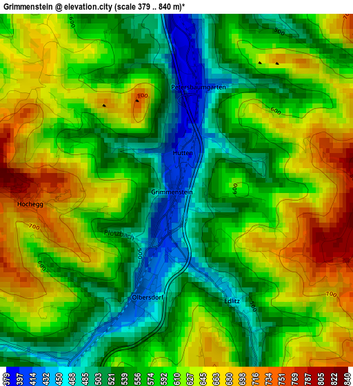
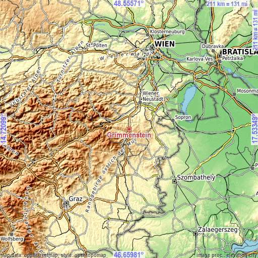
| \ | Map #1 | Topo.Map |
| Scale [m] | 379..840 m | × |
| Scale [ft] | 1243..2756 ft | × |
| Average | 589.2 m = 1933 ft | × |
| Width | 6.59 km = 4.1 mi | 210.8 km = 131 mi |
| Height | 6.59 km = 4.1 mi | 210.8 km = 131 mi |
| ↑Max Latitude | 47.645965° | 48.55571° |
| Latitude at center | 47.61635° | 47.61635° |
| ↓Min Latitude | 47.586718° | 46.65981° |
| ← Min Longitude | 16.083295° | 14.72099° |
| Longitude center | 16.12724° | 16.12724° |
| →Max Longitude | 16.171185° | 17.53349° |
Nearby cities:
Cities around Grimmenstein sort by population:
• Kirchberg am Wechsel elevation 560 m
10.3 km,  264°
264°
• Aspang Markt 553 m
8.1 km,  204°
204°
• Edlitz 453 m
2.3 km,  154°
154°
• Seebenstein 345 m
9.3 km,  8°
8°
• Feistritz am Wechsel 492 m
6.1 km,  252°
252°
• Wartmannstetten 403 m
9.4 km,  335°
335°
• Warth 466 m
3.8 km,  348°
348°
• Thomasberg 674 m
5.5 km,  175°
175°
• Sankt Corona am Wechsel 866 m
10.2 km, 248°
• Bromberg 429 m
8.3 km,  48°
48°
• Lichtenegg 757 m
5.7 km,  108°
108°
• Altendorf 644 m
9.1 km,  294°
294°
Multilingual:
 En español:
Grimmenstein elevación 404 m.
 En France:
Grimmenstein élévation 404 m.
 Auf Deutsch:
Grimmenstein höhe über dem Meeresspiegel ist 404 m.

Sources and notes:
- [note 1] Map square and city borders are not equal. Map elevation data is calculated only from area inside that square.
- [src 1] Elevation data from geonames database provided with same terms of usage.
- [src 2] The elevation map of Grimmenstein is generated using elevation data from NASA's 3 arcsec (90m) resolution SRTM data.
- [src 3] Base (background) map © OpenStreetMap contributors tiles are generated by Geofabrik and OpenTopoMap.
Copyright & License:
This Grimmenstein Elevation Map is licensed under CC BY-SA. You may reuse any part from this page, if you give a proper credit by linking to this URL:
 More info on terms of use page.