Hainburg an der Donau elevation
Hainburg an der Donau (Lower Austria, Politischer Bezirk Bruck an der Leitha), Austria elevation is 170 meters and Hainburg an der Donau elevation in feet is 558 ft above sea level [src 1]. Hainburg an der Donau is a populated place (feature code) with elevation that is 339 meters (1112 ft) smaller than average city elevation in Austria.
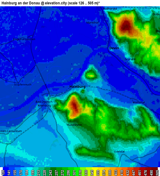
Below is the Elevation map of Hainburg an der Donau, which displays elevation range with different colors. Scale of the first map is from 126 to 475 m (413 to 1558 ft) with average elevation of 191.6 meters (=629 ft) [note 1]
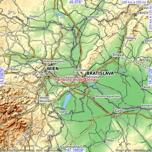
These maps also provides idea of topography and contour of this city, they are displayed at different zoom levels. More info about maps, scale and edge coordinates you can find below images.

| \ | Map #1 | Map #2 | Topo.Map |
| Scale [m] | 126..475 m | 126..505 m | × |
| Scale [ft] | 413..1558 ft | 413..1657 ft | × |
| Average | 191.6 m = 629 ft | 187.3 m = 615 ft | × |
| Width | 6.52 km = 4.1 mi | 13.04 km = 8.1 mi | 208.7 km = 129.7 mi |
| Height | 6.52 km = 4.1 mi | 13.04 km = 8.1 mi | 208.6 km = 129.6 mi |
| ↑Max Latitude | 48.175583° | 48.20488° | 49.076° |
| Latitude at center | 48.14627° | 48.14627° | 48.14627° |
| ↓Min Latitude | 48.11694° | 48.087593° | 47.19939° |
| ← Min Longitude | 16.901095° | 16.857149° | 15.53879° |
| Longitude center | 16.94504° | 16.94504° | 16.94504° |
| →Max Longitude | 16.988985° | 17.032931° | 18.35129° |
Nearby cities:
Cities around Hainburg an der Donau sort by population:
• Kittsee elevation 136 m
10.7 km,  124°
124°
• Bad Deutsch-Altenburg 149 m
3.2 km,  245°
245°
• Petronell-Carnuntum 177 m
6.9 km,  237°
237°
• Prellenkirchen 171 m
8.1 km,  176°
176°
• Wolfsthal 159 m
4.3 km,  109°
109°
• Engelhartstetten 143 m
6 km,  310°
310°
• Berg 148 m
8.5 km,  125°
125°
• Edelstal 194 m
5.9 km,  151°
151°
• Potzneusiedl 154 m
11.3 km, 178°
• Hundsheim 214 m
3.3 km,  192°
192°
• Eckartsau 145 m
11 km,  269°
269°
• Rohrau 144 m
11.3 km,  218°
218°
Multilingual:
 En español:
Hainburg an der Donau elevación 170 m.
 En France:
Hainburg an der Donau élévation 170 m.
 Auf Deutsch:
Hainburg an der Donau höhe über dem Meeresspiegel ist 170 m.
 На русском:
Хайнбург-ан-дер-Донау высота над уровнем моря 170 м
Sources and notes:
- [note 1] Map square and city borders are not equal. Map elevation data is calculated only from area inside that square.
- [src 1] Elevation data from geonames database provided with same terms of usage.
- [src 2] The elevation map of Hainburg an der Donau is generated using elevation data from NASA's 3 arcsec (90m) resolution SRTM data.
- [src 3] Base (background) map © OpenStreetMap contributors tiles are generated by Geofabrik and OpenTopoMap.
Copyright & License:
This Hainburg an der Donau Elevation Map is licensed under CC BY-SA. You may reuse any part from this page, if you give a proper credit by linking to this URL:
 More info on terms of use page.