Metnitz elevation
Metnitz (Carinthia, Politischer Bezirk Sankt Veit an der Glan), Austria elevation is 851 meters and Metnitz elevation in feet is 2792 ft above sea level [src 1]. Metnitz is a seat of a third-order administrative division (feature code) with elevation that is 342 meters (1122 ft) bigger than average city elevation in Austria.
Below is the Elevation map of Metnitz, which displays elevation range with different colors. Scale of the first map is from 756 to 1483 m (2480 to 4865 ft) with average elevation of 1083.2 meters (=3554 ft) [note 1]
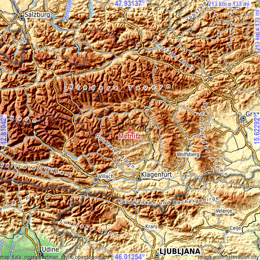
These maps also provides idea of topography and contour of this city, they are displayed at different zoom levels. More info about maps, scale and edge coordinates you can find below images.
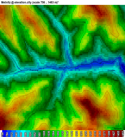
| \ | Map #1 | Topo.Map |
| Scale [m] | 756..1483 m | × |
| Scale [ft] | 2480..4865 ft | × |
| Average | 1083.2 m = 3554 ft | × |
| Width | 6.67 km = 4.1 mi | 213.4 km = 132.6 mi |
| Height | 6.67 km = 4.1 mi | 213.3 km = 132.5 mi |
| ↑Max Latitude | 47.010533° | 47.93137° |
| Latitude at center | 46.98056° | 46.98056° |
| ↓Min Latitude | 46.95057° | 46.01254° |
| ← Min Longitude | 14.172725° | 12.81042° |
| Longitude center | 14.21667° | 14.21667° |
| →Max Longitude | 14.260615° | 15.62292° |
Nearby cities:
Cities around Metnitz sort by population:
• Murau elevation 841 m
14.9 km,  346°
346°
• Friesach 635 m
14.6 km,  101°
101°
• Sankt Lambrecht 1047 m
11.5 km,  33°
33°
• Straßburg-Stadt 647 m
12.8 km,  138°
138°
• Gurk 665 m
13.2 km,  154°
154°
• Weitensfeld 701 m
14.9 km,  187°
187°
• Sankt Blasen 1296 m
13.1 km, 28°
• Sankt Georgen ob Murau 844 m
16 km,  326°
326°
• Glödnitz 747 m
14 km,  212°
212°
• Dürnstein in der Steiermark 663 m
13.3 km,  86°
86°
• Zeutschach 1038 m
14.9 km,  49°
49°
• Triebendorf 878 m
15.2 km,  4°
4°
Multilingual:
 En español:
Metnitz elevación 851 m.
 En France:
Metnitz élévation 851 m.


Sources and notes:
- [note 1] Map square and city borders are not equal. Map elevation data is calculated only from area inside that square.
- [src 1] Elevation data from geonames database provided with same terms of usage.
- [src 2] The elevation map of Metnitz is generated using elevation data from NASA's 3 arcsec (90m) resolution SRTM data.
- [src 3] Base (background) map © OpenStreetMap contributors tiles are generated by Geofabrik and OpenTopoMap.
Copyright & License:
This Metnitz Elevation Map is licensed under CC BY-SA. You may reuse any part from this page, if you give a proper credit by linking to this URL:
 More info on terms of use page.