Sankt Lambrecht elevation
Sankt Lambrecht (Styria, Politischer Bezirk Murau), Austria elevation is 1047 meters and Sankt Lambrecht elevation in feet is 3435 ft above sea level [src 1]. Sankt Lambrecht is a seat of a third-order administrative division (feature code) with elevation that is 538 meters (1765 ft) bigger than average city elevation in Austria.
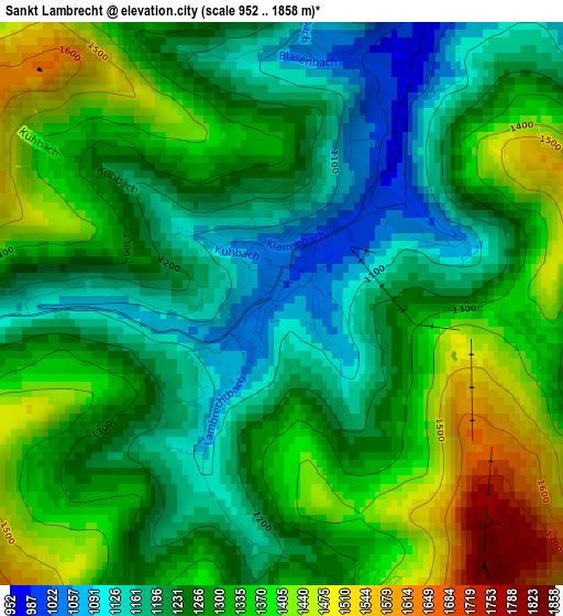
Below is the Elevation map of Sankt Lambrecht, which displays elevation range with different colors. Scale of the first map is from 952 to 1858 m (3123 to 6096 ft) with average elevation of 1284.9 meters (=4216 ft) [note 1]
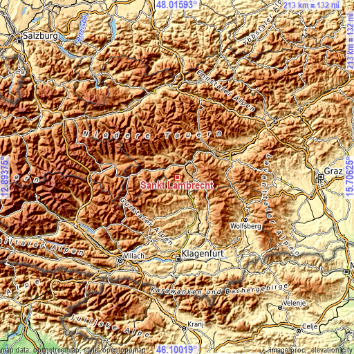
These maps also provides idea of topography and contour of this city, they are displayed at different zoom levels. More info about maps, scale and edge coordinates you can find below images.
| \ | Map #1 | Topo.Map |
| Scale [m] | 952..1858 m | × |
| Scale [ft] | 3123..6096 ft | × |
| Average | 1284.9 m = 4216 ft | × |
| Width | 6.66 km = 4.1 mi | 213 km = 132.4 mi |
| Height | 6.66 km = 4.1 mi | 213 km = 132.4 mi |
| ↑Max Latitude | 47.096595° | 48.01593° |
| Latitude at center | 47.06667° | 47.06667° |
| ↓Min Latitude | 47.036728° | 46.10019° |
| ← Min Longitude | 14.256055° | 12.89375° |
| Longitude center | 14.3° | 14.3° |
| →Max Longitude | 14.343945° | 15.70625° |
Nearby cities:
Cities around Sankt Lambrecht sort by population:
• Murau elevation 841 m
11 km,  296°
296°
• Neumarkt in Steiermark 838 m
9.7 km,  85°
85°
• Mariahof 959 m
8.4 km,  63°
63°
• Teufenbach 763 m
8.2 km,  32°
32°
• Niederwölz 748 m
11 km, 31°
• Sankt Blasen 1296 m
1.9 km,  0°
0°
• Metnitz 851 m
11.5 km,  213°
213°
• Sankt Marein bei Neumarkt 826 m
9.8 km, 90°
• Sankt Lorenzen bei Scheifling 793 m
11.9 km,  42°
42°
• Dürnstein in der Steiermark 663 m
11.1 km,  141°
141°
• Zeutschach 1038 m
5 km, 90°
• Triebendorf 878 m
7.5 km,  317°
317°
Multilingual:
 En español:
Sankt Lambrecht elevación 1047 m.
 En France:
Sankt Lambrecht élévation 1047 m.
 Auf Deutsch:
Sankt Lambrecht höhe über dem Meeresspiegel ist 1047 m.

Sources and notes:
- [note 1] Map square and city borders are not equal. Map elevation data is calculated only from area inside that square.
- [src 1] Elevation data from geonames database provided with same terms of usage.
- [src 2] The elevation map of Sankt Lambrecht is generated using elevation data from NASA's 3 arcsec (90m) resolution SRTM data.
- [src 3] Base (background) map © OpenStreetMap contributors tiles are generated by Geofabrik and OpenTopoMap.
Copyright & License:
This Sankt Lambrecht Elevation Map is licensed under CC BY-SA. You may reuse any part from this page, if you give a proper credit by linking to this URL:
 More info on terms of use page.