Oberzeiring elevation
Oberzeiring (Styria, Politischer Bezirk Murtal), Austria elevation is 937 meters and Oberzeiring elevation in feet is 3074 ft above sea level [src 1]. Oberzeiring is a seat of a third-order administrative division (feature code) with elevation that is 428 meters (1404 ft) bigger than average city elevation in Austria.
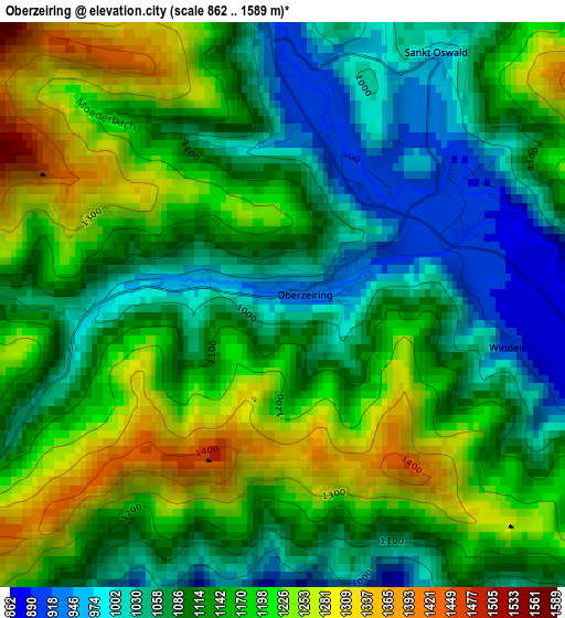
Below is the Elevation map of Oberzeiring, which displays elevation range with different colors. Scale of the first map is from 862 to 1589 m (2828 to 5213 ft) with average elevation of 1132.4 meters (=3715 ft) [note 1]
These maps also provides idea of topography and contour of this city, they are displayed at different zoom levels. More info about maps, scale and edge coordinates you can find below images.
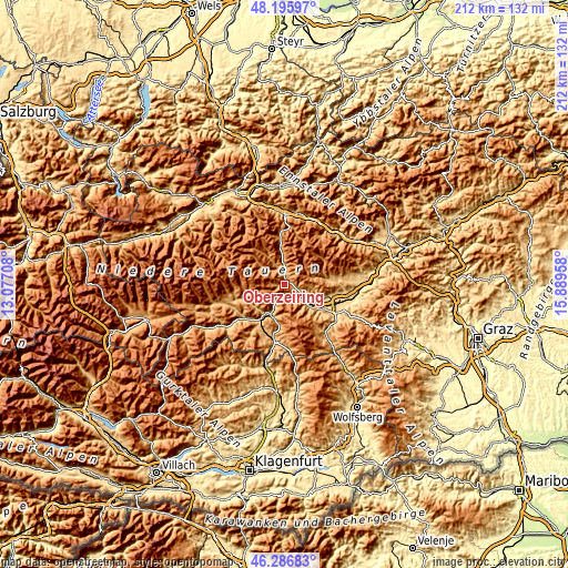
| \ | Map #1 | Topo.Map |
| Scale [m] | 862..1589 m | × |
| Scale [ft] | 2828..5213 ft | × |
| Average | 1132.4 m = 3715 ft | × |
| Width | 6.63 km = 4.1 mi | 212.3 km = 131.9 mi |
| Height | 6.63 km = 4.1 mi | 212.3 km = 131.9 mi |
| ↑Max Latitude | 47.279822° | 48.19597° |
| Latitude at center | 47.25° | 47.25° |
| ↓Min Latitude | 47.220161° | 46.28683° |
| ← Min Longitude | 14.439385° | 13.07708° |
| Longitude center | 14.48333° | 14.48333° |
| →Max Longitude | 14.527275° | 15.88958° |
Nearby cities:
Cities around Oberzeiring sort by population:
• Dietersdorf elevation 726 m
14.9 km,  111°
111°
• Pöls 791 m
8.4 km,  116°
116°
• Scheifling 766 m
12.3 km,  205°
205°
• Niederwölz 748 m
13.7 km,  216°
216°
• Pusterwald 1073 m
10.2 km,  307°
307°
• Sankt Peter ob Judenburg 792 m
10.7 km,  133°
133°
• Sankt Georgen ob Judenburg 734 m
4.8 km,  167°
167°
• Sankt Lorenzen bei Scheifling 793 m
13 km, 206°
• Bretstein 1024 m
10.5 km,  331°
331°
• Gaal 898 m
14.3 km,  79°
79°
• Oberkurzheim 863 m
7.8 km,  103°
103°
• Sankt Johann am Tauern 1085 m
11.2 km,  353°
353°
Multilingual:
 En español:
Oberzeiring elevación 937 m.
 En France:
Oberzeiring élévation 937 m.
 Auf Deutsch:
Oberzeiring höhe über dem Meeresspiegel ist 937 m.

Sources and notes:
- [note 1] Map square and city borders are not equal. Map elevation data is calculated only from area inside that square.
- [src 1] Elevation data from geonames database provided with same terms of usage.
- [src 2] The elevation map of Oberzeiring is generated using elevation data from NASA's 3 arcsec (90m) resolution SRTM data.
- [src 3] Base (background) map © OpenStreetMap contributors tiles are generated by Geofabrik and OpenTopoMap.
Copyright & License:
This Oberzeiring Elevation Map is licensed under CC BY-SA. You may reuse any part from this page, if you give a proper credit by linking to this URL:
 More info on terms of use page.