Pottendorf elevation
Pottendorf (Lower Austria, Politischer Bezirk Baden), Austria elevation is 219 meters and Pottendorf elevation in feet is 719 ft above sea level [src 1]. Pottendorf is a seat of a third-order administrative division (feature code) with elevation that is 290 meters (951 ft) smaller than average city elevation in Austria.
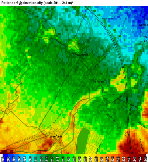
Below is the Elevation map of Pottendorf, which displays elevation range with different colors. Scale of the first map is from 201 to 244 m (659 to 801 ft) with average elevation of 219.1 meters (=719 ft) [note 1]
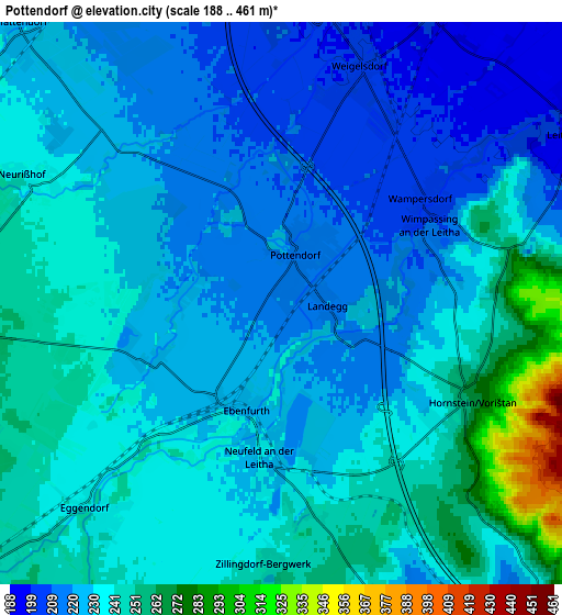
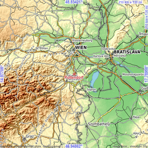
These maps also provides idea of topography and contour of this city, they are displayed at different zoom levels. More info about maps, scale and edge coordinates you can find below images.
| \ | Map #1 | Map #2 | Topo.Map |
| Scale [m] | 201..244 m | 188..461 m | × |
| Scale [ft] | 659..801 ft | 617..1512 ft | × |
| Average | 219.1 m = 719 ft | 232.3 m = 762 ft | × |
| Width | 6.55 km = 4.1 mi | 13.1 km = 8.1 mi | 209.7 km = 130.3 mi |
| Height | 6.55 km = 4.1 mi | 13.1 km = 8.1 mi | 209.6 km = 130.2 mi |
| ↑Max Latitude | 47.929454° | 47.958891° | 48.83421° |
| Latitude at center | 47.9° | 47.9° | 47.9° |
| ↓Min Latitude | 47.87053° | 47.841042° | 46.94862° |
| ← Min Longitude | 16.339385° | 16.295439° | 14.97708° |
| Longitude center | 16.38333° | 16.38333° | 16.38333° |
| →Max Longitude | 16.427275° | 16.471221° | 17.78958° |
Nearby cities:
Cities around Pottendorf sort by population:
• Ebreichsdorf elevation 199 m
6.5 km,  15°
15°
• Eggendorf 239 m
6.5 km,  224°
224°
• Neufeld an der Leitha 231 m
3.8 km,  185°
185°
• Hornstein 269 m
5 km,  115°
115°
• Unterwaltersdorf 198 m
6.1 km, 24°
• Weigelsdorf 202 m
5.7 km,  12°
12°
• Steinbrunn 211 m
7.8 km,  161°
161°
• Ebenfurth 228 m
2.8 km,  205°
205°
• Wimpassing an der Leitha 207 m
4.2 km,  63°
63°
• Zillingdorf 238 m
6.7 km, 213°
• Leithaprodersdorf 194 m
8.1 km, 62°
• Landegg 216 m
1.2 km,  90°
90°
Multilingual:
 En español:
Pottendorf elevación 219 m.
 En France:
Pottendorf élévation 219 m.
 Auf Deutsch:
Pottendorf höhe über dem Meeresspiegel ist 219 m.

Sources and notes:
- [note 1] Map square and city borders are not equal. Map elevation data is calculated only from area inside that square.
- [src 1] Elevation data from geonames database provided with same terms of usage.
- [src 2] The elevation map of Pottendorf is generated using elevation data from NASA's 3 arcsec (90m) resolution SRTM data.
- [src 3] Base (background) map © OpenStreetMap contributors tiles are generated by Geofabrik and OpenTopoMap.
Copyright & License:
This Pottendorf Elevation Map is licensed under CC BY-SA. You may reuse any part from this page, if you give a proper credit by linking to this URL:
 More info on terms of use page.