Siegendorf im Burgenland elevation
Siegendorf im Burgenland (Burgenland, Eisenstadt-Umgebung), Austria elevation is 162 meters and Siegendorf im Burgenland elevation in feet is 531 ft above sea level [src 1]. Siegendorf im Burgenland is a populated place (feature code) with elevation that is 347 meters (1138 ft) smaller than average city elevation in Austria.
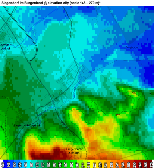
Below is the Elevation map of Siegendorf im Burgenland, which displays elevation range with different colors. Scale of the first map is from 143 to 270 m (469 to 886 ft) with average elevation of 178.9 meters (=587 ft) [note 1]
These maps also provides idea of topography and contour of this city, they are displayed at different zoom levels. More info about maps, scale and edge coordinates you can find below images.
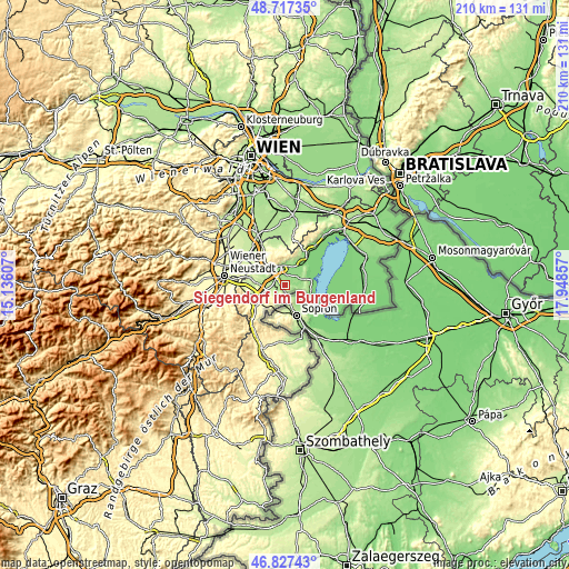
| \ | Map #1 | Topo.Map |
| Scale [m] | 143..270 m | × |
| Scale [ft] | 469..886 ft | × |
| Average | 178.9 m = 587 ft | × |
| Width | 6.57 km = 4.1 mi | 210.1 km = 130.5 mi |
| Height | 6.57 km = 4.1 mi | 210.1 km = 130.5 mi |
| ↑Max Latitude | 47.810501° | 48.71735° |
| Latitude at center | 47.78098° | 47.78098° |
| ↓Min Latitude | 47.751442° | 46.82743° |
| ← Min Longitude | 16.498375° | 15.13607° |
| Longitude center | 16.54232° | 16.54232° |
| →Max Longitude | 16.586265° | 17.94857° |
Nearby cities:
Cities around Siegendorf im Burgenland sort by population:
• Eisenstadt elevation 182 m
7.3 km,  348°
348°
• Kleinhöflein im Burgenland 212 m
7.3 km,  337°
337°
• Sankt Margarethen im Burgenland 147 m
5.6 km,  63°
63°
• Sankt Georgen am Leithagebirge 157 m
7.7 km,  4°
4°
• Trausdorf an der Wulka 153 m
3.8 km,  17°
17°
• Grosshöflein 212 m
7.7 km,  322°
322°
• Wulkaprodersdorf 167 m
3.4 km,  303°
303°
• Drassburg 233 m
5.7 km,  227°
227°
• Klingenbach 239 m
3.2 km,  182°
182°
• Zagersdorf 179 m
2.8 km, 229°
• Hirm 180 m
6.6 km,  275°
275°
• Antau 185 m
4.7 km,  260°
260°
Multilingual:
 En español:
Siegendorf im Burgenland elevación 162 m.
 En France:
Siegendorf im Burgenland élévation 162 m.
 Auf Deutsch:
Siegendorf höhe über dem Meeresspiegel ist 162 m.
 На русском:
Siegendorf im Burgenland высота над уровнем моря 162 м
Sources and notes:
- [note 1] Map square and city borders are not equal. Map elevation data is calculated only from area inside that square.
- [src 1] Elevation data from geonames database provided with same terms of usage.
- [src 2] The elevation map of Siegendorf im Burgenland is generated using elevation data from NASA's 3 arcsec (90m) resolution SRTM data.
- [src 3] Base (background) map © OpenStreetMap contributors tiles are generated by Geofabrik and OpenTopoMap.
Copyright & License:
This Siegendorf im Burgenland Elevation Map is licensed under CC BY-SA. You may reuse any part from this page, if you give a proper credit by linking to this URL:
 More info on terms of use page.