Trautmannsdorf an der Leitha elevation
Trautmannsdorf an der Leitha (Lower Austria, Politischer Bezirk Bruck an der Leitha), Austria elevation is 167 meters and Trautmannsdorf an der Leitha elevation in feet is 548 ft above sea level [src 1]. Trautmannsdorf an der Leitha is a seat of a third-order administrative division (feature code) with elevation that is 342 meters (1122 ft) smaller than average city elevation in Austria.
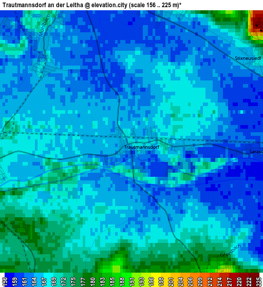
Below is the Elevation map of Trautmannsdorf an der Leitha, which displays elevation range with different colors. Scale of the first map is from 156 to 225 m (512 to 738 ft) with average elevation of 166.5 meters (=546 ft) [note 1]
These maps also provides idea of topography and contour of this city, they are displayed at different zoom levels. More info about maps, scale and edge coordinates you can find below images.
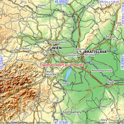
| \ | Map #1 | Topo.Map |
| Scale [m] | 156..225 m | × |
| Scale [ft] | 512..738 ft | × |
| Average | 166.5 m = 546 ft | × |
| Width | 6.54 km = 4.1 mi | 209.2 km = 130 mi |
| Height | 6.54 km = 4.1 mi | 209.1 km = 129.9 mi |
| ↑Max Latitude | 48.052953° | 48.95553° |
| Latitude at center | 48.02357° | 48.02357° |
| ↓Min Latitude | 47.99417° | 47.07445° |
| ← Min Longitude | 16.588715° | 15.22641° |
| Longitude center | 16.63266° | 16.63266° |
| →Max Longitude | 16.676605° | 18.03891° |
Nearby cities:
Cities around Trautmannsdorf an der Leitha sort by population:
• Mannersdorf am Leithagebirge elevation 228 m
6.8 km,  201°
201°
• Ebergassing 180 m
8.9 km,  285°
285°
• Schwadorf 164 m
6.4 km,  322°
322°
• Enzersdorf an der Fischa 157 m
7.1 km,  345°
345°
• Sommerein 257 m
4.7 km,  163°
163°
• Reisenberg 179 m
9 km,  248°
248°
• Hof am Leithaberge 218 m
9 km, 204°
• Götzendorf an der Leitha 168 m
3.7 km,  258°
258°
• Margarethen am Moos 164 m
2.7 km, 294°
• Wilfleinsdorf 156 m
6.3 km,  97°
97°
• Maria Ellend 185 m
9.3 km,  23°
23°
• Klein-Neusiedl 157 m
8 km, 346°
Multilingual:
 En español:
Trautmannsdorf an der Leitha elevación 167 m.
 En France:
Trautmannsdorf an der Leitha élévation 167 m.
 Auf Deutsch:
Trautmannsdorf an der Leitha höhe über dem Meeresspiegel ist 167 m.
 На русском:
Траутмансдорф-ан-дер-Лайта высота над уровнем моря 167 м
Sources and notes:
- [note 1] Map square and city borders are not equal. Map elevation data is calculated only from area inside that square.
- [src 1] Elevation data from geonames database provided with same terms of usage.
- [src 2] The elevation map of Trautmannsdorf an der Leitha is generated using elevation data from NASA's 3 arcsec (90m) resolution SRTM data.
- [src 3] Base (background) map © OpenStreetMap contributors tiles are generated by Geofabrik and OpenTopoMap.
Copyright & License:
This Trautmannsdorf an der Leitha Elevation Map is licensed under CC BY-SA. You may reuse any part from this page, if you give a proper credit by linking to this URL:
 More info on terms of use page.