Mannersdorf am Leithagebirge elevation
Mannersdorf am Leithagebirge (Lower Austria, Politischer Bezirk Bruck an der Leitha), Austria elevation is 228 meters and Mannersdorf am Leithagebirge elevation in feet is 748 ft above sea level [src 1]. Mannersdorf am Leithagebirge is a seat of a third-order administrative division (feature code) with elevation that is 281 meters (922 ft) smaller than average city elevation in Austria.
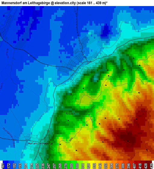
Below is the Elevation map of Mannersdorf am Leithagebirge, which displays elevation range with different colors. Scale of the first map is from 161 to 439 m (528 to 1440 ft) with average elevation of 246.1 meters (=807 ft) [note 1]
These maps also provides idea of topography and contour of this city, they are displayed at different zoom levels. More info about maps, scale and edge coordinates you can find below images.
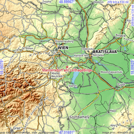
| \ | Map #1 | Topo.Map |
| Scale [m] | 161..439 m | × |
| Scale [ft] | 528..1440 ft | × |
| Average | 246.1 m = 807 ft | × |
| Width | 6.54 km = 4.1 mi | 209.4 km = 130.1 mi |
| Height | 6.54 km = 4.1 mi | 209.4 km = 130.1 mi |
| ↑Max Latitude | 47.996086° | 48.89967° |
| Latitude at center | 47.96667° | 47.96667° |
| ↓Min Latitude | 47.937237° | 47.01651° |
| ← Min Longitude | 16.556055° | 15.19375° |
| Longitude center | 16.6° | 16.6° |
| →Max Longitude | 16.643945° | 18.00625° |
Nearby cities:
Cities around Mannersdorf am Leithagebirge sort by population:
• Purbach am Neusiedler See elevation 126 m
9.3 km,  130°
130°
• Sommerein 257 m
4.2 km,  63°
63°
• Donnerskirchen 148 m
8.8 km,  156°
156°
• Reisenberg 179 m
6.7 km,  297°
297°
• Hof am Leithaberge 218 m
2.2 km,  213°
213°
• Götzendorf an der Leitha 168 m
5.7 km,  347°
347°
• Margarethen am Moos 164 m
7.4 km,  0°
0°
• Trautmannsdorf an der Leitha 167 m
6.8 km,  21°
21°
• Au am Leithaberge 211 m
5.8 km, 212°
• Stotzing 239 m
7.8 km, 211°
• Seibersdorf 184 m
6.1 km,  261°
261°
• Loretto 211 m
8.3 km,  227°
227°
Multilingual:
 En español:
Mannersdorf am Leithagebirge elevación 228 m.
 En France:
Mannersdorf am Leithagebirge élévation 228 m.
 Auf Deutsch:
Mannersdorf am Leithagebirge höhe über dem Meeresspiegel ist 228 m.
 На русском:
Маннерсдорф-ам-Лайтагебирге высота над уровнем моря 228 м
Sources and notes:
- [note 1] Map square and city borders are not equal. Map elevation data is calculated only from area inside that square.
- [src 1] Elevation data from geonames database provided with same terms of usage.
- [src 2] The elevation map of Mannersdorf am Leithagebirge is generated using elevation data from NASA's 3 arcsec (90m) resolution SRTM data.
- [src 3] Base (background) map © OpenStreetMap contributors tiles are generated by Geofabrik and OpenTopoMap.
Copyright & License:
This Mannersdorf am Leithagebirge Elevation Map is licensed under CC BY-SA. You may reuse any part from this page, if you give a proper credit by linking to this URL:
 More info on terms of use page.