Unterbergla elevation
Unterbergla (Styria, Politischer Bezirk Deutschlandsberg), Austria elevation is 345 meters and Unterbergla elevation in feet is 1132 ft above sea level [src 1]. Unterbergla is a seat of a third-order administrative division (feature code) with elevation that is 164 meters (538 ft) smaller than average city elevation in Austria.
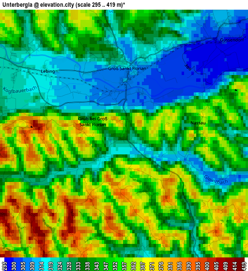
Below is the Elevation map of Unterbergla, which displays elevation range with different colors. Scale of the first map is from 295 to 419 m (968 to 1375 ft) with average elevation of 342.4 meters (=1123 ft) [note 1]
These maps also provides idea of topography and contour of this city, they are displayed at different zoom levels. More info about maps, scale and edge coordinates you can find below images.
| \ | Map #1 | Topo.Map |
| Scale [m] | 295..419 m | × |
| Scale [ft] | 968..1375 ft | × |
| Average | 342.4 m = 1123 ft | × |
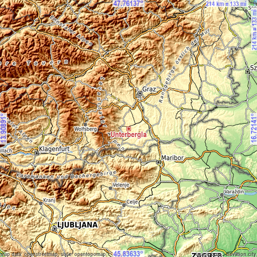
| Width | 6.69 km = 4.2 mi | 214 km = 133 mi |
| Height | 6.69 km = 4.2 mi | 214 km = 133 mi |
| ↑Max Latitude | 46.83753° | 47.76137° |
| Latitude at center | 46.80746° | 46.80746° |
| ↓Min Latitude | 46.777373° | 45.83633° |
| ← Min Longitude | 15.271215° | 13.90891° |
| Longitude center | 15.31516° | 15.31516° |
| →Max Longitude | 15.359105° | 16.72141° |
Nearby cities:
Cities around Unterbergla sort by population:
• Deutschlandsberg elevation 362 m
7.1 km,  277°
277°
• Freidorf an der Laßnitz 341 m
5.1 km, 281°
• Brunn 330 m
8.8 km,  187°
187°
• Gleinstätten 298 m
7.3 km,  145°
145°
• Groß Sankt Florian 309 m
1.9 km,  7°
7°
• Pistorf 321 m
6 km,  139°
139°
• Wettmannstätten 301 m
6.1 km,  64°
64°
• Stallhof 327 m
8.8 km,  343°
343°
• Sankt Peter im Sulmtal 410 m
8.1 km,  217°
217°
• Rassach 382 m
6.8 km,  329°
329°
• Hollenegg 470 m
7.9 km,  257°
257°
• Sankt Martin im Sulmtal 336 m
5.9 km, 193°
Multilingual:
 En español:
Unterbergla elevación 345 m.
 En France:
Unterbergla élévation 345 m.
 Auf Deutsch:
Unterbergla höhe über dem Meeresspiegel ist 345 m.

Sources and notes:
- [note 1] Map square and city borders are not equal. Map elevation data is calculated only from area inside that square.
- [src 1] Elevation data from geonames database provided with same terms of usage.
- [src 2] The elevation map of Unterbergla is generated using elevation data from NASA's 3 arcsec (90m) resolution SRTM data.
- [src 3] Base (background) map © OpenStreetMap contributors tiles are generated by Geofabrik and OpenTopoMap.
Copyright & License:
This Unterbergla Elevation Map is licensed under CC BY-SA. You may reuse any part from this page, if you give a proper credit by linking to this URL:
 More info on terms of use page.